Country:
 Cambodia
Region:
City:
Latitude and Longitude:
Time Zone:
Postal Code:
IP information under different IP Channel
ip-api
Country
Region
City
ASN
Time Zone
ISP
Blacklist
Proxy
Latitude
Longitude
Postal
Route
IPinfo
Country
Region
City
ASN
Time Zone
ISP
Blacklist
Proxy
Latitude
Longitude
Postal
Route
MaxMind
Country
Region
City
ASN
Time Zone
ISP
Blacklist
Proxy
Latitude
Longitude
Postal
Route
Luminati
Country
KHASN
Time Zone
Asia/Phnom_Penh
ISP
ISPIXP IN CAMBODIA WITH THE BEST VERVICE IN THERE.
Latitude
Longitude
Postal
db-ip
Country
Region
City
ASN
Time Zone
ISP
Blacklist
Proxy
Latitude
Longitude
Postal
Route
ipdata
Country
Region
City
ASN
Time Zone
ISP
Blacklist
Proxy
Latitude
Longitude
Postal
Route
Popular places and events near this IP address

Tuol Sleng Genocide Museum
Museum dedicated to the Cambodian Genocide
Distance: Approx. 1394 meters
Latitude and longitude: 11.54944444,104.91777778
The Tuol Sleng Genocide Museum (Khmer: សារមន្ទីរឧក្រិដ្ឋកម្មប្រល័យពូជសាសន៍ទួលស្លែង, romanized: Saromontir Ukredth Kamm Braly Pouchsasa Tuol Sleng), or simply Tuol Sleng (Khmer: ទួលស្លែង, Tuŏl Slêng [tuəl slaeŋ]; lit. "Hill of the Poisonous Trees" or "Strychnine Hill"), is a museum chronicling the Cambodian genocide. Located in Phnom Penh, the site is a former secondary school which was used as Security Prison 21 (S-21; Khmer: មន្ទីរស-២១) by the Khmer Rouge regime from 1975 until its fall in 1979.

Olympic Stadium (Phnom Penh)
Multi-purpose stadium in Phnom Penh, Cambodia
Distance: Approx. 1268 meters
Latitude and longitude: 11.55833333,104.91194444
The Olympic Stadium (Khmer: ពហុកីឡាដ្ឋានជាតិអូឡាំពិក) is a multi-purpose stadium in Phnom Penh, Cambodia. It has a capacity of 50,000. Despite its name, the stadium has never hosted an Olympic Games.

Apostolic Vicariate of Phnom Penh
Catholic missionary jurisdiction in Cambodia
Distance: Approx. 1320 meters
Latitude and longitude: 11.56,104.91
The Apostolic Vicariate of Phnom Penh (Khmer: សាវកជំនួសរាជធានីភ្នំពេញ) is a territorial subdivision of the Catholic Church in Cambodia. It is immediately subject to the Holy See and it is presided over by Bishop Olivier Schmitthaeusler M.E.P. since 10 October 2010. The vicariate covers an area of 32,063 km2 (12,380 sq mi) of southern Cambodia, including Phnom Penh and other main urban areas such as Kep, Sihanoukville, Kandal, Takéo, Kampot, Kampong Speu and Koh Kong provinces.
Khan Chamkar Mon
District in Phnom Penh, Cambodia
Distance: Approx. 2182 meters
Latitude and longitude: 11.54340167,104.92410917
Chamkar Mon (Khmer: ចំការមន, meaning 'Mulberry Farm') is the southernmost district in central Phnom Penh, Cambodia. The district has an area of 10.56 km2. As of the 2019 census, its population was 70,772.

Khan Prampir Makara
Section in Phnom Penh, Cambodia
Distance: Approx. 1832 meters
Latitude and longitude: 11.56333333,104.91361111
Prampir Makara (Khmer: ប្រាំពីរមករា [prampiː meakaraː]; meaning 'Seventh of January'), also 7 Makara (Khmer: ៧មករា; meaning '7th of January'), is a section (khan) in Phnom Penh, Cambodia. The section is subdivided into 8 sangkats and 33 kroms. The section has an area of 2.21 km2 (0.85 sq mi).

Sihanouk Boulevard
Boulevard in Phnom Penh
Distance: Approx. 1872 meters
Latitude and longitude: 11.555,104.92111111
Sihanouk Boulevard (Khmer: មហាវិថីព្រះសីហនុ) is a central boulevard of Phnom Penh which is the capital of Cambodia. The boulevard crosses the city in an east–west direction. It is named in honour of the late King Norodom Sihanouk, one of the country's greatest kings.
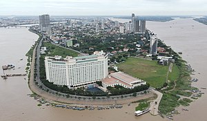
The Great Duke Phnom Penh Hotel
Hotel in Phnom Penh, Cambodia
Distance: Approx. 290 meters
Latitude and longitude: 11.5505,104.9027
The Great Duke Phnom Penh Hotel was a 5-star hotel in Phnom Penh, Cambodia. The 15-story hotel had 346 rooms, and was located in the city centre.

Khmer–Soviet Friendship Hospital
Hospital in Youtheapol Khemarak Phumin Blvd , Phnom Penh
Distance: Approx. 497 meters
Latitude and longitude: 11.544837,104.904022
The Khmer–Soviet Friendship Hospital (KSFH; Khmer: មន្ទីរពេទ្យមិត្តភាពខ្មែរ-សូវៀត, Môntirpéty Mĭttâphéap Khmêr-Soviĕt) is a public hospital located in Phnom Penh, capital of Cambodia. The hospital is currently managed by the Ministry of Health.

Wat Moha Montrey
Distance: Approx. 1080 meters
Latitude and longitude: 11.55444444,104.91333333
Wat Moha Montrey (Khmer: វត្តមហាមន្ត្រី, UNGEGN: Vôtt Môha Môntrei, ALA-LC: Vatt Mahā Mantrī [ʋɔət mɔhaː mɔntrəj]) is a wat located on Sihanouk Boulevard in Phnom Penh, Cambodia. Built in 1970, it was used by the Khmer Rouge between 1975 and 1979 as a storage house for rice and corn. The tower measures 35 metres in height.
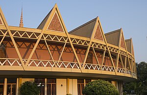
Chaktomuk Conference Hall
Theatre located in Phnom Penh, Cambodia
Distance: Approx. 1081 meters
Latitude and longitude: 11.5442,104.9135
The Chaktomuk Conference Hall (Khmer: សាលសន្និសីទចតុមុខ, Sal Sânnĭsit Châtŏmŭkh) is a theatre located in the city of Phnom Penh, Cambodia. The fan-shaped hall is one of the most iconic works of famous Cambodian architect Vann Molyvann and was since its construction in 1961 one of the "landmarks and infrastructures of the newly independent nation". Mainly used for the purpose of conducting ceremonies for foreign governors, the hall is a designed concrete structure which radiates in a fan shape referencing a palm leaf.
Khan Chroy Changvar
Satellite city in Phnom Penh
Distance: Approx. 2182 meters
Latitude and longitude: 11.54340167,104.92410917
Chroy Changvar (Khmer: ជ្រោយចង្វារ) is a satellite city in Phnom Penh, Cambodia.

Khan Boeng Keng Kang
Section in Phnom Penh, Cambodia
Distance: Approx. 1164 meters
Latitude and longitude: 11.548,104.9156
Boeng Keng Kang (Khmer: បឹងកេងកង [ɓəŋ keːŋkɑːŋ]) is a section (khan) in Phnom Penh, Cambodia. This khan was created on January 8, 2019, according to sub-decree 03 អនក្រ.បក by taking 7 quarters (sangkat) from Chamkar Mon Section. It has a population of 66,658.
Weather in this IP's area
moderate rain
32 Celsius
39 Celsius
32 Celsius
32 Celsius
1007 hPa
70 %
1007 hPa
1005 hPa
10000 meters
1.54 m/s
150 degree
40 %
05:50:01
17:40:20