Country:
 Hong Kong (China)
Region:
City:
Latitude and Longitude:
Time Zone:
Postal Code:
IP information under different IP Channel
ip-api
Country
Region
City
ASN
Time Zone
ISP
Blacklist
Proxy
Latitude
Longitude
Postal
Route
IPinfo
Country
Region
City
ASN
Time Zone
ISP
Blacklist
Proxy
Latitude
Longitude
Postal
Route
MaxMind
Country
Region
City
ASN
Time Zone
ISP
Blacklist
Proxy
Latitude
Longitude
Postal
Route
Luminati
Country
HKASN
Time Zone
Asia/Hong_Kong
ISP
velia.net Internetdienste GmbH
Latitude
Longitude
Postal
db-ip
Country
Region
City
ASN
Time Zone
ISP
Blacklist
Proxy
Latitude
Longitude
Postal
Route
ipdata
Country
Region
City
ASN
Time Zone
ISP
Blacklist
Proxy
Latitude
Longitude
Postal
Route
Popular places and events near this IP address

Lai Chi Kok station
MTR station in Kowloon, Hong Kong
Distance: Approx. 235 meters
Latitude and longitude: 22.3373,114.1482
Lai Chi Kok (Chinese: 茘枝角) is a rapid transit station on the Tsuen Wan line of the Hong Kong MTR system, between Cheung Sha Wan and Mei Foo stations. It was opened on 17 May 1982. The station is in an orange-red colour, and is a simple through station with an island platform.

Caritas Medical Centre
Hospital in Kowloon, Hong Kong
Distance: Approx. 528 meters
Latitude and longitude: 22.3411111,114.1527778
Caritas Medical Centre (Chinese: 明愛醫院; Cantonese Yale: Mìhng'oi Yīyún) is a Roman Catholic founded district general hospital in So Uk, Cheung Sha Wan, New Kowloon, Hong Kong. It is the largest hospital in Sham Shui Po District and co-managed by the Hospital Authority and Caritas Hong Kong.

Ching Cheung Road
Road in Hong Kong
Distance: Approx. 137 meters
Latitude and longitude: 22.3405,114.1474
Ching Cheung Road (Chinese: 呈祥道; Jyutping: ching4 cheung4 dou6), part of the Route 7, is a dual carriageway in New Kowloon, Hong Kong linking Lung Cheung Road and Tai Po Road near Tai Wo Ping and Kwai Chung Road of Route 5 near Lai Chi Kok, varying between 2+2 lanes and 3+4 lanes for its length. This road was named in honour of Sir David Trench, the Governor of Hong Kong when it was finished, and the road's name was derived from the connection of his Chinese name (戴麟趾) and the proverb “麟趾呈祥” (Jyutping: lun4 zi2 cing4 coeng4). Kwun Tong (connected by Lung Cheung Road and Kwun Tong Road) in eastern New Kowloon was the main manufacturing centre of Hong Kong during the 1960s.
So Uk
Distance: Approx. 725 meters
Latitude and longitude: 22.3411,114.1548
So Uk (Chinese: 蘇屋; Cantonese Yale: Sōuūk) is an area in New Kowloon of Hong Kong, located to the north of Cheung Sha Wan. It was originally a village founded and resided by a clan bearing the surname So. The area now includes the area surrounding So Uk Estate, and a major hospital, Caritas Medical Centre, is also located within the area.
Butterfly Valley
Distance: Approx. 679 meters
Latitude and longitude: 22.34416667,114.14388889
Butterfly Valley, or Wu Tip Kuk (Chinese: 蝴蝶谷), is a valley in north of Lai Chi Kok in New Kowloon of Hong Kong, located between O Pui Shan and Piper's Hill.

Manhattan Hill
Housing estate in Lai Chi Kok, Hong Kong
Distance: Approx. 749 meters
Latitude and longitude: 22.335,114.1425
Manhattan Hill (Chinese: 曼克頓山) is a high-rise development located in the Lai Chi Kok district of Kowloon in Hong Kong, formerly Kowloon Motor Bus Lai Chi Kok Depot. The complex consists of five towers. Towers 1 and 2, which are interconnected, rise 51 floors, while towers 3, 5 and 6 rise 49 floors; each of the five towers is 198 metres (650 ft) high.
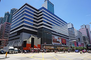
Cheung Sha Wan Plaza
Shopping centre in Cheung Sha Wan, Hong Kong
Distance: Approx. 265 meters
Latitude and longitude: 22.3371,114.14867
Cheung Sha Wan Plaza (Chinese: 長沙灣廣場; Cantonese Yale: chēuhng sā wāhn gwóng chēuhng, Jyutping: coeng4 saa1 waan1 gwong2 coeng4) is shopping centre and office complex in Cheung Sha Wan, New Kowloon, Hong Kong. It was developed by Lai Sun Development in 1989. It is erected over MTR Lai Chi Kok station, consisting of a bus terminus, multi-storey car parks, a commercial/retail podium and two office towers.

Sham Shui Po Sports Ground
Sports ground in Kowloon, Hong Kong
Distance: Approx. 499 meters
Latitude and longitude: 22.337068,114.152142
Sham Shui Po Sports Ground (Chinese: 深水埗運動場) is public sports ground located in Cheung Sha Wan, Kowloon, Hong Kong. It opened on 9 January 1988.

Hoi Lai Estate
Public housing estate in Cheung Sha Wan, Hong Kong
Distance: Approx. 828 meters
Latitude and longitude: 22.3321151,114.1463783
Hoi Lai Estate (Chinese: 海麗邨) is a public housing estate in Cheung Sha Wan, Kowloon, Hong Kong, built on the reclaimed land of south Cheung Sha Wan, near Lai Chi Kok station and four private housing estates, namely Aqua Marine, Banyan Garden, Liberté and The Pacifica. The estate consists of 12 residential buildings and a shopping centre completed between 2004 and 2005. It was planned for HOS court, but it was changed to rental housing before it was occupied.
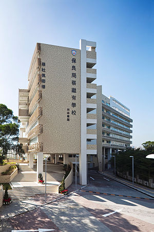
Po Leung Kuk Choi Kai Yau School
School
Distance: Approx. 584 meters
Latitude and longitude: 22.344632,114.148394
Po Leung Kuk Choi Kai Yau School (Chinese: 保良局蔡繼有學校, abbreviated PLKCKY) is a private independent school for boys and girls aged 6–18, ranging from primary through to International Baccalaureate (IB) diploma students. Situated in Sham Shui Po, Hong Kong (previously in Tin Hau prior to 2009), PLKCKY is a school with approximately 1,300 students. The school opened and moved into its new campus in September 2009.

Tsing Sha Highway
Road in Hong Kong
Distance: Approx. 826 meters
Latitude and longitude: 22.332784,114.144373
Tsing Sha Highway (Chinese: 青沙公路) is a major expressway in Hong Kong, which links the island of Tsing Yi to Sha Tin. The road is part of Route 8, which starts in Sha Tin and terminates in Tung Chung. It was opened in March 2008 and extended in December 2009.

Lai Chi Kok Hospital
Hospital in Lai Chi Kok, Hong Kong
Distance: Approx. 642 meters
Latitude and longitude: 22.337922,114.141976
The former Lai Chi Kok Hospital, located at No.800 Castle Peak Road, Lai Chi Kok, Kowloon, was listed as one of the Grade III historic buildings in Hong Kong on 24 June 2010. The site has now been transformed into Jao Tsung-I Academy under batch 1 of the Hong Kong Government's revitalisation scheme. In the 19th century, the hospital first served as a labourers' dormitory for The Chamber of Mines Labour Importation Agency.
Weather in this IP's area
overcast clouds
30 Celsius
36 Celsius
28 Celsius
30 Celsius
1004 hPa
80 %
1004 hPa
1001 hPa
10000 meters
2.24 m/s
4.02 m/s
135 degree
92 %
06:11:19
18:23:14