103.66.115.244 - IP Lookup: Free IP Address Lookup, Postal Code Lookup, IP Location Lookup, IP ASN, Public IP
Country:
Region:
City:
Location:
Time Zone:
Postal Code:
ISP:
ASN:
language:
User-Agent:
Proxy IP:
Blacklist:
IP information under different IP Channel
ip-api
Country
Region
City
ASN
Time Zone
ISP
Blacklist
Proxy
Latitude
Longitude
Postal
Route
db-ip
Country
Region
City
ASN
Time Zone
ISP
Blacklist
Proxy
Latitude
Longitude
Postal
Route
IPinfo
Country
Region
City
ASN
Time Zone
ISP
Blacklist
Proxy
Latitude
Longitude
Postal
Route
IP2Location
103.66.115.244Country
Region
gujarat
City
himatnagar
Time Zone
Asia/Kolkata
ISP
Language
User-Agent
Latitude
Longitude
Postal
ipdata
Country
Region
City
ASN
Time Zone
ISP
Blacklist
Proxy
Latitude
Longitude
Postal
Route
Popular places and events near this IP address

Sabarkantha district
District of Gujarat in India
Distance: Approx. 0 meters
Latitude and longitude: 23.6,72.95
Sabarkantha district is one of the 33 districts of Gujarat state of India, located in the northeastern part of the state. The administrative headquarters of the district are located in Himatnagar.

Himatnagar
City in Gujarat, India
Distance: Approx. 0 meters
Latitude and longitude: 23.6,72.95
Himatnagar or Himmatnagar is a city and the headquarters of Sabarkantha district in the Indian state of Gujarat. The city is on the bank of the river Hathmati.
APMC College of Pharmaceutical Education and Research, Himatnagar
Distance: Approx. 1474 meters
Latitude and longitude: 23.595099,72.963424
APMCCPER (Agricultural Produce Market Committee College of Pharmaceutical Education and Research), established in 2000, is a graduate and post-graduate Pharmaceutical Educational Institute in Himatnagar. It is governed by Himatnagar Kelavani Mandal and is under the Gujarat Technological University, Ahmedabad.
Himatnagar Assembly constituency
Legislative Assembly constituency in Gujarat State, India
Distance: Approx. 1020 meters
Latitude and longitude: 23.6,72.96
Himatnagar is one of the 182 Legislative Assembly constituencies of Gujarat state in India. It is part of Sabarkantha district. It is numbered as 27-Himatnagar.

Vijaynagar State
Distance: Approx. 0 meters
Latitude and longitude: 23.6,72.95
Vijaynagar State, known as Pol State before 1934 and also called Ghodadar for a short time, was a princely state under the Mahi Kantha Agency, Bombay Presidency in NE Gujarat during the British Raj. The capital of the state was in Vijaynagar taluka, Sabarkantha district. The state's last ruler signed the accession to the Indian Union on 8 August 1947.

Akodara
Village in Gujarat, India
Distance: Approx. 8608 meters
Latitude and longitude: 23.5312591,72.9886454
Akodara is a village in Sabarkantha district of Gujarat State, India. It is located 10 kilometres (6.2 mi) away from Himmatnagar, 41 kilometres (25 mi) from district headquarter Sabarkantha and 64 kilometres (40 mi) from state capital Gandhinagar. The village is administrated by Sarpanch.

Himmatnagar Junction railway station
Railway station in Gujarat, India
Distance: Approx. 1381 meters
Latitude and longitude: 23.591848,72.960209
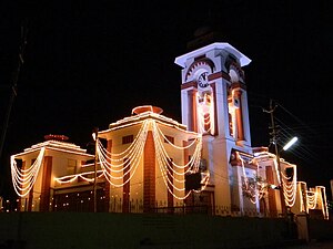
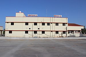
Himmatnagar Junction railway station is a small railway station in Sabarkantha district, Gujarat. Its code is HMT. It serves Himatnagar city. The station consists of two platforms.
Weather in this IP's area
clear sky
17 Celsius
17 Celsius
17 Celsius
17 Celsius
1014 hPa
57 %
1014 hPa
997 hPa
10000 meters
2.38 m/s
2.47 m/s
64 degree