Country:
 Australia
Region:
City:
Latitude and Longitude:
Time Zone:
Postal Code:
IP information under different IP Channel
ip-api
Country
Region
City
ASN
Time Zone
ISP
Blacklist
Proxy
Latitude
Longitude
Postal
Route
IPinfo
Country
Region
City
ASN
Time Zone
ISP
Blacklist
Proxy
Latitude
Longitude
Postal
Route
MaxMind
Country
Region
City
ASN
Time Zone
ISP
Blacklist
Proxy
Latitude
Longitude
Postal
Route
Luminati
Country
AURegion
qld
City
brisbane
ASN
Time Zone
Australia/Brisbane
ISP
GSL Networks Pty LTD
Latitude
Longitude
Postal
db-ip
Country
Region
City
ASN
Time Zone
ISP
Blacklist
Proxy
Latitude
Longitude
Postal
Route
ipdata
Country
Region
City
ASN
Time Zone
ISP
Blacklist
Proxy
Latitude
Longitude
Postal
Route
Popular places and events near this IP address

Riparian Plaza
Skyscraper in Brisbane, Queensland, Australia
Distance: Approx. 241 meters
Latitude and longitude: -27.468136,153.030072
Riparian Plaza is a 53-storey skyscraper located in the central business district of Brisbane, Queensland, Australia. The building stands at 250 m (820 ft) in height to its communications spire and 200 m (660 ft) to its roof. It was Brisbane's tallest building until it was surpassed by Aurora in 2006 and is a particularly iconic building on the Brisbane skyline.

AMP Place, Brisbane
Skyscraper in Brisbane, Queensland
Distance: Approx. 304 meters
Latitude and longitude: -27.46930556,153.02986111
Originally named the AMP Centre, Gold Tower is a gold-coloured skyscraper located in the heart of the Brisbane central business district in Queensland, Australia. It can be seen from most parts of the city. When the skyscraper was completed in 1978, it was Brisbane's tallest building.

Customs House, Brisbane
Heritage-listed house in Brisbane, Queensland
Distance: Approx. 311 meters
Latitude and longitude: -27.4654,153.0311
Customs House is a heritage-listed customs house at 427 Queen Street, Brisbane CBD, Brisbane, Queensland, Australia. It was designed by Charles H McLay and built from 1886 to 1889 at a cost of £38,346 by John Petrie & Son. It was originally used for the collection of customs duty and was opened in 1889, when Queensland was a British colony, replacing the original Customs House located at Petrie Bight.

Riverside Centre, Brisbane
Skyscraper in Brisbane, Queensland
Distance: Approx. 245 meters
Latitude and longitude: -27.467174,153.030163
The Riverside Centre is a skyscraper designed by Harry Seidler and located at 123 Eagle Street, Brisbane, Queensland, Australia. Completed in 1986, it contains 40 storeys and rises 146 m above ground. The building is owned by General Property Trust.

Holman Street ferry wharf
Ferry wharf in Brisbane, Australia
Distance: Approx. 268 meters
Latitude and longitude: -27.4657,153.0336
Holman Street ferry wharf is a heritage-listed ferry wharf located on the southern side of the Brisbane River in Kangaroo Point, City of Brisbane, Queensland, Australia. It is served by RiverCity Ferries' CityHopper and the Cross River service to Riverside wharf. It was added to the Queensland Heritage Register in 2004.

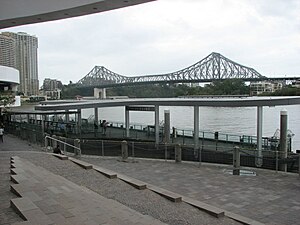
Eagle Street Pier ferry wharf
Distance: Approx. 187 meters
Latitude and longitude: -27.4688,153.0309
Eagle Street Pier ferry wharf was located on the northern side of the Brisbane River serving the Brisbane central business district in Queensland, Australia. It was served by Transdev Brisbane Ferries' CityHopper service and a cross-river service to Kangaroo Point (to the Holman Street and Thornton Street ferry terminals). These services were suspended in July 2020 and formally cancelled to stop at this wharf in October 2020.
Riverside ferry wharf
Distance: Approx. 155 meters
Latitude and longitude: -27.467,153.0313
Riverside ferry wharf is located on the northern side of the Brisbane River serving the Brisbane central business district in Queensland, Australia. It is served by RiverCity Ferries' CityCat services. From 15 November 2020 it is also being served by CityHopper and Cross River services.

Petrie Bight
Distance: Approx. 217 meters
Latitude and longitude: -27.466,153.032
Petrie Bight is a reach of the Brisbane River in Brisbane, Queensland, Australia. The land to the north of the bight, centred on the area under the Story Bridge's northern point and around the Brisbane River to Customs House is also known as Petrie Bight and was formerly a suburb of Brisbane. The area whilst still informally known as Petrie Bight, was absorbed into the suburbs of the Brisbane CBD and Fortitude Valley during consolidation of suburbs by the Brisbane City Council.

One One One Eagle Street
194.7-metre (639 ft) office building in Brisbane, Queensland, Australia
Distance: Approx. 215 meters
Latitude and longitude: -27.46759167,153.03035556
One One One Eagle Street is a 194.7-metre (639 ft) office building at 111 Eagle Street, Brisbane, Queensland, Australia, located in the city centre. With 6 star Green Star office design rating, the building is part of the CBD's 'Golden Triangle' district. Its location is the site of the old Indigo House building, which was demolished over a period of six months starting in 2008.
Electoral district of Maree
Former state electoral district of Queensland, Australia
Distance: Approx. 160 meters
Latitude and longitude: -27.46666667,153.03333333
Maree was a Legislative Assembly electorate in the state of Queensland, Australia.

Mooney Memorial Fountain
Heritage-listed memorial in Brisbane, Queensland
Distance: Approx. 310 meters
Latitude and longitude: -27.466,153.0302
Mooney Memorial Fountain is a heritage-listed memorial at 118 Eagle Street, Brisbane City, City of Brisbane, Queensland, Australia. It was designed by William Holloway Chambers and built from 1878 to 1880 by William Webster. It is also known as Eagle Street Fountain.

Eagle Street Fig Trees
Heritage-listed group of trees in Brisbane, Queensland
Distance: Approx. 287 meters
Latitude and longitude: -27.4677,153.0296
Eagle Street Fig Trees is a heritage-listed group of trees at 118A Eagle Street, Brisbane City, City of Brisbane, Queensland, Australia. They were planted c. 1889 by Walter Hill. It is also known as Fig Tree Reserve and Plantation Reserve.
Weather in this IP's area
clear sky
21 Celsius
21 Celsius
19 Celsius
22 Celsius
1018 hPa
82 %
1018 hPa
1017 hPa
10000 meters
6.69 m/s
360 degree
05:53:54
17:37:40