Country:
 Hong Kong (China)
Region:
City:
Latitude and Longitude:
Time Zone:
Postal Code:
IP information under different IP Channel
ip-api
Country
Region
City
ASN
Time Zone
ISP
Blacklist
Proxy
Latitude
Longitude
Postal
Route
IPinfo
Country
Region
City
ASN
Time Zone
ISP
Blacklist
Proxy
Latitude
Longitude
Postal
Route
MaxMind
Country
Region
City
ASN
Time Zone
ISP
Blacklist
Proxy
Latitude
Longitude
Postal
Route
Luminati
Country
HKCity
hongkong
ASN
Time Zone
Asia/Hong_Kong
ISP
NETACTUATE
Latitude
Longitude
Postal
db-ip
Country
Region
City
ASN
Time Zone
ISP
Blacklist
Proxy
Latitude
Longitude
Postal
Route
ipdata
Country
Region
City
ASN
Time Zone
ISP
Blacklist
Proxy
Latitude
Longitude
Postal
Route
Popular places and events near this IP address

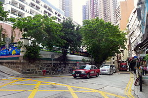
PMQ (Hong Kong)
Historic building in Hong Kong
Distance: Approx. 108 meters
Latitude and longitude: 22.283354,114.151862
PMQ (formerly, Police Married Quarters) is the historic site of the old Hollywood Road Police Married Quarters, which is now a mixed-use arts and design venue in Hong Kong, between Aberdeen Street, Staunton Street, Hollywood Road, and Shing Wong Street. The site occupies what was originally the grounds of Queen's College, which was built on the site in 1889. After damage during World War II, it was repurposed as quarters for married junior policemen.

Sheung Wan
Area in Hong Kong
Distance: Approx. 154 meters
Latitude and longitude: 22.28524,114.15139
Sheung Wan (Chinese: 上環) is an area in Hong Kong, located in the north-west of Hong Kong Island, between Central and Sai Ying Pun. Administratively, it is part of the Central and Western District. The name can be variously interpreted as Upper District (occupying relatively high ground compared to Central and Wan Chai), or Gateway District (perhaps a reference to the location where the British first entered and occupied Hong Kong).
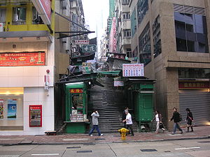
Hollywood Road
Street in Hong Kong
Distance: Approx. 88 meters
Latitude and longitude: 22.284172,114.150201
Hollywood Road is a street in Central and Sheung Wan, on Hong Kong Island, Hong Kong. The street runs between Central and Sheung Wan, with Wyndham Street, Arbuthnot Road, Ladder Street, Upper Lascar Row, and Old Bailey Street in the vicinity. Hollywood Road was the second road to be built when the colony of Hong Kong was founded, after Queen's Road Central.

Ladder Street
Street in Hong Kong
Distance: Approx. 100 meters
Latitude and longitude: 22.284177,114.150081
Ladder Street is a street in the Central and Western District of Hong Kong, consisting entirely of steps and landings formed by granite slabs or concrete paving. It was so named because it extends straight up and down like a ladder. The street has been listed as a Grade I historic building.

Man Mo temples in Hong Kong
Distance: Approx. 79 meters
Latitude and longitude: 22.283982,114.150239
A Man Mo temple, or Man Mo Miu, is a temple for the worship of the Civil or Literature God Man Tai (文帝) / Man Cheong (文昌) and the Martial God Mo Tai (武帝) / Kwan Tai (關帝). The two deities were popularly patronized by scholars and students seeking progress in their study or ranking in the civil examinations in the Ming and Qing dynasties. There are several Man Mo temples in Hong Kong, the best known of which is the temple in Sheung Wan.
Aberdeen Street
Street on Hong Kong Island, Hong Kong
Distance: Approx. 150 meters
Latitude and longitude: 22.2833,114.1523
Aberdeen Street is a border street dividing Sheung Wan and Central on Hong Kong Island, Hong Kong. It ascends from Queen's Road Central to Caine Road in Mid-Levels. The street is named after George Hamilton-Gordon, 4th Earl of Aberdeen, Foreign Secretary at the time of the cession of Hong Kong Island to the United Kingdom in 1842.

Shing Wong Street
Distance: Approx. 69 meters
Latitude and longitude: 22.2841,114.15163
Shing Wong Street (Chinese: 城皇街) is a street on the hill slope of Sheung Wan and Mid-Levels, Hong Kong. The street extends from Gough Street at its lowest to Caine Road highest. The street is one of ladder streets in Hong Kong, made of stone steps, in the section between Hollywood Road and Caine Road.

Bridges Street
Street in Hong Kong
Distance: Approx. 105 meters
Latitude and longitude: 22.283701,114.150003
Bridges Street (Chinese: 必列者士街) is a 300-metre two-way street in Sheung Wan, Hong Kong.

Jervois Street
Distance: Approx. 138 meters
Latitude and longitude: 22.28514,114.15098
Jervois Street (Chinese: 蘇杭街, formerly 乍畏街) is a street in the Sheung Wan district of Hong Kong Island, Hong Kong.

Hillier Street
Street in Sheung Wan, Hong Kong
Distance: Approx. 146 meters
Latitude and longitude: 22.28517,114.15137
Hillier Street (Chinese: 禧利街), is a street in Sheung Wan of Hong Kong Island, Hong Kong, located between Connaught Road Central and Queen's Road Central.
Bridges Street Market
Market building in Hong Kong
Distance: Approx. 64 meters
Latitude and longitude: 22.283324,114.150959
Bridges Street Market (Chinese: 必列啫士街街市) is located at No. 2 Bridges Street, at the corner of Shing Wong Street, in Sheung Wan, Hong Kong. It is a Bauhaus style market building, originally opened in 1953, and has been renovated and open in 2018 as a news museum.
Coa (bar)
Bar in Hong Kong
Distance: Approx. 114 meters
Latitude and longitude: 22.283987,114.152103
Coa is a bar in Hong Kong.
Weather in this IP's area
overcast clouds
27 Celsius
29 Celsius
25 Celsius
27 Celsius
1013 hPa
83 %
1013 hPa
1001 hPa
10000 meters
1.34 m/s
80 degree
98 %
06:21:09
17:55:14