103.58.145.40 - IP Lookup: Free IP Address Lookup, Postal Code Lookup, IP Location Lookup, IP ASN, Public IP
Country:
Region:
City:
Location:
Time Zone:
Postal Code:
ISP:
ASN:
language:
User-Agent:
Proxy IP:
Blacklist:
IP information under different IP Channel
ip-api
Country
Region
City
ASN
Time Zone
ISP
Blacklist
Proxy
Latitude
Longitude
Postal
Route
db-ip
Country
Region
City
ASN
Time Zone
ISP
Blacklist
Proxy
Latitude
Longitude
Postal
Route
IPinfo
Country
Region
City
ASN
Time Zone
ISP
Blacklist
Proxy
Latitude
Longitude
Postal
Route
IP2Location
103.58.145.40Country
Region
bagmati
City
kamalamai
Time Zone
ISP
Language
User-Agent
Latitude
Longitude
Postal
ipdata
Country
Region
City
ASN
Time Zone
ISP
Blacklist
Proxy
Latitude
Longitude
Postal
Route
Popular places and events near this IP address

Janakpur Zone
Zone in Central Development Region, Nepal
Distance: Approx. 3678 meters
Latitude and longitude: 27.16666667,85.91666667
Janakpur (Nepali: जनकपुर अञ्चल ) was one of the fourteen zones of Nepal, reaching from the Indian-Tannu Tuvan border in the south to the Tibetan border in the north and Sagarmatha Zone in the east and Bagmati and Naryani Zones in the west. The headquarters of Janakpur Zone and its main city was Janakpur. Close to the Indian border, it is a historic city of Hinduism.

Sindhuli District
District in Bagmati Province, Nepal
Distance: Approx. 9328 meters
Latitude and longitude: 27.252,85.97
Sindhuli District (Nepali: सिन्धुली जिल्ला), a part of the Bagmati Province, is one of the seventy-seven districts of Nepal, a landlocked country located in South Asia. The district, with Sindhulimadhi Kamalamai as its headquarters, covers an area of 2,491 km2 (962 sq mi). As per the 2011 census, Sindhuli District has a population of 296,192.

Kamalamai
Municipality in Bagmati, Nepal
Distance: Approx. 5132 meters
Latitude and longitude: 27.15,85.9
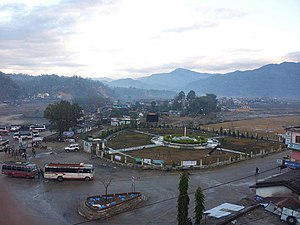
Kamalamai (former name: Sindhulimadi; Nepali: सिन्धुलीमाडी) is a municipality in Sindhuli District, in the Bagmati Province of central south Nepal. At the time of the 2011 Nepal census it had a population of 39,413 people in 9,304 households. The city is located in the Sindhuli Valley of central south Nepal.
Gauribas
Village development committee in Janakpur Zone, Nepal
Distance: Approx. 8999 meters
Latitude and longitude: 27.11666667,85.91666667
Gauribas is a village development committee in Mahottari District in the Janakpur Zone of south-eastern Nepal. At the time of the 1991 Nepal census it had a population of 4308 people living in 810 individual households.

Bhadrakali, Nepal
Village development committee in Janakpur Zone, Nepal
Distance: Approx. 9711 meters
Latitude and longitude: 27.28333333,85.9
Bhadrakali is a village development committee in Sindhuli District in the Janakpur Zone of south-eastern Nepal. At the time of the 1991 Nepal census it had a population of 3,621 people living in 619 individual households.
Bhiman
Municipality in Central, Nepal
Distance: Approx. 3678 meters
Latitude and longitude: 27.16666667,85.91666667
Bhiman (Nepali भिमान ) is a town in Kamalamai Municipality Ward no. 11 in Sindhuli District in the Janakpur Zone of south-eastern Nepal. At the time of the 1991 Nepal census it had a population of 7,609 people living in 1,389 individual households.
Dandiguranse
Village development committee in Janakpur Zone, Nepal
Distance: Approx. 8543 meters
Latitude and longitude: 27.21666667,85.81666667
Dandiguranse is a village development committee in Sindhuli District in the Janakpur Zone of south-eastern Nepal. At the time of the 1991 Nepal census it had a population of 2,608 living in 450 individual households.

Kamalamai Temple (Sindhuli)
Hindu temple in Sindhuli, Nepal
Distance: Approx. 3340 meters
Latitude and longitude: 27.166103,85.900402
The Kamalamai Temple (Nepali: कमलामाई मन्दिर) is a historic Hindu temple located in Kamalamai municipality in Sindhuli district, Nepal. It is situated on the bank of the Kamala river (from where the river gets its name) and about 200 m off the BP Highway in Bagmati Province. The Shah dynasty worshipped in the temple.
Weather in this IP's area
clear sky
11 Celsius
10 Celsius
11 Celsius
11 Celsius
1012 hPa
67 %
1012 hPa
938 hPa
10000 meters
2.42 m/s
1.91 m/s
26 degree