103.54.29.198 - IP Lookup: Free IP Address Lookup, Postal Code Lookup, IP Location Lookup, IP ASN, Public IP
Country:
 India
IndiaRegion:
City:
Location:
Time Zone:
Postal Code:
ISP:
ASN:
language:
User-Agent:
Proxy IP:
Blacklist:
IP information under different IP Channel
ip-api
Country
Region
City
ASN
Time Zone
ISP
Blacklist
Proxy
Latitude
Longitude
Postal
Route
db-ip
Country
Region
City
ASN
Time Zone
ISP
Blacklist
Proxy
Latitude
Longitude
Postal
Route
IPinfo
Country
Region
City
ASN
Time Zone
ISP
Blacklist
Proxy
Latitude
Longitude
Postal
Route
IP2Location
103.54.29.198Country
inRegion
haryana
City
bawal
Time Zone
Asia/Kolkata
ISP
Language
User-Agent
Latitude
Longitude
Postal
ipdata
Country
Region
City
ASN
Time Zone
ISP
Blacklist
Proxy
Latitude
Longitude
Postal
Route
Popular places and events near this IP address

Bawal
Town in Haryana, India
Distance: Approx. 490 meters
Latitude and longitude: 28.08,76.58
Bawal is a big industrial town located, near Rewari city in Rewari district in Indian state of Haryana. It lies in the National Capital Region (NCR) of India. It is located on national highway NH 48 (formerly called NH 8), 11 km from Rewari, the district headquarter, 50 km from Gurugram and 91 km from New Delhi railway station.
Nangli Godha
Village in Haryana, India
Distance: Approx. 8869 meters
Latitude and longitude: 28.1589,76.5548
Nangli Godha is a village in Rewari tehsil of Rewari in the Indian state of Haryana. The literacy rate is 75.4% which translates to 751 literate citizens. There are 217 homes in the village leading to 4.6 people per house on average.
Ramsinghpur
Town in Rajasthan, India
Distance: Approx. 5245 meters
Latitude and longitude: 28.06666667,76.53333333
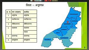
Ramsinghpur, also known as 59 Gb, is a small town located in Anupgarh tehsil and is a sub-tehsil in district of Anupgarh in Rajasthan of India. It is located on Anupgarh-Suratgarh Road and is 20 km from Anupgarh and 19 km from Vijaynagar.
Jaliawas
Place in India
Distance: Approx. 2361 meters
Latitude and longitude: 28.102468,76.59359
Jaliawas is situated in Rewari district, which is about 10.3 km from Rewari town. It is on Rewari-Bawal Road near Neemrana at 10.3 kilometres (6.4 mi) distance from Rewari in Bawal block.
Peacock & Chinkara Breeding Centre, Jhabua
Indian peafowl & Chinkara Wildlife protection in Haryana
Distance: Approx. 5710 meters
Latitude and longitude: 28.03666667,76.6075
Peacock & Chinkara Breeding Centre, Jhabuwa is a 750-acre protected peacock (Indian peafowl) and chinkara reserve forest in Jhabuwa village 15 km south of Bawal in Rewari district in the Indian state of Haryana. Jhabuwa is 100 kilometres (62 mi) from Delhi and 70 kilometres (43 mi) from Gurugram and 200 km from Hisar.
Bharawas
Village in India
Distance: Approx. 7412 meters
Latitude and longitude: 28.1484327,76.5676071
Bharawas is a village in Rewari tehsil of Rewari district in the Indian state of Haryana. It lies on NH15 south of Rewari at about 8 kilometres (5.0 mi) on the Rewari-Bawad road.

Bawal Assembly constituency
Legislative Assembly constituency in Haryana State, India
Distance: Approx. 1972 meters
Latitude and longitude: 28.1,76.59
Bawal is one of the 90 Legislative Assembly constituencies of Haryana state in India. It is part of Rewari district and is reserved for candidates belonging to the Scheduled Castes.
Weather in this IP's area
clear sky
23 Celsius
23 Celsius
23 Celsius
23 Celsius
1011 hPa
36 %
1011 hPa
980 hPa
10000 meters
2.62 m/s
2.63 m/s
12 degree
3 %