Country:
Region:
City:
Latitude and Longitude:
Time Zone:
Postal Code:
IP information under different IP Channel
ip-api
Country
Region
City
ASN
Time Zone
ISP
Blacklist
Proxy
Latitude
Longitude
Postal
Route
Luminati
Country
ASN
Time Zone
Asia/Singapore
ISP
SingAREN
Latitude
Longitude
Postal
IPinfo
Country
Region
City
ASN
Time Zone
ISP
Blacklist
Proxy
Latitude
Longitude
Postal
Route
db-ip
Country
Region
City
ASN
Time Zone
ISP
Blacklist
Proxy
Latitude
Longitude
Postal
Route
ipdata
Country
Region
City
ASN
Time Zone
ISP
Blacklist
Proxy
Latitude
Longitude
Postal
Route
Popular places and events near this IP address

Sri Mariamman Temple, Singapore
Hindu temple in Singapore
Distance: Approx. 210 meters
Latitude and longitude: 1.28261111,103.84527778
The Sri Mariamman Temple (Tamil: ஸ்ரீ மாரியம்மன் கோவில், romanized: Srī Māriyam'maṉ Kōvil) is Singapore's oldest Hindu temple. It is an agamic temple, built in the Dravidian style. Located at 244 South Bridge Road, in the downtown Chinatown district, the temple serves the majority Hindu Singaporeans, Tamilians, in the city-state.
Killing of Hoi Kim Heng
1994 case of a Singaporean police officer stabbed to death during a police chase
Distance: Approx. 166 meters
Latitude and longitude: 1.28471389,103.84633333
On 21 May 1994, Corporal Hoi Kim Heng, a police officer of the Singapore Police Force, was stabbed to death by a drug addict, Soh Loo Ban, after a chase near Fook Hai Building in Chinatown, Singapore.

Thian Hock Keng
Mazu temple in Singapore
Distance: Approx. 265 meters
Latitude and longitude: 1.28105556,103.84752778
Thian Hock Keng (Chinese: 天福宮; pinyin: Tiānfú Gōng; Pe̍h-ōe-jī: Thian-hok-keng or the Tianfu Temple, literally "Palace of Heavenly Happiness"), is a temple built for the worship of Mazu, a Chinese sea goddess, located in Singapore. It is the oldest and most important temple of the Hokkien (Hoklo) people in the country. Another shrine at the back is Buddhist dedicated to Guanyin, the Mahayana Buddhist bodhisattva of mercy.

Masjid Jamae
Distance: Approx. 168 meters
Latitude and longitude: 1.2832,103.8455
Jamae Mosque is one of the earliest mosques in Singapore, and is located on South Bridge Road in the Chinatown district within the Central Area. The mosque was established in 1826. This mosque is also known as Chulia Mosque and Periya Paḷḷi among the Tamil Muslim community in Singapore.

Telok Ayer MRT station
Mass Rapid Transit station in Singapore
Distance: Approx. 215 meters
Latitude and longitude: 1.282125,103.848472
Telok Ayer MRT station is an underground Mass Rapid Transit (MRT) station on the Downtown line (DTL). Situated in Outram, Singapore, the station serves various offices and commercial developments around the junction of Cross Street and Telok Ayer Street. The station is operated by SBS Transit.
Fuk Tak Chi Temple
Distance: Approx. 201 meters
Latitude and longitude: 1.28292,103.84875
The Fuk Tak Chi Temple or Fook Tet Soo Khek Temple (Chinese: 海唇福德祠) was one of the oldest former temple in Singapore built in 1820 by Cantonese and Hakka immigrants from Kwong Wai Siew (广惠肇三府). It is currently a museum housing more than 200 artefacts.
Nagore Durgha, Singapore
Place in Singapore
Distance: Approx. 237 meters
Latitude and longitude: 1.28141667,103.84783333
The Nagore Dargah (or Nagore Dargah) is a shrine in Singapore built by Muslims from southern India between 1828 and 1830, and was originally known as Shahul Hamid Dargah. When this shrine was first built, Telok Ayer Street where the shrine is located was a sandy beach crowded with sailing craft. While its physical surroundings have changed beyond recognition, the monument itself – save for conservation and preservation work in 2007 – has changed little since the late 19th century.
Mosque Street, Singapore
Street in Chinatown, Singapore
Distance: Approx. 249 meters
Latitude and longitude: 1.2838,103.8448
Mosque Street (Chinese: 摩士街; Malay: Lebuh Masjid) is a one-way street located in Chinatown within the Outram Planning Area in Singapore. The road links South Bridge Road to New Bridge Road near Chinatown MRT station.
Club Street
Street in Chinatown, Singapore
Distance: Approx. 148 meters
Latitude and longitude: 1.2822,103.84638
Club Street (simplified Chinese: 客纳街; traditional Chinese: 客納街) is a street located in Chinatown within the Outram Planning Area in Singapore. Club Street links Cross Street with Ann Siang Hill, which leads to South Bridge Road. The street is lined with conserved shops that are occupied by restaurants, bars and several galleries.
Ying Fo Fui Kun
Historic site in Telok Ayer Street
Distance: Approx. 190 meters
Latitude and longitude: 1.28247222,103.84844444
Ying Fo Fui Kun (simplified Chinese: 应和会馆; traditional Chinese: 應和會館; pinyin: Yìnghè Huìguǎn) is a Hakka clan association in Singapore. Its clan house is located at Telok Ayer Street in the Outram Planning Area, within the Central Area. The Ying Fo Fui Kun clan house building was constructed in 1881-1882.
Pickering Operations Complex
Commercial offices in Downtown Core, Singapore
Distance: Approx. 247 meters
Latitude and longitude: 1.285201,103.848266
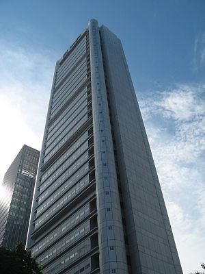
The Pickering Operations Complex is a 177 m (581 ft) skyscraper at 20 Pickering Street, in Raffles Place in the central business district of Singapore. The tower is situated adjacent to OCBC Centre and One George Street.

Parkroyal Collection Pickering
Distance: Approx. 273 meters
Latitude and longitude: 1.285777,103.846476
Parkroyal Collection Pickering, Singapore (formerly known as PARKROYAL on Pickering), is a luxury five-star hotel located in Singapore's Central Area. It is owned by the Singaporean investment and property development company UOL Group.
Weather in this IP's area
light rain
32 Celsius
37 Celsius
31 Celsius
32 Celsius
1011 hPa
62 %
1011 hPa
1007 hPa
10000 meters
4.63 m/s
180 degree
75 %
06:46:10
18:50:11


