Country:
Region:
City:
Latitude and Longitude:
Time Zone:
Postal Code:
IP information under different IP Channel
ip-api
Country
Region
City
ASN
Time Zone
ISP
Blacklist
Proxy
Latitude
Longitude
Postal
Route
Luminati
Country
ASN
Time Zone
Asia/Tokyo
ISP
BEKKOAME INTERNET INC.
Latitude
Longitude
Postal
IPinfo
Country
Region
City
ASN
Time Zone
ISP
Blacklist
Proxy
Latitude
Longitude
Postal
Route
db-ip
Country
Region
City
ASN
Time Zone
ISP
Blacklist
Proxy
Latitude
Longitude
Postal
Route
ipdata
Country
Region
City
ASN
Time Zone
ISP
Blacklist
Proxy
Latitude
Longitude
Postal
Route
Popular places and events near this IP address
Hiyoshi
Distance: Approx. 2331 meters
Latitude and longitude: 35.55741667,139.64711111
Hiyoshi (日吉) is a part of the city of Yokohama, Kanagawa Prefecture, Japan. It is located within Kōhoku Ward in the northeast of Yokohama City.
Nakahara-ku, Kawasaki
Ward in Kantō, Japan
Distance: Approx. 2466 meters
Latitude and longitude: 35.57611111,139.65583333
Nakahara-ku (中原区) is one of the 7 wards of the city of Kawasaki in Kanagawa Prefecture, Japan. As of November 2014, the ward had an estimated population of 244,565 and a density of 16,637 persons per km². The total area was 14.70 km².

Hiyoshi Station (Kanagawa)
Railway and metro station in Yokohama, Japan
Distance: Approx. 2679 meters
Latitude and longitude: 35.553062,139.64678
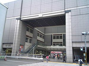
Hiyoshi Station (日吉駅, Hiyoshi-eki) is an interchange passenger railway station located in Kōhoku-ku, Yokohama, Kanagawa Prefecture, Japan, jointly managed by the private railway operator Tokyu Corporation and the Yokohama City Transportation Bureau.
Motosumiyoshi Station
Railway station in Kawasaki, Kanagawa Prefecture, Japan
Distance: Approx. 2436 meters
Latitude and longitude: 35.564315,139.654046
Motosumiyoshi Station (元住吉駅, Motosumiyoshi-eki) is a junction passenger railway station located in Nakahara-ku, Kawasaki, Kanagawa Prefecture, Japan, operated by the private railway company Tokyu Corporation.
Musashi-Nakahara Station
Railway station in Kawasaki, Kanagawa Prefecture, Japan
Distance: Approx. 1443 meters
Latitude and longitude: 35.5816,139.6401
Musashi-Nakahara Station (武蔵中原駅, Musashi-Nakahara-eki) is a passenger railway station located in Nakahara-ku, Kawasaki, Kanagawa Prefecture, Japan, operated by the East Japan Railway Company (JR East).
Musashi-Shinjō Station
Railway station in Kawasaki, Kanagawa Prefecture, Japan
Distance: Approx. 1692 meters
Latitude and longitude: 35.5875,139.6291
Musashi-Shinjō Station (武蔵新城駅, Musashi-Shinjō-eki) is a passenger railway station located in Nakahara-ku, Kawasaki, Kanagawa Prefecture, Japan, operated by the East Japan Railway Company (JR East).

Hiyoshi-Honchō Station
Metro station in Yokohama, Japan
Distance: Approx. 2560 meters
Latitude and longitude: 35.5496,139.6335
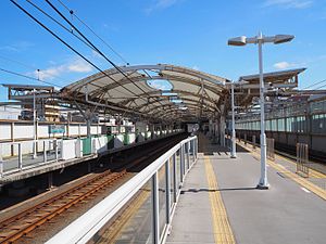
Hiyoshi-Honchō Station (日吉本町駅, Hiyoshi-Honchō-eki) is a metro station located in Kōhoku Ward, Yokohama, Kanagawa Prefecture, Japan. It is served by the Yokohama Municipal Subway’s Green Line (Line 4) and is 11.6 kilometers from the terminus of the Green Line at Nakayama.

Takata Station (Kanagawa)
Metro station in Yokohama, Japan
Distance: Approx. 2649 meters
Latitude and longitude: 35.549625,139.62013611
Takata Station (高田駅, Takata-eki) is a metro station located in Kōhoku Ward, Yokohama, Kanagawa Prefecture, Japan. It is served by the Yokohama Municipal Subway’s Green Line (Line 4) and is 10.3 kilometers from the terminus of the Green Line at Nakayama.

Kawasaki City Todoroki Arena
Distance: Approx. 2355 meters
Latitude and longitude: 35.587287,139.647357
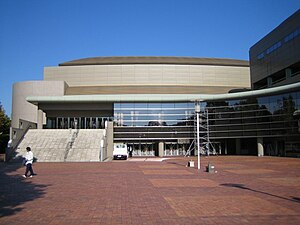
Todoroki Arena is a multi-purpose indoor arena in the Todoroki Park in Kawasaki, Kanagawa, Japan. The capacity of the arena is 6,500 and was opened in 1995. The arena is the playing ground for the Kawasaki Brave Thunders.
Todoroki Ryokuchi
Park in Japan
Distance: Approx. 2445 meters
Latitude and longitude: 35.58611111,139.65
Todoroki Ryokuchi (等々力緑地) is a park located in Nakahara-ku ward, Kawasaki, in Kanagawa Prefecture, Japan. It is famous for its sport facilities including an athletics stadium, gym, a baseball field, a pool, a tennis court, and it contains a museum as well.

Senzoku Gakuen
Private educational institution in Kanagawa, Japan
Distance: Approx. 2694 meters
Latitude and longitude: 35.59388889,139.61555556
Senzoku Gakuen (洗足学園, Senzoku gakuen) is a private educational institution in Kawasaki, Kanagawa, Japan. The institution operates a school of music, a junior college, primary and secondary schools, and a kindergarten. The first Senzoku Gakuen school, the Hiratsuka Sewing School for Women, was founded in 1924 by Wakao Maeda, followed by the opening of Senzoku Women's Higher School in 1927.
Tomahawks Field
Outdoor Stadium in Japan
Distance: Approx. 1751 meters
Latitude and longitude: 35.57222222,139.64833333
Tomahawks Field was an outdoor athletic stadium in Tokyo, Japan, the home field of the Hosei Orange of the Kantoh Collegiate American Football Association. With permission, and assistance, from Boise State University, Hosei is the first university to have a blue turf playing surface granted to them under the first international licensing of the playing surface through a Boise State trademark.
Weather in this IP's area
light intensity shower rain
14 Celsius
13 Celsius
12 Celsius
15 Celsius
1016 hPa
69 %
1016 hPa
1014 hPa
10000 meters
8.75 m/s
30 degree
75 %
06:20:08
16:33:27


