Country:
Region:
City:
Latitude and Longitude:
Time Zone:
Postal Code:
IP information under different IP Channel
ip-api
Country
Region
City
ASN
Time Zone
ISP
Blacklist
Proxy
Latitude
Longitude
Postal
Route
Luminati
Country
ASN
Time Zone
Asia/Tokyo
ISP
Dream Wave Shizuoka Co. Ltd.
Latitude
Longitude
Postal
IPinfo
Country
Region
City
ASN
Time Zone
ISP
Blacklist
Proxy
Latitude
Longitude
Postal
Route
db-ip
Country
Region
City
ASN
Time Zone
ISP
Blacklist
Proxy
Latitude
Longitude
Postal
Route
ipdata
Country
Region
City
ASN
Time Zone
ISP
Blacklist
Proxy
Latitude
Longitude
Postal
Route
Popular places and events near this IP address

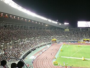
Nagai Stadium
Building in Higashisumiyoshi-ku, Osaka Prefecture, Japan
Distance: Approx. 660 meters
Latitude and longitude: 34.61411944,135.51845
Nagai Stadium (大阪市 長居陸上競技場, Ōsaka-shi Nagai Rikujō Kyōgijō) is a stadium in Osaka, Japan. It is the home ground of J. League club Cerezo Osaka. The stadium has a seating capacity of 47,000.

Sumiyoshi-ku, Osaka
Ward of Osaka, Japan
Distance: Approx. 1357 meters
Latitude and longitude: 34.603675,135.50062778
Sumiyoshi-ku (住吉区) is one of 24 wards of Osaka, Japan. It is located on the southern part of the Uemachi Plateau, in the southernmost part of Osaka City, and is separated from Sakai City's Sakai-ku and Kita-ku by the Yamato River. There are six rail lines, and three main thoroughfares - Abiko-Suji (which run north–south through the centre of the ward), Abeno-Suji (which continues north through the area of Tennoji) and Nagai Koen-Dori, which runs east–west and connects the area with the port to the west.

Yanmar Field Nagai
Stadium in Higashisumiyoshi-ku, Osaka Prefecture, Japan
Distance: Approx. 610 meters
Latitude and longitude: 34.611352,135.518641
The Yanmar Field Nagai (ヤンマーフィールド長居) is an athletics stadium, also used as the support stadium for the Yanmar Stadium Nagai in Nagai Park, Higashisumiyoshi-ku, Osaka, Japan. The Aid Stadium, occasionally called The Second Nagai Stadium allows the bigger stadium to host world class athletic events. It seats 15,000 with overflow room on a grass hill.

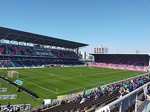
Yodoko Sakura Stadium
Distance: Approx. 599 meters
Latitude and longitude: 34.615339,135.516572
Yodoko Sakura Stadium (ヨドコウ桜スタジアム), a.k.a. “Nagai Ballgame Field” (長居球技場), is a stadium located in Nagai Park, Higashisumiyoshi-ku, Osaka, Japan. It plays host to J.League association football, international rugby, Japan Rugby League One, and X-League American football games.

Nishitanabe Station
Metro station in Osaka, Japan
Distance: Approx. 1164 meters
Latitude and longitude: 34.621627,135.515153
Nishitanabe Station (西田辺駅, Nishitanabe-eki) is a subway station on the Osaka Metro Midosuji Line in Abeno-ku, Osaka, Japan.

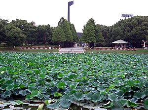
Nagai Park
Park and sports complex in Osaka, Japan
Distance: Approx. 786 meters
Latitude and longitude: 34.61194444,135.52055556
Nagai Park (長居公園, Nagai kōen) is a large sports complex located in Higashisumiyoshi-ku, Osaka. Its facilities include three multipurpose sports stadiums, including 50,000-seat Nagai Stadium; Nagai Botanical Garden, which has over 1,000 species of trees and flowers; a swimming pool and gymnasium; and a tract of preserved local forest. It also hosts a large number of cherry trees and is a popular area for picnics during cherry blossom (sakura) season in early spring.

Nagai Botanical Garden
Distance: Approx. 893 meters
Latitude and longitude: 34.61055556,135.52166667
The Nagai Botanical Garden (大阪市立長居植物園, Ōsaka Shiritsu Nagai Shokubutsuen) is a botanical garden located in the southern part of Nagai Park, Higashisumiyoshi-ku, Osaka, Japan. An admission fee is charged for adults, while middle school students and under are free. It opened in 1974.
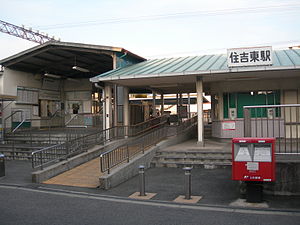
Sumiyoshihigashi Station
Railway station in Osaka, Japan
Distance: Approx. 1342 meters
Latitude and longitude: 34.61294444,135.49744444
Sumiyoshihigashi Station (住吉東駅, Sumiyoshihigashi-eki) is a railway station in Sumiyoshi-ku, Osaka, Osaka Prefecture, Japan, operated by the private railway operator Nankai Electric Railway.

Tsurugaoka Station
Railway station in Osaka, Japan
Distance: Approx. 812 meters
Latitude and longitude: 34.61772222,135.51661389
Tsurugaoka Station (鶴ヶ丘駅, Tsurugaoka-eki) is a railway station on the West Japan Railway Company (JR West) Hanwa Line in Nishi-Tanabecho Nichome, Abeno-ku, Osaka, Osaka Prefecture, Japan. When the platforms and the tracks were located on the ground, the station was located in Yamasaka Gochome, Higashisumiyoshi-ku. It is administrated by Sakaishi Station.

Abikochō Station
Railway station in Osaka, Japan
Distance: Approx. 1157 meters
Latitude and longitude: 34.6021,135.5066
Abikochō Station (我孫子町駅, Abikochō-eki) is a railway station on the West Japan Railway Company Hanwa Line in Sumiyoshi-ku, Osaka, Osaka Prefecture, Japan.

Osaka Museum of Natural History
Museum in Ōsaka, Japan
Distance: Approx. 977 meters
Latitude and longitude: 34.61037,135.522562
Osaka Museum of Natural History (大阪市立自然史博物館, Ōsaka-shi-ritsu Shizen-shi Hakubutsukan) is a museum of natural history in Higashisumiyoshi-ku, Ōsaka, Japan.

Osaka General Medical Center
Hospital in Osaka, Japan
Distance: Approx. 862 meters
Latitude and longitude: 34.61692778,135.50528611
Osaka General Medical Center (Osaka General Medical Center) is located in Mandai 3chiome, Sumiyoshi-ku, Osaka, Japan. It has 865 beds and is run by the Osaka Prefectural government. This hospital was founded in 1871, and its role includes comprehensive rehabilitation medical care from the acute stage to the convalescent stage.
Weather in this IP's area
broken clouds
8 Celsius
5 Celsius
7 Celsius
8 Celsius
1029 hPa
74 %
1029 hPa
1027 hPa
10000 meters
5.28 m/s
9.9 m/s
11 degree
79 %
06:35:34
16:51:24
