Country:
Region:
City:
Latitude and Longitude:
Time Zone:
Postal Code:
IP information under different IP Channel
ip-api
Country
Region
City
ASN
Time Zone
ISP
Blacklist
Proxy
Latitude
Longitude
Postal
Route
Luminati
Country
Region
vic
City
melbourne
ASN
Time Zone
Australia/Melbourne
ISP
Slnet Hosting
Latitude
Longitude
Postal
IPinfo
Country
Region
City
ASN
Time Zone
ISP
Blacklist
Proxy
Latitude
Longitude
Postal
Route
db-ip
Country
Region
City
ASN
Time Zone
ISP
Blacklist
Proxy
Latitude
Longitude
Postal
Route
ipdata
Country
Region
City
ASN
Time Zone
ISP
Blacklist
Proxy
Latitude
Longitude
Postal
Route
Popular places and events near this IP address

Braybrook, Victoria
Suburb of Melbourne, Victoria, Australia
Distance: Approx. 1659 meters
Latitude and longitude: -37.78555556,144.85527778
Braybrook is an inner suburb in Melbourne, Victoria, Australia, 9 km (5.6 mi) west of Melbourne's Central Business District, located within the City of Maribyrnong local government area. Braybrook recorded a population of 9,682 at the 2021 census. Braybrook is bounded in the west by Duke Street, in the north by the Maribyrnong River, in the east by Ashley Street, and in the south by the Sunbury railway line and Sunshine Road.

Maidstone, Victoria
Suburb of Melbourne, Victoria, Australia
Distance: Approx. 604 meters
Latitude and longitude: -37.783,144.878
Maidstone ( MAYD-stən) is an inner suburb in Melbourne, Victoria, Australia, 7 km (4.3 mi) north-west of Melbourne's Central Business District, located with the City of Maribyrnong local government area. Maidstone recorded a population of 9,389 at the 2021 census. The suburb predominantly consists of residential areas.

Tottenham railway station
Railway station in Melbourne, Australia
Distance: Approx. 1630 meters
Latitude and longitude: -37.7993,144.8632
Tottenham railway station is a commuter railway station on the Sunbury line, which is part of the Melbourne railway network. It serves the western suburb of West Footscray, in Melbourne, Victoria, Australia. Tottenham station is a ground-level unstaffed station, featuring an island platform.

Whitten Oval
Stadium in Melbourne, Victoria, Australia
Distance: Approx. 1725 meters
Latitude and longitude: -37.799166,144.886748
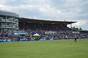
Whitten Oval (also known as Mission Whitten Oval under a naming rights agreement) is a stadium in the inner-western suburbs of Melbourne, Victoria, Australia, located in Barkly Street, West Footscray. It is the training and administrative headquarters of the Western Bulldogs (formerly the Footscray Football Club), which competes in the Australian Football League (AFL). The ground is also the home of the club's women's and reserves teams which compete in the AFL Women's (AFLW), Victorian Football League (VFL), and VFL Women's (VFLW).

Maribyrnong College
Public sports high school in Maribyrnong, Melbourne, Victoria, Australia
Distance: Approx. 1561 meters
Latitude and longitude: -37.779,144.8882
Maribyrnong College, also known as Maribyrnong Secondary College, and formerly known as Maribyrnong High School, is a government-funded secondary day school that specialises in sports, located in Maribyrnong in the inner western suburbs of Melbourne, Victoria, Australia. Students enrol based on local residence and/or in the selective sports academy. The school offers an accelerated learning program to prospective students who demonstrate academic ability.

Snuff Puppets
Australian puppet theatre company
Distance: Approx. 1754 meters
Latitude and longitude: -37.7986647,144.8879336
Snuff Puppets is an Australian puppet theatre company. Founded in 1992, they combine elements of puppetry, live music, visual, and physical theatre to discuss taboo topics and make political satire.

Electoral district of Footscray
State electoral district of Victoria, Australia
Distance: Approx. 1543 meters
Latitude and longitude: -37.8,144.86666667
The electoral district of Footscray is an electoral district of the Victorian Legislative Assembly. It lies just north of Melbourne, covering the suburbs of Footscray, Maidstone, Maribyrnong, Seddon, West Footscray, and parts of Yarraville. The seat was first created by The Electoral Act Amendment Act 1876 taking effect at the 1877 elections.
Maribyrnong Immigration Detention Centre
Immigration detention facility in Victoria, Australia 1950–2018
Distance: Approx. 1190 meters
Latitude and longitude: -37.776861,144.876263
Maribyrnong Immigration Detention Centre was an Australian immigration detention facility in Maribyrnong, Victoria. The centre was originally opened in 1950, as the Maribyrnong Migrant Hostel, then later the Midway (Migrant) Hostel in the late 1960s. The Phillip Migrant Hostel was added later.

ETA Foods Factory
Heritage-listed food factory, Braybrook, Victoria
Distance: Approx. 1532 meters
Latitude and longitude: -37.780128,144.8592
The former ETA Foods Factory is a heritage-listed building as an important Modernist industrial building in Victoria, Australia, notable for its glass curtain wall design. The building was constructed in 1957 in Braybrook, a suburb of Melbourne, on Ballarat Road.

Skinner Reserve
Distance: Approx. 1646 meters
Latitude and longitude: -37.78722222,144.85527778
Skinner Reserve is an Australian rules football stadium located on Churchill Avenue, Braybrook, Victoria. It is most notable as the former home ground of the Sunshine Football Club in the Victorian Football Association (VFA). Prior to Skinner Reserve being developed as a football ground, the primary sports venue in the City of Sunshine was Selwyn Park, Albion.
Footscray Hospital
Hospital in Victoria, Australia
Distance: Approx. 1241 meters
Latitude and longitude: -37.79191,144.886886
Footscray Hospital is a public hospital located on Gordon Street in Footscray, an inner-western suburb of Melbourne, Australia. It is one of three major hospitals operated by Western Health in the western suburbs of Melbourne.

Maidstone tram depot
Distance: Approx. 1289 meters
Latitude and longitude: -37.776186,144.877641
Maidstone tram depot is a future depot on the Yarra Trams network in Melbourne. As of March 2024 it is under construction on Hampstead Road, Maidstone near the intersection with Williamson Road, on part of the site of the former Student Village (before that the Maribyrnong Migrant Hostel). The Maidstone depot will be home for the new G-class trams.
Weather in this IP's area
few clouds
13 Celsius
12 Celsius
12 Celsius
14 Celsius
1017 hPa
76 %
1017 hPa
1012 hPa
10000 meters
5.14 m/s
290 degree
20 %
05:58:24
20:13:12