103.38.104.126 - IP Lookup: Free IP Address Lookup, Postal Code Lookup, IP Location Lookup, IP ASN, Public IP
Country:
Region:
City:
Location:
Time Zone:
Postal Code:
ISP:
ASN:
language:
User-Agent:
Proxy IP:
Blacklist:
IP information under different IP Channel
ip-api
Country
Region
City
ASN
Time Zone
ISP
Blacklist
Proxy
Latitude
Longitude
Postal
Route
db-ip
Country
Region
City
ASN
Time Zone
ISP
Blacklist
Proxy
Latitude
Longitude
Postal
Route
IPinfo
Country
Region
City
ASN
Time Zone
ISP
Blacklist
Proxy
Latitude
Longitude
Postal
Route
IP2Location
103.38.104.126Country
Region
jawa tengah
City
purbalingga
Time Zone
Asia/Jakarta
ISP
Language
User-Agent
Latitude
Longitude
Postal
ipdata
Country
Region
City
ASN
Time Zone
ISP
Blacklist
Proxy
Latitude
Longitude
Postal
Route
Popular places and events near this IP address

Purbalingga
Regency capital in Central Java, Indonesia
Distance: Approx. 392 meters
Latitude and longitude: -7.39027778,109.36111111
Purbalingga (Javanese: ꦥꦸꦂꦧꦭꦶꦁꦒ) is a town and district in Central Java Province of Indonesia and the seat of Purbalingga Regency.

Goentoer Darjono Stadium
Distance: Approx. 743 meters
Latitude and longitude: -7.39388889,109.36055556
Goentoer Darjono Stadium is a football stadium in the town of Purbalingga, Indonesia. The stadium has a capacity of 15,000 people. It is the home base of Persibangga Purbalingga .
Bakulan
Place in Central Java, Indonesia
Distance: Approx. 6675 meters
Latitude and longitude: -7.44516667,109.38247222
Bakulan is a village in Kemangkon, Purbalingga, Central Java, Indonesia.
Bokol
Place in Central Java, Indonesia
Distance: Approx. 8880 meters
Latitude and longitude: -7.46666667,109.35
Bokol is a village in the Kemangkon District, Central Java, Indonesia.

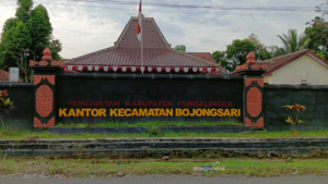
Bojongsari, Purbalingga
District in Purbalingga Regency, Central Java, Indonesia
Distance: Approx. 4052 meters
Latitude and longitude: -7.352724,109.355257
Bojongsari is a district in Purbalingga Regency, Central Java, Indonesia. This district is about 10 km away from Purbalingga, the capital city of Purbalingga Regency. The northern part of this district is the slopes of Mount Slamet.

Bobotsari, Purbalingga
District in Central Java, Indonesia
Distance: Approx. 9166 meters
Latitude and longitude: -7.30586111,109.36808333
Bobotsari is a town and administrative district (kecamatan) in Purbalingga Regency, Central Java, Indonesia. Its capital lays at the town of Bobotsari, though Gandasuli was sometimes considered the de facto capital of Bobotsari District. Bobotsari is also the second largest district town (id:Kota kecamatan) after Purbalingga in Purbalingga Regency.
Weather in this IP's area
overcast clouds
26 Celsius
26 Celsius
26 Celsius
26 Celsius
1011 hPa
87 %
1011 hPa
966 hPa
10000 meters
0.55 m/s
0.82 m/s
181 degree
100 %