Country:
Region:
City:
Latitude and Longitude:
Time Zone:
Postal Code:
IP information under different IP Channel
ip-api
Country
Region
City
ASN
Time Zone
ISP
Blacklist
Proxy
Latitude
Longitude
Postal
Route
Luminati
Country
ASN
Time Zone
Asia/Hong_Kong
ISP
IPTELECOM ASIA
Latitude
Longitude
Postal
IPinfo
Country
Region
City
ASN
Time Zone
ISP
Blacklist
Proxy
Latitude
Longitude
Postal
Route
db-ip
Country
Region
City
ASN
Time Zone
ISP
Blacklist
Proxy
Latitude
Longitude
Postal
Route
ipdata
Country
Region
City
ASN
Time Zone
ISP
Blacklist
Proxy
Latitude
Longitude
Postal
Route
Popular places and events near this IP address

Kwai Hing station
MTR station in the New Territories, Hong Kong
Distance: Approx. 870 meters
Latitude and longitude: 22.3632,114.1312
Kwai Hing (Chinese: 葵興) is an elevated railway station on the Tsuen Wan line of Hong Kong MTR system. It is named after the nearest public housing estate, and is between Kwai Fong and Tai Wo Hau stations. Opened on 10 May 1982, it forced most direct bus services into Kowloon to be cancelled.

Sheng Kung Hui Lam Woo Memorial Secondary School
Secondary school in Hong Kong
Distance: Approx. 894 meters
Latitude and longitude: 22.36494444,114.130425
Sheng Kung Hui Lam Woo Memorial Secondary School (LWMSS, Traditional Chinese: 聖公會林護紀念中學) is an Anglican secondary school located at Kwai Shing Circuit, Kwai Chung, the New Territories, Hong Kong. The school was founded in 1970 by Hong Kong Sheng Kung Hui (Anglican Church in Hong Kong) and was named after Mr. Lam Woo for his donations to promote education.
CNEC Christian College
Secondary school in Kwai Chung, New Territories
Distance: Approx. 285 meters
Latitude and longitude: 22.3637,114.1396
CNEC Christian College (Chinese: 中華傳道會安柱中學) is a subsidised English Medium of Instruction school located in Kwai Chung, New Territories, Hong Kong. Founded in 1973, it is a Christian school.

Shek Lei Estate
Public housing estate in Kwai Chung, New Territories
Distance: Approx. 232 meters
Latitude and longitude: 22.364344,114.140021
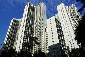
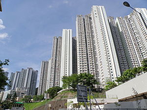
Shek Lei Estate (Chinese: 石籬邨), also known by Shek Lei (石籬/石梨, both are currently used) is a public housing estate in Hong Kong, situated in the Shek Lei Pui (石梨貝/石梨背/石犁背) area in northeast Kwai Chung, New Territories, near Shek Yam Estate, On Yam Estate and Shek Yam East Estate. The estate is separated into two parts, namely Shek Lei (I) Estate (石籬(一)邨) and Shek Lei (II) Estate (石籬(二)邨). It has a total of 21 residential blocks with a population of about 40,000, as well as two shopping centres.

Kwai Hing
Distance: Approx. 859 meters
Latitude and longitude: 22.36314,114.13134
Kwai Hing is an area of Kwai Chung Town, Hong Kong. The mainly residential area extends to North Kwai Chung in the north and east, Kwai Fong in the south, and Kwai Chung Estate to the west. It is part of the reclamation of Gin Drinkers Bay in 1960s.

Kwai Hing Estate
Public housing estate in Kwai Chung, Hong Kong
Distance: Approx. 707 meters
Latitude and longitude: 22.365822,114.132148
Kwai Hing Estate (Chinese: 葵興邨) is a public housing estate in Kwai Hing, Kwai Chung, New Territories, Hong Kong. It was built in the valley of Gin Drinkers Bay, later the town centre of Kwai Chung. Kwai Hing station is named after the name of the estate.

Shek Yam East Estate
Public housing estate in Kwai Chung, Hong Kong
Distance: Approx. 661 meters
Latitude and longitude: 22.372125,114.139447
Shek Yam East Estate (Chinese: 石蔭東邨) is a public housing estate in North Kwai Chung, New Territories, Hong Kong. It has three blocks built in 1996. It was developed on the former site of Tai Pak Tin Temporary Housing Area (Chinese: 大白田臨時房屋區), and not as a redevelopment of Shek Yam Estate.
On Yam Estate
Public housing estate in Kwai Chung, Hong Kong
Distance: Approx. 777 meters
Latitude and longitude: 22.372899,114.14112
On Yam Estate (Chinese: 安蔭邨) is a public housing estate in North Kwai Chung, New Territories, Hong Kong. It is situated on land which was formerly the location of Shek Yam Temporary Housing Area (Chinese: 石蔭臨時房屋區) and Shek Lei Temporary Housing Area (Chinese: 石籬臨時房屋區). The estate consists of 8 residential buildings (in Phase 1 and 2) completed in 1994 and 1995.

Shek Yam Estate
Public housing estate in Kwai Chung, Hong Kong
Distance: Approx. 661 meters
Latitude and longitude: 22.372125,114.139447
Shek Yam Estate (Chinese: 石蔭邨) is a public housing estate in North Kwai Chung, New Territories, Hong Kong. It was the first Government Low Cost Housing Scheme estate in Kwai Chung. It had 8 blocks built in 1968, which were all demolished in the 1990s and 2000s.
Golden Hill, Hong Kong
Distance: Approx. 834 meters
Latitude and longitude: 22.365,114.147
Golden Hill (Chinese: 金山), also known as Kam Shan, is a 369 metres (1,211 ft) tall mountain located in Hong Kong's New Territories.

Pope Paul VI College
Secondary school in Kwai Chung, New Territories
Distance: Approx. 325 meters
Latitude and longitude: 22.3633,114.1386
Pope Paul VI College is a band 1B Roman Catholic girls' secondary school in Hong Kong. The school was founded by Missionary Sisters of the Immaculate in 1969. It is an English medium of instruction school.
Yau Ma Hom
Village in Hong Kong
Distance: Approx. 822 meters
Latitude and longitude: 22.371561,114.133508
Yau Ma Hom or Yau Ma Hom Resite Village (Chinese: 油麻磡村) is a village in the Tsuen Wan District of Hong Kong.
Weather in this IP's area
overcast clouds
27 Celsius
28 Celsius
27 Celsius
29 Celsius
1017 hPa
60 %
1017 hPa
1011 hPa
10000 meters
4.47 m/s
360 degree
88 %
06:29:51
17:44:11

