103.26.108.237 - IP Lookup: Free IP Address Lookup, Postal Code Lookup, IP Location Lookup, IP ASN, Public IP
Country:
 India
IndiaRegion:
City:
Location:
Time Zone:
Postal Code:
ISP:
ASN:
language:
User-Agent:
Proxy IP:
Blacklist:
IP information under different IP Channel
ip-api
Country
Region
City
ASN
Time Zone
ISP
Blacklist
Proxy
Latitude
Longitude
Postal
Route
db-ip
Country
Region
City
ASN
Time Zone
ISP
Blacklist
Proxy
Latitude
Longitude
Postal
Route
IPinfo
Country
Region
City
ASN
Time Zone
ISP
Blacklist
Proxy
Latitude
Longitude
Postal
Route
IP2Location
103.26.108.237Country
inRegion
tamil nadu
City
tiruchchendur
Time Zone
Asia/Kolkata
ISP
Language
User-Agent
Latitude
Longitude
Postal
ipdata
Country
Region
City
ASN
Time Zone
ISP
Blacklist
Proxy
Latitude
Longitude
Postal
Route
Popular places and events near this IP address

Avathara Pathi
Distance: Approx. 1314 meters
Latitude and longitude: 8.49076111,78.12594722
Avathara Pathi is a phrase in Tamil which represents 'The place where God incarnates'. The Avathara Pathi is one among the holy places of Ayyavazhi, in Thiruchendur. Avathara Pathi is located half-a-mile south to the Murugan Temple, at the sea-shore."Makara Theertham", the primary sea-Teertha is located here.

Tiruchendur
Town in Tamil Nadu, India
Distance: Approx. 1382 meters
Latitude and longitude: 8.4946,78.1219
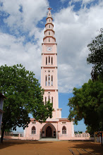
Tiruchendur (Tamil: Tiruccentūr [ˈt̪iɾɯtːʃen̪d̪uːr], also jayantipuram) is a municipality in Thoothukudi district, Tamil Nadu, India. It is home to the Arulmigu Subramaniya Swamy Temple, one of the Six Abodes of Murugan.

Sawyerpuram
Town in Tamil Nadu, India
Distance: Approx. 1984 meters
Latitude and longitude: 8.49,78.1
Sawyerpuram is a town panchayat in Tuticorin district, Tamil Nadu, India. Microliths are found in large in numbers around Sawyerpuram (and additionally in Kulattur, Tirunelveli). They were found embedded in the fossil-bearing sand dunes.
Virapandianpatnam
Village in Tamil Nadu, India
Distance: Approx. 4088 meters
Latitude and longitude: 8.52,78.11805556
Virapandianpattanam or Virapandianpatnam is a village on the southeastern coast of the Indian peninsula, near Thiruchendur, Thoothukudi District, Tamil Nadu. Many people were converted to Roman Catholicism there by St. Francis Xavier by 1544.
Tiruchendur Lok Sabha constituency
Former constituency of the Indian parliament in Tamil Nadu
Distance: Approx. 2615 meters
Latitude and longitude: 8.5,78.1
Tiruchendur was a Lok Sabha constituency in Tamil Nadu until 2008 constituency realignment.
Kayamozhi
Village in Tamil Nadu, India
Distance: Approx. 8363 meters
Latitude and longitude: 8.50888889,78.04527778
Kayamozhi (Tamil pronunciation: [/kaːjaːmoɻi/]) is a village 9km west of Thiruchendur in Thoothukudi District, Tamil Nadu, India. Its was established in the 16th century as the capital of the old Vadapattu region. It has an elevation of 15m (49ft) above mean sea level.

V. O. Chidambaranar Port
Port in India
Distance: Approx. 1263 meters
Latitude and longitude: 8.473,78.1215
V. O. Chidambaranar Port is a port in Thoothukudi, Tamil Nadu, and is one of the 13 major ports in India. It was declared to be a major port on 11 July 1974. It is the second largest port in Tamil Nadu and third largest container terminal in India.

Tiruchendur Assembly constituency
One of the 234 State Legislative Assembly Constituencies in Tamil Nadu
Distance: Approx. 1894 meters
Latitude and longitude: 8.5,78.12
Tiruchendur is one of the 234 state legislative assembly constituencies in Tamil Nadu in southern India. It is also one of the 6 state legislative assembly constituencies included in the Thoothukkudi Lok Sabha constituency. It is one of the oldest assembly segments in Tamil Nadu since Independence.

Dr. Sivanthi Aditanar College of Engineering
Engineering college in Tiruchedur, Tamil Nadu, India
Distance: Approx. 5224 meters
Latitude and longitude: 8.5214,78.089
The Dr. Sivanthi Aditanar College of Engineering (abbr. Dr.
Manadu
Village in Tamil Nadu, India
Distance: Approx. 0 meters
Latitude and longitude: 8.4833,78.1167
Manadu Thandupathu is an Indian village in Thoothukudi district near Tiruchendur above 12 km. It is famous for 'Pathene'. Many people have moved to nearby cities, especially to Chennai.
Vellalanvilai
Place in Tamil Nadu, India
Distance: Approx. 8550 meters
Latitude and longitude: 8.4701,78.0402
Vellalanvilai is a village panchayat in Thoothukudi district in the Indian state of Tamil Nadu. As of 2011 India census, Vellalanvilai had a population of 1947. The nearby villages are Zion Nagar, Thandupathu, Vattanvilai and Mannadu.
Kulasekarapattinam Spaceport
Under-development spaceport in India
Distance: Approx. 6605 meters
Latitude and longitude: 8.4398,78.0759
Kulasekarapattinam Spaceport is the second spaceport of the Indian Space Research Organisation (ISRO), located in Kulasekarapattinam, a coastal village in Thoothukudi district of Tamil Nadu, India. The facility is being constructed over 2,350 acres. As of September 2023, more than 90% of land has been acquired and the groundbreaking was done on 28 February 2024.
Weather in this IP's area
few clouds
24 Celsius
24 Celsius
24 Celsius
24 Celsius
1011 hPa
77 %
1011 hPa
1009 hPa
10000 meters
5.15 m/s
8.67 m/s
19 degree
19 %