Country:
 Australia
Region:
City:
Latitude and Longitude:
Time Zone:
Postal Code:
IP information under different IP Channel
ip-api
Country
Region
City
ASN
Time Zone
ISP
Blacklist
Proxy
Latitude
Longitude
Postal
Route
IPinfo
Country
Region
City
ASN
Time Zone
ISP
Blacklist
Proxy
Latitude
Longitude
Postal
Route
MaxMind
Country
Region
City
ASN
Time Zone
ISP
Blacklist
Proxy
Latitude
Longitude
Postal
Route
Luminati
Country
AUASN
Time Zone
Australia/Sydney
ISP
TPG Telecom Limited
Latitude
Longitude
Postal
db-ip
Country
Region
City
ASN
Time Zone
ISP
Blacklist
Proxy
Latitude
Longitude
Postal
Route
ipdata
Country
Region
City
ASN
Time Zone
ISP
Blacklist
Proxy
Latitude
Longitude
Postal
Route
Popular places and events near this IP address

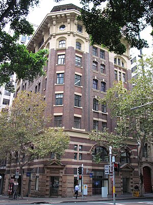
Grace Building, Sydney
Historic building in Sydney
Distance: Approx. 70 meters
Latitude and longitude: -33.868923,151.205853
The Grace Building is a heritage-listed building of the Federation Skyscraper Gothic style that houses a bar, hotel, cafe and restaurant and is located at 77–79 York Street in the Sydney central business district in New South Wales, Australia. Designed by Morrow and Gordon and built by Kell & Rigby during the late 1920s, it was opened in 1930 by Grace Bros, the Australian department store magnates, as their headquarters. "The building was designed to use the first two storeys in the manner of a department store.

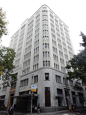
AWA Tower
Heritage-listed building in Sydney, Australia
Distance: Approx. 156 meters
Latitude and longitude: -33.86694444,151.20555556
The AWA Tower is a heritage-listed office and communications complex in Sydney, in the state of New South Wales, Australia built for AWA. The AWA Tower consists of a radio transmission tower atop a 15-storey building. It is located in the Sydney central business district at 45-47 York Street, close to Wynyard Park and Wynyard railway station. It was designed by Robertson, Marks and McCredie in association with DT Morrow and Gordon and built from 1937 to 1939 by William Hughes and Co.
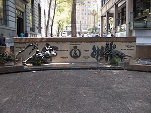
Regimental Square
War memorial in Sydney
Distance: Approx. 161 meters
Latitude and longitude: -33.86706389,151.20689167
Regimental Square is a war memorial in the Wynyard area in the city centre of Sydney, Australia. An upgrade of the area was expected to be completed by mid-2016.

Pinnacle House
Historic site in Sydney central business district, Australia
Distance: Approx. 104 meters
Latitude and longitude: -33.8675,151.2054
Pinnacle House is a heritage-listed former warehouse at 2-6 Barrack Street, in the Sydney central business district, in the City of Sydney local government area of New South Wales, Australia. It was designed by Sheerin & Hennessy and built from 1888 to 1892 by Allum Brothers. It was added to the New South Wales State Heritage Register on 2 April 1999.

73 York Street, Sydney
Heritage-listed building in Sydney, Australia
Distance: Approx. 29 meters
Latitude and longitude: -33.8684,151.2057
73 York Street is a heritage-listed former warehouse and now office building located at 73 York Street, in the Sydney central business district in the City of Sydney local government area of New South Wales, Australia. It was built in 1892, with the design having been attributed to Herbert S. Thompson. It is also known as Henley House, Hardware House, ICLE House, Monte Paschi House and Cassa Commerciale House.
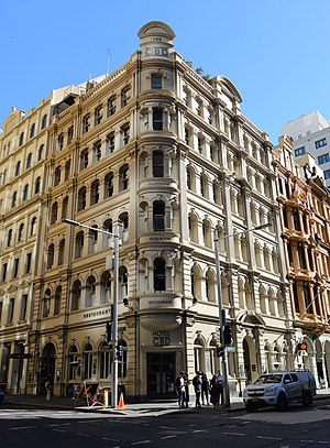
National House
Historic building in Sydney
Distance: Approx. 28 meters
Latitude and longitude: -33.8685,151.2058
National House is a heritage-listed former warehouse and bank branch and now pub located at 75 York Street, on the corner of King Street, in the Sydney central business district, in the City of Sydney local government area of New South Wales, Australia. It now operates as the Hotel CBD. It was added to the New South Wales State Heritage Register on 2 April 1999.

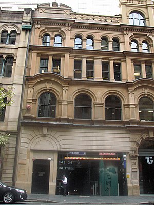
341 George Street, Sydney
Heritage-listed building in Sydney, Australia
Distance: Approx. 125 meters
Latitude and longitude: -33.8673,151.2066
341 George Street, Sydney is a heritage-listed bank building located at 341 George Street, in the Sydney central business district, in the City of Sydney local government area of New South Wales, Australia. It was built from 1927 to 1932 and housed the headquarters of the Bank of New South Wales, and later Westpac. It is also known as Westpac Bank building and Bank of NSW building.
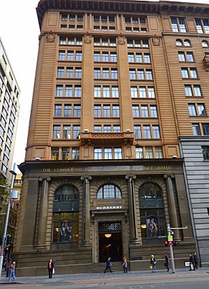
343 George Street, Sydney
Heritage-listed building in Sydney, Australia
Distance: Approx. 111 meters
Latitude and longitude: -33.8675,151.2067
343 George Street, Sydney is a heritage-listed former bank building and now nine-storey retail and commercial premises. It is located at 343 George Street in the Sydney central business district, in the City of Sydney local government area of New South Wales, Australia. It was built from 1921 to 1925, and until 2008 housed banking premises of the Commercial Banking Company of Sydney (CBC) and later National Australia Bank.
22 York Street, Sydney
Heritage-listed building in Sydney, Australia
Distance: Approx. 22 meters
Latitude and longitude: -33.8682,151.2062
22 York Street, Sydney is a heritage-listed commercial office and former warehouse located at 22 York Street, in the Sydney central business district, in the City of Sydney local government area of New South Wales, Australia. It has now been incorporated into the Landmark Building development. The property is privately owned.
International House, Sydney
Historic site in New South Wales, Australia
Distance: Approx. 59 meters
Latitude and longitude: -33.8678,151.2062
International House is a heritage-listed commercial building at 14-16 York Street, in the Sydney central business district, in the City of Sydney local government area of New South Wales, Australia. It was designed by Robertson & Marks and built during 1913 by Howie, Brown & Moffat, Master Builders. It is also known as Pomeroy House.

Red Cross House
Heritage building in Sydney, New South Wales, Australia
Distance: Approx. 115 meters
Latitude and longitude: -33.868,151.2048
The Red Cross House is a heritage-listed former commercial building and now Australian Red Cross and blood transfusion centre located at 153-159 Clarence Street, Sydney, New South Wales, Australia. It was designed by Samuel Lipson, architect, in conjunction with Robertson and Marks and McCredie and built from 1937 to 1938 by Kell & Rigby. It was originally built for the firm of S. Hoffnung & Co.
James Hardie House
Commercial building in Sydney, Australia
Distance: Approx. 50 meters
Latitude and longitude: -33.867908,151.205726
The James Hardie House (also known as the Asbestos House) is an Art Deco commercial building in Sydney, Australia.
Weather in this IP's area
overcast clouds
14 Celsius
13 Celsius
12 Celsius
14 Celsius
1024 hPa
79 %
1024 hPa
1019 hPa
10000 meters
0.45 m/s
1.79 m/s
345 degree
100 %
06:20:04
19:04:01