103.251.81.128 - IP Lookup: Free IP Address Lookup, Postal Code Lookup, IP Location Lookup, IP ASN, Public IP
Country:
Region:
City:
Location:
Time Zone:
Postal Code:
ISP:
ASN:
language:
User-Agent:
Proxy IP:
Blacklist:
IP information under different IP Channel
ip-api
Country
Region
City
ASN
Time Zone
ISP
Blacklist
Proxy
Latitude
Longitude
Postal
Route
db-ip
Country
Region
City
ASN
Time Zone
ISP
Blacklist
Proxy
Latitude
Longitude
Postal
Route
IPinfo
Country
Region
City
ASN
Time Zone
ISP
Blacklist
Proxy
Latitude
Longitude
Postal
Route
IP2Location
103.251.81.128Country
Region
west bengal
City
pandua
Time Zone
Asia/Kolkata
ISP
Language
User-Agent
Latitude
Longitude
Postal
ipdata
Country
Region
City
ASN
Time Zone
ISP
Blacklist
Proxy
Latitude
Longitude
Postal
Route
Popular places and events near this IP address
Pandua, Hooghly
Census Town in West Bengal, India
Distance: Approx. 499 meters
Latitude and longitude: 23.08,88.28
Pandua (Bengali: পাণ্ডুয়া) is a census town in the Pandua CD block in the Chinsurah subdivision of the Hooghly district in the Indian state of West Bengal.

Pandua (community development block)
Community development block in West Bengal, India
Distance: Approx. 499 meters
Latitude and longitude: 23.08,88.28
Pandua is a community development block that forms an administrative division in Chinsurah subdivision of Hooghly district in the Indian state of West Bengal.

Bejoy Narayan Mahavidyalaya
College in Itachuna, Hooghly, West Bengal, India
Distance: Approx. 5688 meters
Latitude and longitude: 23.0374181,88.3077349
Bejoy Narayan Mahavidyalaya, also known as Itachuna College, is the only college in Itachuna, West Bengal, India. Established in 1950, it is located in the district of Hooghly in West Bengal. It was affiliated with Calcutta University from 1950 to 1957, but has been affiliated with the University of Burdwan since then.

Simlagarh
Village in West Bengal, India
Distance: Approx. 5320 meters
Latitude and longitude: 23.09638889,88.23333333
Simlagarh is a small village under Pandua police station of Chinsurah subdivision in Hooghly district in the state of West Bengal, India.
Itachuna
Village in West Bengal, India
Distance: Approx. 5980 meters
Latitude and longitude: 23.0352,88.3093
Itachuna is a village and Itachuna-Khanyan is a gram panchayat in Pandua CD Block in Chinsurah subdivision of Hooghly district in the state of West Bengal, India.
Purusattompur
Census Town in West Bengal, India
Distance: Approx. 2088 meters
Latitude and longitude: 23.0792,88.2634
Purusattompur is a census town in Pandua CD Block in Chinsurah subdivision of Hooghly district in the Indian state of West Bengal.
Namajgram
Census Town in West Bengal, India
Distance: Approx. 2263 meters
Latitude and longitude: 23.0702,88.2664
Namajgram is a census town in Pandua CD Block in Chinsurah subdivision of Hooghly district in the Indian state of West Bengal.
Badla, Purba Bardhaman
Village in West Bengal, India
Distance: Approx. 8173 meters
Latitude and longitude: 23.1567,88.2816
Badla is a village in Kalna II CD block in Kalna subdivision of Purba Bardhaman district in the Indian state of West Bengal.

Khanyan railway station
Railway Station in West Bengal, India
Distance: Approx. 5257 meters
Latitude and longitude: 23.046446,88.315393
Khanyan railway station is a Kolkata Suburban Railway station on the Howrah–Bardhaman main line operated by Eastern Railway zone of Indian Railways. It is situated beside Polba-Khanyan Road at Khanyan in Hooghly district in the Indian state of West Bengal.

Pundooah railway station
Railway station in West Bengal, India
Distance: Approx. 1982 meters
Latitude and longitude: 23.070651,88.26968
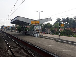
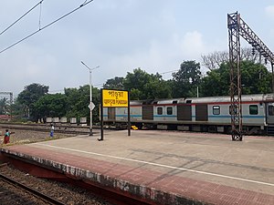
Pundooah railway station is a Kolkata Suburban Railway station on the Howrah–Bardhaman main line operated by Eastern Railway zone of Indian Railways. It is situated beside Station Road at Pandua in Hooghly district in the Indian state of West Bengal. Number of EMU and passenger trains stop at Pundooah railway station.

Simlagarh railway station
Railway station in West Bengal, India
Distance: Approx. 5485 meters
Latitude and longitude: 23.096234,88.23161
Simlagarh railway station is a Kolkata Suburban Railway station on the Howrah–Bardhaman main line operated by Eastern Railway zone of Indian Railways. It is situated beside Talbona Colony Road, National Highway 2 at Simlagarh in Hooghly district in the Indian state of West Bengal. The distance between Howrah and Simlagarh railway station is approximately 65 km.

Bainchigram railway station
Railway station in West Bengal, India
Distance: Approx. 7350 meters
Latitude and longitude: 23.106517,88.216109
Bainchigram railway station is a Kolkata Suburban Railway station on the Howrah–Bardhaman main line operated by Eastern Railway zone of Indian Railways. It is situated beside Grand Trunk Road at Bainchigram in Hooghly district in the Indian state of West Bengal.
Weather in this IP's area
clear sky
16 Celsius
15 Celsius
16 Celsius
16 Celsius
1014 hPa
60 %
1014 hPa
1012 hPa
10000 meters
0.87 m/s
0.87 m/s
83 degree