Country:
Region:
City:
Latitude and Longitude:
Time Zone:
Postal Code:
IP information under different IP Channel
ip-api
Country
Region
City
ASN
Time Zone
ISP
Blacklist
Proxy
Latitude
Longitude
Postal
Route
Luminati
Country
ASN
Time Zone
Asia/Kolkata
ISP
TATA Communications formerly VSNL is Leading ISP
Latitude
Longitude
Postal
IPinfo
Country
Region
City
ASN
Time Zone
ISP
Blacklist
Proxy
Latitude
Longitude
Postal
Route
db-ip
Country
Region
City
ASN
Time Zone
ISP
Blacklist
Proxy
Latitude
Longitude
Postal
Route
ipdata
Country
Region
City
ASN
Time Zone
ISP
Blacklist
Proxy
Latitude
Longitude
Postal
Route
Popular places and events near this IP address
Buckingham Canal
Canal that runs in Andhra Pradesh and Tamilnadu in India
Distance: Approx. 695 meters
Latitude and longitude: 12.9849,80.2527
The Buckingham Canal is a 796 kilometres (494.6 mi)-long fresh water navigation canal, that parallels the Coromandel Coast of South India from Kakinada of Andhra Pradesh to Parangipettai near Chidambaram of Tamil Nadu. The canal connects most of the natural backwaters along the coast to Chennai (Madras) port. The canal was constructed during British rule, and was an important waterway during the late nineteenth and early twentieth centuries.

Tharamani
Neighbourhood in Chennai, Tamil Nadu, India
Distance: Approx. 1142 meters
Latitude and longitude: 12.9863,80.2432
Tharamani is an area in the south Indian city of Chennai. It is known for the presence of the city's first IT parks and numerous government educational and research institutions. It is located adjacent to the posh residential area of Adyar and Besant Nagar in South Chennai.

TIDEL Park
Tech Park in Chennai, India
Distance: Approx. 1208 meters
Latitude and longitude: 12.9896946,80.2487258
TIDEL Park is an information technology (IT) park situated in the city of Chennai, India. The name TIDEL is a portmanteau of TIDCO and ELCOT. An ISO 9001/14001 company, In 2000, it was one of the largest IT parks in India.
Thiruvanmiyur
Neighbourhood in Chennai, Tamil Nadu, India
Distance: Approx. 1383 meters
Latitude and longitude: 12.9856,80.2614
Thiruvanmiyur is a largely residential neighborhood in the south of Chennai, Tamil Nadu, India. Thiruvanmiyur witnessed a spike in its economy with the construction of Chennai's first dedicated technology office space, the Tidel Information Technology Park in neighboring Taramani. The subsequent rise of several information technology businesses, research centres and offices around Tidel park proved fortuitous for Thiruvanmiyur, as many of the workers at these offices often made Thiruvanmiyur their home.
Perungudi
Neighbourhood in Chennai, Tamil Nadu, India
Distance: Approx. 1591 meters
Latitude and longitude: 12.9654,80.2461
Perungudi is a neighbourhood of Chennai in the state of Tamil Nadu, India. It is situated about 10 kilometres (6.2 mi) south of Adyar. It is bordered on two sides by the Old Mahabalipuram Road and the Perungudi lake.
Kottivakkam
Neighbourhood in Chennai, Tamil Nadu, India
Distance: Approx. 1284 meters
Latitude and longitude: 12.97,80.258
Kottivakam is a locality in the south of Chennai in Chennai district in the Indian state of Tamil Nadu. Kottivakkam is included with the Chennai Corporation.

Rajiv Gandhi Salai
State highway in Tamil Nadu
Distance: Approx. 348 meters
Latitude and longitude: 12.975897,80.251018
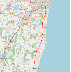
State Highway 49A (SH-49A), also known as Rajiv Gandhi Salai and Rajiv Gandhi IT Expressway or just IT Expressway, is a major road connecting Chennai, Tamil Nadu state with Mahabalipuram in Chengalpattu district, in the same state. It is 45 km long and was earlier known as the Old Mahabalipuram Road (OMR). The road starts from Madhya Kailash Temple on Sardar Patel Road in South-East Chennai and terminates on East Coast Road near Mahabalipuram.

Marundeeswarar Temple
Hindu temple in Chennai, Tamil Nadu, India
Distance: Approx. 1379 meters
Latitude and longitude: 12.98555556,80.26138889
Marundeeswarar Temple is a temple dedicated to Hindu deity Shiva, located in Thiruvanmiyur, Chennai adjacent to the beach of Bay of Bengal. It is one of the 275 Paadal Petra Sthalams where two of the most revered Nayanars (Saivite Saints), Appar and Tirugnana Sambandar, have glorified the temple with their verses during the 7th century CE. The temple has been widely expanded by Chola kings during the 11th century CE. The temple has two seven-tiered gateway towers, a huge tank, with the overall temple area covering 1 acre. The Marundeeswarar temple has been a place of curative worship for people with diseases.

International Tech Park, Chennai
Technology park in south India
Distance: Approx. 893 meters
Latitude and longitude: 12.985688,80.246061
The International Tech Park Chennai, Taramani or ITPC (as it is popularly known) is an hi-tech park in Taramani, Chennai. Located in Chennai's IT Corridor, it spans 15 acres, offering approximately 2 million sq ft of office space. Over 40 IT/ITES companies are operating out of the park.

Ramanujan IT City
Information Technology Park in Chennai, India
Distance: Approx. 1376 meters
Latitude and longitude: 12.99083333,80.24694444
Ramanujan IT City is an information technology (IT) special economic zone (SEZ) situated in Chennai, India. Named after the Indian Mathematician Srinivasa Ramanujan, it is a joint venture of Tata Realty and Infrastructure Limited (TRIL), Indian Hotels Company Limited (IHCL) and Tamil Nadu Industrial Development Corporation (TIDCO). Situated next to the Tidel Park, it is being developed in a land measuring 25 acres with two zones with a total built-up area of 5.7 million sq ft.

World Bank office, Chennai
Extension of the World Bank headquartered in Washington, DC.
Distance: Approx. 838 meters
Latitude and longitude: 12.98388889,80.24472222
The World Bank Chennai is the extension of the World Bank headquartered in Washington, DC. The World Bank Chennai office offers corporate financial, accounting, administrative and IT services for the bank's offices in around 150 countries. The Chennai office handles several value-added operations of the bank that were earlier handled only in its Washington, D.C., office.

National Institute of Technical Teachers' Training and Research, Chennai
Institute in India
Distance: Approx. 928 meters
Latitude and longitude: 12.9873,80.2498
National Institute of Technical Teachers' Training and Research, Chennai (NITTTR) is a deemed to be university under distinct category under the Ministry of Education (or MoE), Government of India. NITTTR Chennai is located in Tharamani in Chennai.
Weather in this IP's area
haze
29 Celsius
35 Celsius
29 Celsius
30 Celsius
1011 hPa
75 %
1011 hPa
1010 hPa
4000 meters
3.6 m/s
40 degree
20 %
06:03:56
17:41:14

