103.245.160.242 - IP Lookup: Free IP Address Lookup, Postal Code Lookup, IP Location Lookup, IP ASN, Public IP
Country:
Region:
City:
Location:
Time Zone:
Postal Code:
IP information under different IP Channel
ip-api
Country
Region
City
ASN
Time Zone
ISP
Blacklist
Proxy
Latitude
Longitude
Postal
Route
Luminati
Country
Region
04
City
nukualofa
ASN
Time Zone
Pacific/Tongatapu
ISP
Tonga Cable Limited
Latitude
Longitude
Postal
IPinfo
Country
Region
City
ASN
Time Zone
ISP
Blacklist
Proxy
Latitude
Longitude
Postal
Route
IP2Location
103.245.160.242Country
Region
ha'apai
City
pangai
Time Zone
Pacific/Tongatapu
ISP
Language
User-Agent
Latitude
Longitude
Postal
db-ip
Country
Region
City
ASN
Time Zone
ISP
Blacklist
Proxy
Latitude
Longitude
Postal
Route
ipdata
Country
Region
City
ASN
Time Zone
ISP
Blacklist
Proxy
Latitude
Longitude
Postal
Route
Popular places and events near this IP address

Haʻapai
Group of islands in the Kingdom of Tonga
Distance: Approx. 5833 meters
Latitude and longitude: -19.75,-174.36666667
Haʻapai is a group of islands, islets, reefs, and shoals in the central part of Tonga. It has a combined land area of 109.30 square kilometres (42.20 sq mi). The Tongatapu island group lies to its south, and the Vavaʻu group lies to its north.

Foa
Island in Tonga
Distance: Approx. 7643 meters
Latitude and longitude: -19.75,-174.3
Foa is an island in Tonga. It is located within the Haʻapai group in the centre of the country, to northeast of the national capital of Nukuʻalofa. Foa is linked to adjacent Lifuka Island by a causeway, and is located 640 metres northeast of Lifuka.

Lifuka
Distance: Approx. 709 meters
Latitude and longitude: -19.79888889,-174.35666667
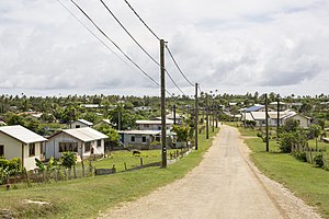
Lifuka is an island in the Kingdom of Tonga. It is located within the Haʻapai Group in the centre of the country, to northeast of the national capital of Nukuʻalofa. It is the administrative centre of the Haʻapai group of islands with Pangai being the administrative capital village.

Lifuka Island Airport
Airport in Lifuka, Haʻapai, Tonga
Distance: Approx. 2759 meters
Latitude and longitude: -19.77666667,-174.34111111
Lifuka Island Airport (IATA: HPA, ICAO: NFTL), also known as Salote Pilolevu Airport or Haʻapai Airport, is an airport on Lifuka in Tonga. The airport is located 5 km (3.1 mi) north of the capital Panga, and is only served domestically, roughly 40 minutes by flight to Tongatapu and 30 minutes to Vava'u. Taxis serve the airport, and services include a cafe inside the terminal.
Uoleva
Distance: Approx. 7882 meters
Latitude and longitude: -19.84888889,-174.40444444
Uoleva is a sand-cay island in Lifuka district, in the Ha'apai islands of Tonga. Almost uninhabited, it is known for its five small resorts and clean, quiet beaches.

Pangai
Distance: Approx. 389 meters
Latitude and longitude: -19.80333333,-174.34888889
Pangai is the administrative capital village of the Haʻapai Group in Tonga.
Fotua
Settlement on Foa Island
Distance: Approx. 6593 meters
Latitude and longitude: -19.749,-174.318
Fotua is a settlement on Foa island, Tonga. It had a population of 259 in 2016.
Fangaleʻounga
Distance: Approx. 5948 meters
Latitude and longitude: -19.753,-174.323
Fangale'ounga is a settlement in Foa island, Tonga. It had a population of 140 in 2016.

Holopeka
Settlement in Lifuka island, Tonga
Distance: Approx. 2015 meters
Latitude and longitude: -19.784,-174.341
Holopeka is a settlement in Lifuka island, Tonga. The population is 132. Holopeka met international acclaim in the mid-1990s, as the ancestral home of New Zealand rugby player Jonah Lomu.

Koulo
Settlement in Tonga
Distance: Approx. 2728 meters
Latitude and longitude: -19.777,-174.341
Koulo is a settlement in the north-west area of Lifuka island, Tonga. The population is 171.

Tongoleleka
Distance: Approx. 1809 meters
Latitude and longitude: -19.816,-174.353
Tongoleleka is a settlement in Lifuka island, Tonga.

Haʻatoʻu
Settlement in Lifuka, Tonga
Distance: Approx. 1225 meters
Latitude and longitude: -19.811,-174.35
Haʻatoʻu is a settlement in Lifuka island, Tonga.
Weather in this IP's area
light rain
27 Celsius
31 Celsius
27 Celsius
27 Celsius
1011 hPa
94 %
1011 hPa
1011 hPa
10000 meters
1.03 m/s
20 %