103.243.238.35 - IP Lookup: Free IP Address Lookup, Postal Code Lookup, IP Location Lookup, IP ASN, Public IP
Country:
Region:
City:
Location:
Time Zone:
Postal Code:
IP information under different IP Channel
ip-api
Country
Region
City
ASN
Time Zone
ISP
Blacklist
Proxy
Latitude
Longitude
Postal
Route
Luminati
Country
ASN
Time Zone
Asia/Dhaka
ISP
CIRCLE NETWORK BANGLADESH
Latitude
Longitude
Postal
IPinfo
Country
Region
City
ASN
Time Zone
ISP
Blacklist
Proxy
Latitude
Longitude
Postal
Route
IP2Location
103.243.238.35Country
Region
dhaka
City
tungi
Time Zone
Asia/Dhaka
ISP
Language
User-Agent
Latitude
Longitude
Postal
db-ip
Country
Region
City
ASN
Time Zone
ISP
Blacklist
Proxy
Latitude
Longitude
Postal
Route
ipdata
Country
Region
City
ASN
Time Zone
ISP
Blacklist
Proxy
Latitude
Longitude
Postal
Route
Popular places and events near this IP address
Tongi
Town in Dhaka Division, Bangladesh
Distance: Approx. 1192 meters
Latitude and longitude: 23.9,90.41
Tongi (Bengali: টঙ্গী) is a major township in Gazipur, Bangladesh, with a population of 350,000. It hosts the Biswa Ijtema and features a BSCIC industrial area, which produces BDT 1500 crore of industrial products annually, and marks the northern border of Dhaka since 1786. Tongi Shahid Smrity high School compound is mass burial site of the genocide in Liberation War of Bangladesh.

Bishwa Ijtema
Worldwide Muslim gathering in Bangladesh
Distance: Approx. 924 meters
Latitude and longitude: 23.8914722,90.3968637
The Bishwa Ijtema (Bengali: বিশ্ব ইজতেমা, lit. 'Global congregation') is an annual gathering of Muslims in Tongi, by the banks of the River Turag, in the outskirts of Dhaka, Bangladesh. The Ijtema is considered a demonstration of Muslim unity, solidarity, mutual love and respect and an opportunity to reiterate their commitment to Islamic values. It is the biggest festival by population in Bengali culture, one of the largest peaceful gatherings in the world, and the second-largest Muslim gathering, with 5 million adherents, after the Arba'een Pilgrimage's 15–20 million attendees in Iraq, both surpassing the 2–3 million worshipers who participate in the Hajj, considered to be one of the five pillars of Islam, in Saudi Arabia.

International University of Business Agriculture and Technology
Private university in Dhaka, Bangladesh
Distance: Approx. 1528 meters
Latitude and longitude: 23.8883,90.3909
International University of Business Agriculture and Technology (IUBAT) was established in 1991 under the Private University Act (PUA) of 1992 (now replaced by PUA 2010) by M Alimullah Miyan. The initial planning began in 1989. Degree programs started in 1992 with agreement with Assumption University of Bangkok, Thailand.
Milestone College
School and college in Dhaka, Bangladesh It was founded in 2002
Distance: Approx. 2028 meters
Latitude and longitude: 23.8779,90.3909
Milestone College (Bengali: মাইলস্টোন কলেজ) is a Bengali and English-medium, co-educational private school in Uttara Model Town, Dhaka, Bangladesh. It was founded by Colonel Nuran Nabi (কর্নেল নুরুন নবি) (Retd) who was also the founding principal of RAJUK Uttara Model College. Milestone ranked tenth nationally in Higher Secondary Certificate (HSC) examination results in 2014.
PeoplesTel
Distance: Approx. 1478 meters
Latitude and longitude: 23.8775,90.4009
Peoples Telecommunication & Information Services Ltd., doing business as (PeoplesTel) (Bengali: পিপলসটেল), is a Bangladeshi fixed line operator.
BGMEA University of Fashion & Technology
University in Bangladesh
Distance: Approx. 1876 meters
Latitude and longitude: 23.874,90.4
BGMEA University of Fashion and Technology (BUFT) is a private university in Bangladesh.
Shaheed Ahsan Ullah Master Stadium
Stadium of Bangladesh popular for archery
Distance: Approx. 536 meters
Latitude and longitude: 23.88905556,90.40063889
Shaheed Ahsan Ullah Master Stadium is a multi-purpose stadium in Tongi, Gazipur.

House Building, Uttara
Area of Uttara in Dhaka Division, Bangladesh
Distance: Approx. 1803 meters
Latitude and longitude: 23.874573,90.400394
House Building (Bengali: হাউজ বিল্ডিং) is an area of Uttara, a suburb of Dhaka, Bangladesh. There is a bus stop in the same name. The name comes from the Bangladesh House Building Finance Corporation located in the area.
Shaheed Ahsan Ullah Master General Hospital
Hospital in Gazipur, Bangladesh
Distance: Approx. 525 meters
Latitude and longitude: 23.8933902,90.4022109
Shaheed Ahsan Ullah Master General Hospital (Bengali: শহীদ আহসান উল্লাহ মাস্টার জেনারেল হাসপাতাল) is a government hospital situated in Gazipur, Bangladesh.
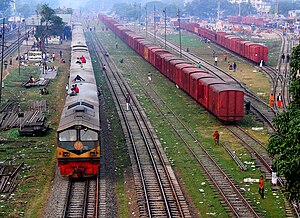
Tongi Junction railway station
Railway station in Gazipur, Bangladesh
Distance: Approx. 994 meters
Latitude and longitude: 23.89859,90.4084504
Tongi Junction Railway Station is a railway station in Bangladesh located in Tongi, Gazipur District. It is a station between Dhirashram and Dhaka Airport railway station. It is about 5 km north of the airport station and about 12 km south of Joydebpur.
Dhakshinkhan Thana
Thana in Dhaka North City Corporation, Bangladesh
Distance: Approx. 2047 meters
Latitude and longitude: 23.87443,90.4165
Dhakshinkhan Thana is a thana of Dhaka city, Bangladesh.

Sector 10, Uttara
Sector in Dhaka, Bangladesh
Distance: Approx. 1719 meters
Latitude and longitude: 23.8858181,90.3895417
Sector 10 (Bengali: ১০ নং সেক্টর) is an area and residential sector in Uttara, Dhaka, Bangladesh. It is the largest administrative sector in the neighbourhood with more than 3000 plots. It was developed as a planned community and its plots were leased for residents in 1990.
Weather in this IP's area
clear sky
28 Celsius
28 Celsius
28 Celsius
28 Celsius
1011 hPa
35 %
1011 hPa
1010 hPa
10000 meters
3.06 m/s
3.35 m/s
224 degree
1 %

