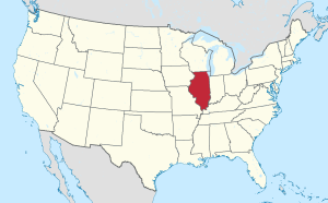
Country:
 USA
USARegion:
City:
Latitude and Longitude:
Time Zone:
Postal Code:
IP information under different IP Channel
ip-api
Country
Region
City
ASN
Time Zone
ISP
Blacklist
Proxy
Latitude
Longitude
Postal
Route
IPinfo
Country
Region
City
ASN
Time Zone
ISP
Blacklist
Proxy
Latitude
Longitude
Postal
Route
MaxMind
Country
Region
City
ASN
Time Zone
ISP
Blacklist
Proxy
Latitude
Longitude
Postal
Route
Luminati
Country
USRegion
il
City
versailles
ASN
Time Zone
America/Chicago
ISP
CASSCOMM
Latitude
Longitude
Postal
db-ip
Country
Region
City
ASN
Time Zone
ISP
Blacklist
Proxy
Latitude
Longitude
Postal
Route
ipdata
Country
Region
City
ASN
Time Zone
ISP
Blacklist
Proxy
Latitude
Longitude
Postal
Route
Popular places and events near this IP address
Brown County, Illinois
County in Illinois, United States
Distance: Approx. 9443 meters
Latitude and longitude: 39.95,-90.75
Brown County is a county located in the U.S. state of Illinois. As of the 2020 census, the population was 6,244. Its county seat is Mount Sterling.
Versailles, Illinois
Village in Illinois, United States
Distance: Approx. 1501 meters
Latitude and longitude: 39.88388889,-90.6575
Versailles is a village in Brown County, Illinois, United States. The population was 446 at the 2020 census.
Chambersburg, Illinois
Unincorporated community in Illinois, United States
Distance: Approx. 8043 meters
Latitude and longitude: 39.81722222,-90.65722222
Chambersburg is an unincorporated community in Pike County, Illinois, United States.

Cooperstown Township, Brown County, Illinois
Township in Illinois, United States
Distance: Approx. 9746 meters
Latitude and longitude: 39.96333333,-90.61527778
Cooperstown Township is one of nine townships in Brown County, Illinois, USA. As of the 2020 census, its population was 264 and it contained 142 housing units.

Elkhorn Township, Brown County, Illinois
Township in Illinois, United States
Distance: Approx. 4908 meters
Latitude and longitude: 39.88277778,-90.73111111
Elkhorn Township is one of nine townships in Brown County, Illinois, USA. As of the 2020 census, its population was 290 and it contained 153 housing units.

Versailles Township, Brown County, Illinois
Township in Illinois, United States
Distance: Approx. 3909 meters
Latitude and longitude: 39.88444444,-90.62861111
Versailles Township is one of nine townships in Brown County, Illinois, USA. As of the 2020 census, its population was 656 and it contained 363 housing units.
Meredosia National Wildlife Refuge
Distance: Approx. 9957 meters
Latitude and longitude: 39.8625,-90.5625
The Meredosia National Wildlife Refuge is a 5,255-acre (21.27 km2) national wildlife refuge located along the Illinois River in Cass County and Morgan County in the U.S. state of Illinois. The refuge is adjacent to Meredosia, Illinois, but is managed by the U.S. Fish and Wildlife Service from a headquarters located in Havana, Illinois.
Gilbirds, Illinois
Unincorporated community in Illinois, United States
Distance: Approx. 4517 meters
Latitude and longitude: 39.92305556,-90.70138889
Gilbirds is an unincorporated community in Brown County, Illinois, United States. Gilbirds is located on Illinois Route 99, northwest of Versailles.
Hersman, Illinois
Unincorporated community in Illinois, United States
Distance: Approx. 8939 meters
Latitude and longitude: 39.95,-90.74111111
Hersman is an unincorporated community in Brown County, Illinois, United States. Hersman is located on Illinois Route 99, southeast of Mount Sterling.
Jaques, Illinois
Unincorporated community in Illinois, United States
Distance: Approx. 5910 meters
Latitude and longitude: 39.88388889,-90.74305556
Jaques is an unincorporated community in Brown County, Illinois, United States. Jaques is south of Mount Sterling and is near Illinois Route 107.
Milton, Brown County, Illinois
Former settlement in Illinois, United States
Distance: Approx. 4929 meters
Latitude and longitude: 39.845766,-90.658085
Milton is a former settlement in Brown County, Illinois, United States. The town was laid out August 25, 1836, by Lewis Gay, situated on the E. i of the S. E. of section 31, and the W. i of the S. W. I of section 32, near the site of the old Johnson mill, on McKee's creek, but it was a failure. Lewis Gay and William C. Ralls were the proprietors of the town, having laid out the town on McKee creek, five miles from the Illinois river.
Weather in this IP's area
clear sky
15 Celsius
14 Celsius
14 Celsius
16 Celsius
1024 hPa
62 %
1024 hPa
1003 hPa
10000 meters
06:37:46
19:22:59