Country:
Region:
City:
Latitude and Longitude:
Time Zone:
Postal Code:
IP information under different IP Channel
ip-api
Country
Region
City
ASN
Time Zone
ISP
Blacklist
Proxy
Latitude
Longitude
Postal
Route
Luminati
Country
ASN
Time Zone
Asia/Kolkata
ISP
Pintwire Infomatics Private Limited
Latitude
Longitude
Postal
IPinfo
Country
Region
City
ASN
Time Zone
ISP
Blacklist
Proxy
Latitude
Longitude
Postal
Route
db-ip
Country
Region
City
ASN
Time Zone
ISP
Blacklist
Proxy
Latitude
Longitude
Postal
Route
ipdata
Country
Region
City
ASN
Time Zone
ISP
Blacklist
Proxy
Latitude
Longitude
Postal
Route
Popular places and events near this IP address

Raipur
Metropolis in Chhattisgarh, India
Distance: Approx. 2850 meters
Latitude and longitude: 21.24444444,81.63055556
Raipur ( ) is the capital city of the Indian state of Chhattisgarh. Raipur is also the administrative headquarters of Raipur district and Raipur division, and the largest city of the state. It was a part of Madhya Pradesh before the state of Chhattisgarh was formed on 1 November 2000.
Birgaon
City in Chhattisgarh, India
Distance: Approx. 3488 meters
Latitude and longitude: 21.30116,81.62866
Birgaon is a municipal corporation and a part of Raipur urban agglomeration in Raipur district in the state of Chhattisgarh, India. The town is known for its famous Banjari Mata Temple.
Gogaon
City in Chhattisgarh, India
Distance: Approx. 1986 meters
Latitude and longitude: 21.26288,81.614647
Gogaon is a census town in Raipur district in the Indian state of Chhattisgarh.
Raj Bhavan, Raipur
Building
Distance: Approx. 3365 meters
Latitude and longitude: 21.242307,81.645209
Raj Bhavan (translation: Government House) is the official residence of the governor of Chhattisgarh. It is located in the capital city of Raipur, Chhattisgarh.
Pt. Jawaharlal Nehru Memorial Medical College
University and hospital in India
Distance: Approx. 2128 meters
Latitude and longitude: 21.252262,81.639847
Pt. Jawahar Lal Nehru Memorial Medical College is a government medical college and hospital in Raipur, Chhattisgarh, India. It was founded on 9 September 1963, and recognised by the Medical Council of India in 1969.The college is one of the oldest institutions in state of Chhattisgarh.

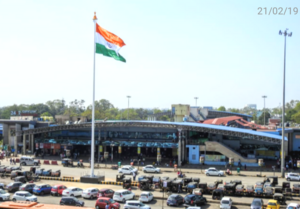
Raipur Junction railway station
Railway junction station in Chattisgarh
Distance: Approx. 1534 meters
Latitude and longitude: 21.2564,81.6298
Raipur Junction is the main railway station serving the city of Raipur. It is only few of the railway stations in India which has been given the grade 'A-1' by the Indian Railways and is one of the highest-revenue-earning railway stations in India. This station is one of the prominent stations on the Howrah–Nagpur–Mumbai line.
Chhattisgarh Kamdhenu Vishwavidyalaya
Indian state university
Distance: Approx. 2089 meters
Latitude and longitude: 21.251384,81.629641
Dau Shri Vasudev Chandrakar Kamdhenu Vishwavidyalaya is a state university located in Durg, Chhattisgarh, India. It was established in 2012 and offers courses in veterinary and animal sciences at various levels.
Raipur railway division
Distance: Approx. 1534 meters
Latitude and longitude: 21.2564,81.6298
Raipur railway division is one of the three railway divisions under South East Central Railway zone of Indian Railways. This railway division was formed on 1 April 2003 and its headquarter is located at Raipur in the state of Chhattisgarh of India. Nagpur SEC railway division and Bilaspur railway division are the other two railway divisions under SECR Zone headquartered at Bilaspur.
Raipur City railway station
Railway station Chhattisgarh
Distance: Approx. 2485 meters
Latitude and longitude: 21.2533,81.6481
Raipur City railway station was a railway station in Raipur district, Chhattisgarh. Its code is RCT. It served Raipur city. The station consisted of one narrow-gauge platform.
Government Engineering College Raipur
Engineering college in Chhattisgarh, India
Distance: Approx. 2238 meters
Latitude and longitude: 21.25,81.63
Here's the improved version of the information about Government Engineering College, Raipur: --- Government Engineering College, Raipur (GEC Raipur) is a public engineering college located in Sejbahar, Raipur, Chhattisgarh, India. Established in 2006, it is affiliated with Chhattisgarh Swami Vivekanand Technical University, Bhilai, and recognized by AICTE, New Delhi. The college offers undergraduate degree courses in various engineering disciplines, including Civil Engineering, Mechanical Engineering, Computer Science Engineering, Electrical and Electronics Engineering, and Electronics and Telecommunications Engineering.
Raipur Central Jail
Jail in Chhattisgarh
Distance: Approx. 2394 meters
Latitude and longitude: 21.251,81.643
Raipur Central Jail is one of the 5 central Jails in Chhattisgarh. The total capacity of this jail is of 1100 people. However, it is reported that at any given time, there are more than double inmates than the capacity of the jail.
Ghadi Chowk, Raipur
Clock tower located in the Raipur, India
Distance: Approx. 3008 meters
Latitude and longitude: 21.244851,81.642792
Ghadi Chowk Raipur also known as "Guru Ghasidas Time Square" is a clock tower located in the heart of Raipur city of Chhattisgarh, India. Constructed in 1995 and the structure was inaugurated on 19 December 1995. This place is considered an important landmark in Raipur and has become iconic symbol of Raipur.
Weather in this IP's area
clear sky
19 Celsius
19 Celsius
19 Celsius
19 Celsius
1014 hPa
63 %
1014 hPa
981 hPa
10000 meters
1.68 m/s
1.7 m/s
27 degree
06:09:05
17:25:08