103.240.88.29 - IP Lookup: Free IP Address Lookup, Postal Code Lookup, IP Location Lookup, IP ASN, Public IP
Country:
Region:
City:
Location:
Time Zone:
Postal Code:
IP information under different IP Channel
ip-api
Country
Region
City
ASN
Time Zone
ISP
Blacklist
Proxy
Latitude
Longitude
Postal
Route
Luminati
Country
ASN
Time Zone
Australia/Sydney
ISP
Micron21 Datacentre Pty Ltd
Latitude
Longitude
Postal
IPinfo
Country
Region
City
ASN
Time Zone
ISP
Blacklist
Proxy
Latitude
Longitude
Postal
Route
IP2Location
103.240.88.29Country
Region
victoria
City
highton
Time Zone
Australia/Melbourne
ISP
Language
User-Agent
Latitude
Longitude
Postal
db-ip
Country
Region
City
ASN
Time Zone
ISP
Blacklist
Proxy
Latitude
Longitude
Postal
Route
ipdata
Country
Region
City
ASN
Time Zone
ISP
Blacklist
Proxy
Latitude
Longitude
Postal
Route
Popular places and events near this IP address

Wandana Heights, Victoria
Suburb of Geelong, Victoria, Australia
Distance: Approx. 1000 meters
Latitude and longitude: -38.17,144.3
Wandana Heights is a residential suburb of Geelong, Victoria, Australia. Suburban development of the suburb commenced in the 1980s which due to the current high property prices in Australia, and the fluctuation of prices in previous years housing development has been sporadic with periods where there has been no new constructions, punctuated with occasional spurts. Another factor affecting the growth of the area is the monetary value for plots, which is significantly higher than the neighbouring suburb of Highton due to the very expansive views of the surrounding district.
Newtown, Victoria
Suburb of Geelong, Victoria, Australia
Distance: Approx. 2972 meters
Latitude and longitude: -38.15,144.333
Newtown is an inner western suburb of Geelong, Victoria, Australia. At the 2021 census, Newtown had a population of 10,445. It is a primarily residential area occupying one of the highest points of urban Geelong.
Highton, Victoria
Suburb of Geelong in Victoria, Australia
Distance: Approx. 579 meters
Latitude and longitude: -38.171,144.318
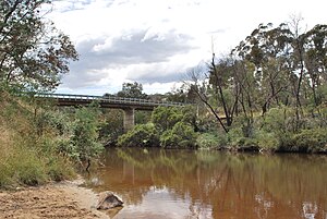
Highton is a residential suburb of Geelong, Victoria, Australia. With views across Geelong, Corio Bay and the surrounding region, Highton is located along the banks of the Barwon River and across the rolling Barrabool Hills. The Barwon River straddles Highton to the north and east, while it is bordered by the hilly Ceres and Wandana Heights to the west, the former (and now underground) Kardinia Creek separates the suburb from Belmont to the south-east, and the Princes Highway and Pigdons Road to the south separate the suburb from Waurn Ponds.

Belmont, Victoria
Suburb of Geelong, Victoria, Australia
Distance: Approx. 2604 meters
Latitude and longitude: -38.173,144.341
Belmont is a southern suburb of Geelong, Victoria, Australia. The name means "beautiful hill". Belmont is geographically separated from the Geelong central business district by the Barwon River.
Moorabool River
River in Victoria, Australia
Distance: Approx. 2959 meters
Latitude and longitude: -38.14416667,144.315
The Moorabool River is a river in Victoria, Australia, which runs for 160 kilometres through several small towns such as Meredith, Anakie, and Staughton Vale. It runs into the Barwon River at Fyansford. It is believed that the name Moorabool derives from an Aboriginal word meaning the cry of a curlew or a ghost.
St Joseph's College, Geelong
Independent secondary school in Newtown, Victoria, Australia
Distance: Approx. 2835 meters
Latitude and longitude: -38.15055556,144.33138889
St Joseph's College (sometimes referred to colloquially as Joeys or SJC) is an independent Catholic secondary school for boys, located in the inner Geelong suburb of Newtown, Victoria, Australia. The school was founded by the Congregation of Christian Brothers in 1935, who continue to run the school, and provides education from year 7–12, offering a broad range of curricular choices for its students in middle and senior schools including VCE, VET and VCAL. In 2014 the Year 9 Westcourt Campus began operation, and the Joseph Innovation Trade Training Centre also commenced classes offering a broad range of study options. The current principal is Tony Paatsch.
Belmont High School (Victoria)
Public high school in Belmont, Victoria, Australia
Distance: Approx. 1740 meters
Latitude and longitude: -38.1769413,144.3295705

Balyang Sanctuary
Distance: Approx. 1874 meters
Latitude and longitude: -38.1642,144.3312
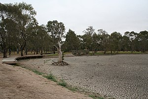
Balyang Sanctuary is a public park in the suburb of Newtown, Geelong. Situated at 38.1642°S 144.3312°E / -38.1642; 144.3312 on the banks of the Barwon River, it is 20 acres (8 ha) in size and consists of open park lands, lakes, and wetlands. It was opened in 1973.
Marcus Oldham College
Agricultural school in Geelong, Australia
Distance: Approx. 2198 meters
Latitude and longitude: -38.18944444,144.30388889
Marcus Oldham College is an agricultural, equine and farm management tertiary education institution located in Geelong, Victoria and is the only private agricultural college operating in Australia. Founded in 1962, the institution attracts enrolments from domestic and international students. At the undergraduate level, the school offers the following degrees: Bachelor of Business in Farm Management, Bachelor of Business in Agribusiness, Associate Degree of Agribusiness, Associate Degree of Farm Business Management, Diploma of Agribusiness, and Diploma of Equine Management.

Christian College, Geelong
Distance: Approx. 2067 meters
Latitude and longitude: -38.18805556,144.30333333
Christian College is a K–12 private school located over six campuses in Geelong, Victoria, Australia. Three campuses are located in suburban Geelong: the Senior Campus at Waurn Ponds (Year 10–12), the Middle School in Highton (Year 5–9), and the Junior School in Belmont (Prep–Year 4). The Bellarine Campus is located in Drysdale (Prep–Year 9), and the Surf Coast campus is located in the coastal town of Torquay, which opened in 2018.

City of South Barwon
Local government area in Victoria, Australia
Distance: Approx. 1969 meters
Latitude and longitude: -38.16666667,144.33333333
The City of South Barwon was a local government area in Victoria, Australia, which contained a number of Geelong suburbs south of the Barwon River, and extending to Torquay in the south and Barwon Heads to the east. The city covered an area of 165.4 square kilometres (63.9 sq mi), and existed from 1863 until 1994.
3GPH
Radio station in Geelong, Victoria
Distance: Approx. 1026 meters
Latitude and longitude: -38.173546,144.300291
3GPH is a community radio station owned and operated by Vision Australia as part of the Vision Australia Radio network. The station broadcasts a radio reading service to Geelong, Victoria, with 18 hours of local programming each week. Outside of local hours, the station is a repeater of the 3RPH service from Melbourne.
Weather in this IP's area
overcast clouds
13 Celsius
12 Celsius
12 Celsius
14 Celsius
1014 hPa
81 %
1014 hPa
1007 hPa
10000 meters
3.47 m/s
6.82 m/s
266 degree
100 %

