Country:
Region:
City:
Latitude and Longitude:
Time Zone:
Postal Code:
IP information under different IP Channel
ip-api
Country
Region
City
ASN
Time Zone
ISP
Blacklist
Proxy
Latitude
Longitude
Postal
Route
Luminati
Country
ASN
Time Zone
Asia/Kolkata
ISP
EAGLE SKY CO LT
Latitude
Longitude
Postal
IPinfo
Country
Region
City
ASN
Time Zone
ISP
Blacklist
Proxy
Latitude
Longitude
Postal
Route
db-ip
Country
Region
City
ASN
Time Zone
ISP
Blacklist
Proxy
Latitude
Longitude
Postal
Route
ipdata
Country
Region
City
ASN
Time Zone
ISP
Blacklist
Proxy
Latitude
Longitude
Postal
Route
Popular places and events near this IP address
Pitampura TV Tower
Distance: Approx. 258 meters
Latitude and longitude: 28.69721,77.15035
Pitampura TV Tower is a 235-metre (771 ft)-tall television tower, built in 1988, with an observation deck that is located in Pitam Pura, Delhi, India. Dilli Haat Pitampura is also situated near the TV tower. The Tower was dedicated to the Nation as Dr.
Sri Guru Gobind Singh College of Commerce
College of the University of Delhi, India
Distance: Approx. 258 meters
Latitude and longitude: 28.69832,77.15265
Sri Guru Gobind Singh College of Commerce, often referred to by its initials SGGSCC, is a constituent college of the University of Delhi located in Delhi, India. It was founded in 1984 and is named after the tenth Sikh Guru. It is the second college of commerce of the University of Delhi and is primarily a co-educational English medium institution.

Keshav Puram
Neighborhood of Delhi in North West Delhi, India
Distance: Approx. 1182 meters
Latitude and longitude: 28.6889,77.1616
Keshav Puram is a locality in the northwest district of Delhi, India. It was first developed by the Delhi Development Authority. The area has a lot of parks and the pollution levels are low.

Kanhaiya Nagar metro station
Metro station in Delhi, India
Distance: Approx. 1928 meters
Latitude and longitude: 28.68238889,77.16480556
The Kanhaiya Nagar metro station is located on the Red Line of the Delhi Metro. This Metro Station serves thousand of daily commuters. The main beneficiary are those living in Tri Nagar and Ashok Vihar.

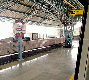
Keshav Puram metro station
Metro station in Delhi, India
Distance: Approx. 1198 meters
Latitude and longitude: 28.68888889,77.16180556
The Keshav Puram metro station is located on the Red Line of the Delhi Metro. It is located in the Keshav Puram locality of North West Delhi district of Delhi.

Netaji Subhash Place metro station
Metro station in Delhi, India
Distance: Approx. 16 meters
Latitude and longitude: 28.69588889,77.1525
The Netaji Subhash Place metro station is an interchange station between the Red Line and Pink Line of the Delhi Metro, catering to the Netaji Subhash Place area of Delhi. This newly opened (March 2018) interchange acts as an alternative route for those going to Blue Line, alleviating crowds on the heavily used Yellow Line.

Kohat Enclave metro station
Metro station in Delhi, India
Distance: Approx. 1173 meters
Latitude and longitude: 28.698,77.14080556
The Kohat Enclave metro station is located on the Red Line of the Delhi Metro, catering to the Kohat Enclave, near Pitam Pura area of Delhi.
Tri Nagar Assembly constituency
Constituency of the Delhi legislative assembly in India
Distance: Approx. 1617 meters
Latitude and longitude: 28.682,77.157
Tri Nagar Assembly constituency is one of the seventy Delhi assembly constituencies of Delhi in northern India. Tri Nagar assembly constituency is a part of Chandni Chowk (Lok Sabha constituency).
Wazirpur Assembly constituency
Constituency of the Delhi legislative assembly in India
Distance: Approx. 1040 meters
Latitude and longitude: 28.698,77.163
Wazirpur Assembly constituency is one of the seventy Delhi assembly constituencies of Delhi in northern India. Wazirpur assembly constituency is a part of Chandni Chowk (Lok Sabha constituency).

Rajkiya Pratibha Vikas Vidyalaya, Shalimar Bagh, Delhi
Government school in India
Distance: Approx. 1177 meters
Latitude and longitude: 28.70480556,77.15927778
Rajkiya Pratibha Vikas Vidyalaya (RPVV) Shalimar Bagh is one of the 21 RPVV schools established as a system of alternate schools for gifted students in Delhi. The school is known for its outstanding result and considered as one of the best government school in Delhi. The school is run by the Directorate of Education, Delhi, under the Department of Education, Government of NCT of Delhi.

Shalimar Bagh metro station
Metro station in Delhi, India
Distance: Approx. 1390 meters
Latitude and longitude: 28.70181889,77.16519111
The Shalimar Bagh metro station is located on the Pink Line of the Delhi Metro.

Shakurpur metro station
Metro station in Delhi, India
Distance: Approx. 1174 meters
Latitude and longitude: 28.68577881,77.14962581
The Shakurpur metro station is located on the Pink Line of the Delhi Metro.
Weather in this IP's area
smoke
24 Celsius
24 Celsius
24 Celsius
24 Celsius
1014 hPa
41 %
1014 hPa
990 hPa
1100 meters
1.54 m/s
280 degree
06:47:36
17:26:19