Country:
 Chinese mainland
Region:
City:
Latitude and Longitude:
Time Zone:
Postal Code:
IP information under different IP Channel
ip-api
Country
Region
City
ASN
Time Zone
ISP
Blacklist
Proxy
Latitude
Longitude
Postal
Route
IPinfo
Country
Region
City
ASN
Time Zone
ISP
Blacklist
Proxy
Latitude
Longitude
Postal
Route
MaxMind
Country
Region
City
ASN
Time Zone
ISP
Blacklist
Proxy
Latitude
Longitude
Postal
Route
Luminati
Country
CNASN
Time Zone
Asia/Shanghai
ISP
CHINA UNICOM China169 Backbone
Latitude
Longitude
Postal
db-ip
Country
Region
City
ASN
Time Zone
ISP
Blacklist
Proxy
Latitude
Longitude
Postal
Route
ipdata
Country
Region
City
ASN
Time Zone
ISP
Blacklist
Proxy
Latitude
Longitude
Postal
Route
Popular places and events near this IP address
Mengjiang
Imperial Japanese puppet state in northern China from 1939 to 1945
Distance: Approx. 5344 meters
Latitude and longitude: 40.81666667,114.88333333
Mengjiang, also known as Mengkiang, officially the Mengjiang United Autonomous Government, was an autonomous zone in Inner Mongolia, formed in 1939 as a puppet state of the Empire of Japan, then from 1940 being under the nominal sovereignty of the Reorganized National Government of the Republic of China (which was itself also a puppet state). It consisted of the previously Chinese provinces of Chahar and Suiyuan, corresponding to the central part of modern Inner Mongolia. It has also been called Mongukuo or Mengguguo (or Mengkukuo; Chinese: 蒙古國; in analogy to Manchukuo, another Japanese puppet state in Manchuria).

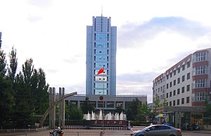
Zhangjiakou
Prefecture-level city in Hebei, People's Republic of China
Distance: Approx. 33 meters
Latitude and longitude: 40.769,114.886
Zhangjiakou (), also known as Kalgan and by several other names, is a prefecture-level city in northwestern Hebei province in Northern China, bordering Beijing to the southeast, Inner Mongolia to the north and west, and Shanxi to the southwest. By 2019, its population was 4,650,000 inhabitants on 36,861.56 square kilometres (14,232.33 sq mi), divided into 17 Counties and Districts. The built-up (or metro) area made of Qiaoxi, Qiaodong, Chongli, Xuanhua, Xiahuayuan Districts largely being conurbated had 1,500,000 inhabitants in 2019 on 1,412.7 km2 (545.4 sq mi).

Qiaoxi, Zhangjiakou
District in Hebei, China
Distance: Approx. 7720 meters
Latitude and longitude: 40.83333333,114.85277778
Qiaoxi District (simplified Chinese: 桥西区; traditional Chinese: 橋西區; pinyin: Qiáoxi Qū; lit. 'West of the Bridge') is a district of the city of Zhangjiakou, Hebei, China.
Qiaodong, Zhangjiakou
District in Hebei, People's Republic of China
Distance: Approx. 2252 meters
Latitude and longitude: 40.788,114.894
Qiaodong District (simplified Chinese: 桥东区; traditional Chinese: 橋東區; pinyin: Qiáodōng Qū; lit. 'East of the Bridge') is a district and the seat of the city of Zhangjiakou, Hebei province, China.

Zhangjiakou railway station (opened in 1909)
Former railway station in Zhangjiakou, China
Distance: Approx. 5008 meters
Latitude and longitude: 40.813647,114.888526
Zhangjiakou railway station was a station on the Beijing–Baotou railway in Qiaodong District, Zhangjiakou, Hebei. The station was closed in July 2014.

Zhangjiakou Ningyuan Airport
Airport in Hebei, north China
Distance: Approx. 5016 meters
Latitude and longitude: 40.73861111,114.93027778
Zhangjiakou Ningyuan Airport (IATA: ZQZ, ICAO: ZBZJ) is a dual-use military and public airport serving the city of Zhangjiakou in Hebei province, north China. It is located 9 kilometers southeast of the city center. Construction to convert the air base to a dual-use airport began in May 2010 at an estimated cost of 450 million yuan.

Dajingmen
Junction of the Great Wall of China
Distance: Approx. 8431 meters
Latitude and longitude: 40.84444,114.88599
Dajingmen (simplified Chinese: 大境门; traditional Chinese: 大境門; pinyin: Dàjìngmén), also known as Dajing Gate, is an important junction of the Great Wall of China in the prefecture-level city of Zhangjiakou within the Chinese province of Hebei. Dajingmen was built in 1644 in the first year of the reign of the Shunzhi Emperor in the Qing Dynasty The gate is 12 metres high, 9 metres wide, and 13 metres deep. Above the gate is a terrace measuring 12 by 7.5 metres.

Zhangjiakou South railway station
Railway station in Zhangjiakou, China
Distance: Approx. 7176 meters
Latitude and longitude: 40.704375,114.880349
The Zhangjiakou South railway station (formerly Shalingzi West railway station) is a railway station on the Beijing–Baotou railway located in Zhangjiakou, Hebei which was initially meant for only freight traffic and was opened for civilian use in late 2017 to service the trains that were originally meant to arrive and depart from Zhangjiakou railway station.

South Chahar Autonomous Government
Former autonomous area in Mongolia
Distance: Approx. 5344 meters
Latitude and longitude: 40.81666667,114.88333333
The South Chahar Autonomous Government was a puppet state of the Empire of Japan, as well as an administratively autonomous component of Mengjiang from its creation in 1937 to its complete merger in 1939. Following the Japanese invasion of China in July 1937, regional governments were established in Japanese-occupied territories. After Operation Chahar in September 1937, which extended Japanese control to northern Shanxi region, more formal control of the area was established through the creation of the North Shanxi Autonomous Government, as well as the South Chahar Autonomous Government to the east of Shanxi.
Weather in this IP's area
scattered clouds
21 Celsius
21 Celsius
21 Celsius
21 Celsius
1016 hPa
81 %
1016 hPa
936 hPa
10000 meters
0.58 m/s
0.84 m/s
334 degree
32 %
06:04:58
18:23:40