103.233.66.75 - IP Lookup: Free IP Address Lookup, Postal Code Lookup, IP Location Lookup, IP ASN, Public IP
Country:
Region:
City:
Location:
Time Zone:
Postal Code:
ISP:
ASN:
language:
User-Agent:
Proxy IP:
Blacklist:
IP information under different IP Channel
ip-api
Country
Region
City
ASN
Time Zone
ISP
Blacklist
Proxy
Latitude
Longitude
Postal
Route
db-ip
Country
Region
City
ASN
Time Zone
ISP
Blacklist
Proxy
Latitude
Longitude
Postal
Route
IPinfo
Country
Region
City
ASN
Time Zone
ISP
Blacklist
Proxy
Latitude
Longitude
Postal
Route
IP2Location
103.233.66.75Country
Region
kerala
City
ferokh
Time Zone
Asia/Kolkata
ISP
Language
User-Agent
Latitude
Longitude
Postal
ipdata
Country
Region
City
ASN
Time Zone
ISP
Blacklist
Proxy
Latitude
Longitude
Postal
Route
Popular places and events near this IP address
Beypore
City in Kerala, India
Distance: Approx. 4384 meters
Latitude and longitude: 11.18,75.81
Beypore or Beypur (formerly Beypoor) is an ancient port town and a locality town in Kozhikode district in the state of Kerala, India. It is located opposite to Chaliyam, the estuary where the river Chaliyar empties into Arabian Sea. Beypore is part of Kozhikode Municipal Corporation.

Feroke
Municipality in Kerala, India
Distance: Approx. 4 meters
Latitude and longitude: 11.18333333,75.85
Feroke (IPA: [fɐroːkːɨ̆]) is a Municipality and a part of Kozhikode metropolitan area under Kozhikode Development Authority (K.D.A) in the Kozhikode district of the Indian state of Kerala. Feroke municipality shares its borders with Kozhikode corporation, Ramanattukara municipality, Kadalundi panchayat and Chelembra panchayath. Feroke is located 11 km away from Kozhikode city.

Ramanattukara
Municipality/Suburb in Kozhikode, Kerala, India
Distance: Approx. 1030 meters
Latitude and longitude: 11.1886744,75.8576775
Ramanattukara is a municipality census town in Kozhikode district in the Indian state of Kerala. The town was formerly called Kadungan Chira village. Ramanattukara is located 16 km away from Kozhikode city.
Kunnummal
Village in Kerala, India
Distance: Approx. 4584 meters
Latitude and longitude: 11.20833333,75.81666667
Kunnummal is a panchayath in Kozhikode district in the state of Kerala, India.
Mahlkot
Town in Kerala, India
Distance: Approx. 4296 meters
Latitude and longitude: 11.16550833,75.81508889
Mahlkot is an area situated in the Kozhikode district of the Kerala state in India. The very same name is some times used to refer to an area in Tirurangadi taluk of Malappuram district.

Cheruvannur Nallalam
Census town in Kerala, India
Distance: Approx. 3526 meters
Latitude and longitude: 11.195,75.82
Cheruvannur is a census town and Cheruvannur-Nallalam Part of Kozhikode Corporation.
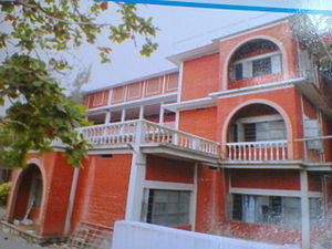
Farook College
Educational institute in Kerala
Distance: Approx. 1848 meters
Latitude and longitude: 11.1984099,75.8570141
Farook College is a government-aided, autonomous, arts and science college located in Feroke near Kozhikode, Kerala, India. It is the largest residential post-graduate aided institution in Kerala affiliated to the University of Calicut; it was granted autonomous college status in 2015. Established in 1948, Farook College has been identified by the University Grants Commission of India as a College with Potential for Excellence (CPE), the first college under Calicut University to receive the status.

Chaliyam
Village in Kerala, India
Distance: Approx. 5485 meters
Latitude and longitude: 11.15592,75.80824
Chaliyam is a village situated at the estuary of Chaliyar (River Beypore) in Kozhikode district of Kerala, India. Chaliyam forms an island, bounded by the Chaliyar in the north, and River Kadalundi in south, and the Conolly Canal in the east. It is located just opposite to Beypore port.

Al-Farook Educational Centre
Distance: Approx. 1708 meters
Latitude and longitude: 11.19653,75.85793
Alfarook Educational Centre is a multi-discipline campus at Feroke in Kozhikode District, India.

Paruthippara
Village in Kerala, India
Distance: Approx. 1877 meters
Latitude and longitude: 11.2000621,75.8481448
Paruthippara or Kodampuzha is a small village near Feroke in Kozhikode District. The village is considered an industrial belt as a large number of small-scale are established here for a long time.
Perumugham
Village in Kerala, India
Distance: Approx. 1737 meters
Latitude and longitude: 11.16826,75.85422
Perumugham is a small village near Feroke in Kozhikode District, Kerala, India.

Kadalundi–Vallikkunnu Community Reserve
Community reserve in Kerala
Distance: Approx. 5307 meters
Latitude and longitude: 11.13933333,75.83122222
Kadalundi–Vallikkunnu Community Reserve is an estuary and community reserve in Malabar Coast of Kerala state, south India. It is the first community reserve in Kerala. In 2018 April, Kerala forest department declared it as an ecotourism center.
Weather in this IP's area
few clouds
34 Celsius
35 Celsius
34 Celsius
34 Celsius
1007 hPa
40 %
1007 hPa
1004 hPa
6000 meters
4.12 m/s
270 degree
20 %
