Country:
Region:
City:
Latitude and Longitude:
Time Zone:
Postal Code:
IP information under different IP Channel
ip-api
Country
Region
City
ASN
Time Zone
ISP
Blacklist
Proxy
Latitude
Longitude
Postal
Route
IPinfo
Country
Region
City
ASN
Time Zone
ISP
Blacklist
Proxy
Latitude
Longitude
Postal
Route
MaxMind
Country
Region
City
ASN
Time Zone
ISP
Blacklist
Proxy
Latitude
Longitude
Postal
Route
Luminati
Country
Region
nt
City
zuccoli
ASN
Time Zone
Australia/Darwin
ISP
ILAND
Latitude
Longitude
Postal
db-ip
Country
Region
City
ASN
Time Zone
ISP
Blacklist
Proxy
Latitude
Longitude
Postal
Route
ipdata
Country
Region
City
ASN
Time Zone
ISP
Blacklist
Proxy
Latitude
Longitude
Postal
Route
Popular places and events near this IP address

Acacia Hills, Northern Territory
Suburb of Darwin, the Northern Territory, Australia
Distance: Approx. 4370 meters
Latitude and longitude: -12.79555556,131.12305556
Acacia Hills is an outer rural locality of Darwin. It is 60 kilometres (37 mi) south of the Darwin CBD in Litchfield Municipality. Named for the acacia shrub that is endemic to the area, the suburb is largely rural land, just north of Manton Dam and west of the Adelaide River.
Fly Creek, Northern Territory
Suburb of Darwin, the Northern Territory, Australia
Distance: Approx. 9876 meters
Latitude and longitude: -12.80122222,131.06878889
Fly Creek is an outer rural locality in Darwin.

Manton, Northern Territory
Suburb of Darwin, the Northern Territory, Australia
Distance: Approx. 1216 meters
Latitude and longitude: -12.82410833,131.15669444
Manton is an outer rural locality of Darwin. The name is derived from Manton Dam on the Manton River, named by Government Resident B. T. Finniss for his second-in-command James Thomas Manton.

Manton Dam
Dam in Northern Territory, Australia
Distance: Approx. 4570 meters
Latitude and longitude: -12.84037,131.12717
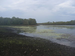
Manton Dam is a small concrete arch dam on the Manton River, approximately 70 km (43 mi) south of Darwin, Northern Territory in Australia. The dam was originally constructed by the Department of Defence during the Second World War to provide a reliable supply of fresh water to Darwin, completed in 1942. The reservoir itself is now mostly used for recreation, such as fishing, boating and water skiing, surrounded by a conservation area for native flora and fauna.
Weather in this IP's area
overcast clouds
39 Celsius
37 Celsius
39 Celsius
39 Celsius
1008 hPa
14 %
1008 hPa
1005 hPa
10000 meters
3.51 m/s
6.67 m/s
119 degree
99 %
06:45:00
18:41:30