103.232.106.46 - IP Lookup: Free IP Address Lookup, Postal Code Lookup, IP Location Lookup, IP ASN, Public IP
Country:
Region:
City:
Location:
Time Zone:
Postal Code:
IP information under different IP Channel
ip-api
Country
Region
City
ASN
Time Zone
ISP
Blacklist
Proxy
Latitude
Longitude
Postal
Route
Luminati
Country
Region
auk
City
auckland
ASN
Time Zone
Pacific/Auckland
ISP
2degrees Networks Limited
Latitude
Longitude
Postal
IPinfo
Country
Region
City
ASN
Time Zone
ISP
Blacklist
Proxy
Latitude
Longitude
Postal
Route
IP2Location
103.232.106.46Country
Region
hawke's bay
City
hastings
Time Zone
Pacific/Auckland
ISP
Language
User-Agent
Latitude
Longitude
Postal
db-ip
Country
Region
City
ASN
Time Zone
ISP
Blacklist
Proxy
Latitude
Longitude
Postal
Route
ipdata
Country
Region
City
ASN
Time Zone
ISP
Blacklist
Proxy
Latitude
Longitude
Postal
Route
Popular places and events near this IP address

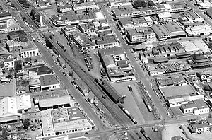
Hastings, New Zealand
City in North Island, New Zealand
Distance: Approx. 569 meters
Latitude and longitude: -39.64166667,176.84444444
Hastings (; Māori: Heretaunga) is an inland city of New Zealand and is one of the two major urban areas in Hawke's Bay, on the east coast of the North Island. The population of Hastings (including Flaxmere) is 52,200 (as of June 2024), with a further 14,900 people in Havelock North and 2,120 in Clive. Hastings is about 18 kilometres inland of the coastal city of Napier.

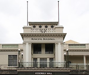
Hastings District, New Zealand
Territorial authority district in Hawke's Bay Region, New Zealand
Distance: Approx. 934 meters
Latitude and longitude: -39.645,176.843
Hastings District is a Territorial authority district within the Hawke's Bay Region, on the east coast of the North Island of New Zealand. It covers the southern half of the Hawke's Bay coast, excluding Napier City, which is a separate territorial authority. Hastings District Council is headquartered in the city of Hastings, the district's largest town.

Heretaunga Street
Street in New Zealand
Distance: Approx. 673 meters
Latitude and longitude: -39.642318,176.843573
Heretaunga Street (Māori pronunciation: [hɛɾɛˈtɑːʉŋa]) is the main arterial road through Hastings, New Zealand. The street forms the heart of the Central Business District of Hastings City across six blocks numbered 100, 200, and 300 Blocks with the railway line dividing the blocks by East and West. The name Heretaunga is taken from the name of the Māori Land Block on which Hastings was established in 1873.
St John's College, Hastings
School in Hastings, Hawkes Bay, New Zealand
Distance: Approx. 611 meters
Latitude and longitude: -39.63944444,176.85611111
St. John's College is a State Integrated, Catholic, Day School for boys, located in Hastings, a provincial city in Hawkes Bay, New Zealand. Founded in 1941 by the Marist Fathers, St.
Taikura Rudolf Steiner School
Co-ed state integrated (years 1–13) school
Distance: Approx. 383 meters
Latitude and longitude: -39.63583333,176.84583333
Taikura Rudolf Steiner School is a co-educational state integrated composite school for students in Years 1 to 13, located in Hastings, New Zealand.
Nelson Cricket Ground
Cricket ground
Distance: Approx. 51 meters
Latitude and longitude: -39.63833889,176.84971111
Nelson Cricket Ground was a cricket ground in Hastings, Hawke's Bay, New Zealand. The first recorded match held on the ground came in February 1878 when Hawke's Bay played the touring Australians. The New Zealand Times referred to the match as taking place "in Mr Braithwaite's paddock at Hastings, about a mile from the railway station".

Hastings railway station, New Zealand
Defunct railway station in New Zealand
Distance: Approx. 257 meters
Latitude and longitude: -39.6391,176.8465
The Hastings railway station in Hastings, New Zealand is the main railway station in Hastings and an intermediate stop on the Palmerston North–Gisborne Line. The station is on the corner of Russell Street (which ran alongside the line) and St Aubyn Street, and is close to the centre of Hastings. It is no longer used by any regularly-scheduled passenger services.
Mayfair, New Zealand
Suburb of Hastings, New Zealand
Distance: Approx. 736 meters
Latitude and longitude: -39.635658,176.857177
Mayfair is a suburb of Hastings City, in the Hawke's Bay Region of New Zealand's North Island. Nine streets in the suburb have poppies on their street signs to commemorate New Zealanders who served in international conflicts.

Hastings Central
Central Business District of Hastings, New Zealand
Distance: Approx. 666 meters
Latitude and longitude: -39.642031,176.843341
Hastings Central is the central suburb and business district of Hastings City, in the Hawke's Bay Region of New Zealand's North Island.
Rush Munro's
New Zealand ice creamery
Distance: Approx. 711 meters
Latitude and longitude: -39.6432,176.8442
Rush Munro's is the oldest running ice creamery in New Zealand. It is based in Hawke's Bay, and its ice cream is sold in supermarkets, cafés, restaurants and ice cream parlours. The company still uses the 1926 recipes of founder Frederick Charles Rush Munro, which contain no preservatives or food colourings.

Cornwall Park, Hastings
Cornwall Park is a public park in Hastings, New Zealand.
Distance: Approx. 773 meters
Latitude and longitude: -39.6313,176.8474
Cornwall Park is a public park in Mahora, a suburb of Hastings, New Zealand, named for King George V. The land was bought by the council in 1901, and the park opened to the public in November 1905. Over time the facilities of the park were expanded to include areas for sports, various trees were planted around the park, and in the 1920s a major renovation saw much of what the park is today come to fruition. The park has had a connection to royal events since its inception, with celebrations for coronations of monarchs being held there, notably including the installation of the King George V Coronation drinking fountain.

Hastings Clock Tower
Clocktower in New Zealand
Distance: Approx. 692 meters
Latitude and longitude: -39.64202778,176.84294444
The Hastings Clock Tower is a public landmark in the New Zealand city of Hastings. Designed by Sidney George Chaplin, and erected in 1935, the tower is located in the Hastings central business district alongside the Palmerston North-Gisborne railway line adjacent to the intersection of Heretaunga Street and Russell Street. The clock tower was designed as a symbol of recovery from the 1931 Hawke's Bay earthquake and was not intended as a memorial; however, in 1995, brass plaques were added to the tower in memory of those who died during the earthquake.
Weather in this IP's area
light rain
13 Celsius
12 Celsius
13 Celsius
13 Celsius
1010 hPa
70 %
1010 hPa
1008 hPa
10000 meters
5.35 m/s
10.61 m/s
245 degree
92 %