Country:
 Bangladesh
Region:
City:
Latitude and Longitude:
Time Zone:
Postal Code:
IP information under different IP Channel
ip-api
Country
Region
City
ASN
Time Zone
ISP
Blacklist
Proxy
Latitude
Longitude
Postal
Route
IPinfo
Country
Region
City
ASN
Time Zone
ISP
Blacklist
Proxy
Latitude
Longitude
Postal
Route
MaxMind
Country
Region
City
ASN
Time Zone
ISP
Blacklist
Proxy
Latitude
Longitude
Postal
Route
Luminati
Country
BDRegion
e
City
joypurhat
ASN
Time Zone
Asia/Dhaka
ISP
Infobd24 Systems
Latitude
Longitude
Postal
db-ip
Country
Region
City
ASN
Time Zone
ISP
Blacklist
Proxy
Latitude
Longitude
Postal
Route
ipdata
Country
Region
City
ASN
Time Zone
ISP
Blacklist
Proxy
Latitude
Longitude
Postal
Route
Popular places and events near this IP address

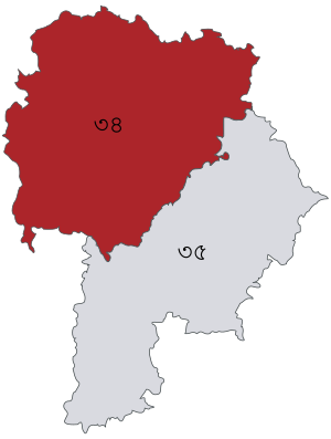
Joypurhat District
District of Bangladesh in Rajshahi Division
Distance: Approx. 601 meters
Latitude and longitude: 25.1,89.03
Joypurhat (Bengali: জয়পুরহাট) is a district in the northern part of Bangladesh, part of the Rajshahi Division.

Joypurhat Girls' Cadet College
Military high school in Bangladesh
Distance: Approx. 1904 meters
Latitude and longitude: 25.0984,89.0064
Joypurhat Girls' Cadet College (Bengali: জয়পুরহাট গার্লস ক্যাডেট কলেজ) is a military high school for girls, located in Joypurhat District, Bangladesh. Cadet colleges are under the auspices of the Ministry of Defence. Inaugurated in 2006, the college occupies 57 acres (230,000 m2) of land and has the capacity for 450 students.
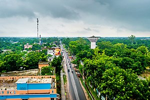
Joypurhat
Municipality in Rajshahi, Bangladesh
Distance: Approx. 376 meters
Latitude and longitude: 25.1,89.024
Joypurhat is a city in northwestern Bangladesh, near the border with India. It is the headquarters of Joypurhat District.
Joypurhat Sadar Upazila
Upazila in Rajshahi, Bangladesh
Distance: Approx. 894 meters
Latitude and longitude: 25.1,89.03333333
Joypurhat Sadar (Bengali: জয়পুরহাট সদর) is an upazila of Joypurhat District in the Division of Rajshahi, Bangladesh.
Khanjanpur
Distance: Approx. 2089 meters
Latitude and longitude: 25.101,89.005
Khanjapur or Khanjapur (Bengali: খাঞ্জাপুর, খান-জা-পুর) is a village situated at the periphery of Gournadi Upazila, Barishal District in the Barishal Division of Bangladesh.
Karai Kadipur massacre
Distance: Approx. 3837 meters
Latitude and longitude: 25.088,89.062
Karai Kadipur massacre (Bengali: কড়ই কাদিপুর গণহত্যা) was the massacre of unarmed Hindu villagers of Joypurhat on 26 April 1971 by the Pakistani army and the Razakars. 370 Hindus were killed in the massacre in the villages of Karai, Kadipur and other adjoining villages.
Panchbibi L. B. Pilot Government High School
Public secondary school in Bangladesh
Distance: Approx. 7549 meters
Latitude and longitude: 25.1,89.1
Panchbibi Lal Bihari Pilot Government High School (Bengali: পাঁচবিবি এল. বি. পাইলট সরকারী উচ্চ বিদ্যালয়) is a secondary school situated in Panchbibi Upazila, Joypurhat District, in northern Bangladesh.
Joypurhat Stadium
Distance: Approx. 1022 meters
Latitude and longitude: 25.10541111,89.02168611
Joypurhat Stadium is situated at Master Para, Joypurhat, Bangladesh.
Joypurhat-1
Constituency of Bangladesh's Jatiya Sangsad
Distance: Approx. 601 meters
Latitude and longitude: 25.1,89.03
Joypurhat-1 is a constituency represented in the Jatiya Sangsad (National Parliament) of Bangladesh. Since 6 August 2024, the constituency is vacant.
R.B. Govt. High School
School in Bangladesh
Distance: Approx. 785 meters
Latitude and longitude: 25.1004,89.0319
R.B. Govt. High School (Bengali: রামদেও বাজলা সরকারি উচ্চ বিদ্যালয়, also known as Zila School or Bazla School) is a Govt. High School in Joypurhat, Bangladesh.
Joypurhat Government College
Distance: Approx. 167 meters
Latitude and longitude: 25.0972,89.0236
Joypurhat Government College is the highest educational institution of Joypurhat. The college was established 1963 and is located near Joypurhat railway station. The college was nationalized in 1980.

Joypurhat Sugar Mill
Distance: Approx. 1585 meters
Latitude and longitude: 25.111,89.024
Joypurhat Sugar Mill is the largest government owned sugar mill factory in Bangladesh. It is located at the north-western Joypurhat district in Rajshahi division. It has the capability of thrashing 14,000 metric tons of sugarcane daily.
Weather in this IP's area
clear sky
28 Celsius
31 Celsius
28 Celsius
28 Celsius
1003 hPa
77 %
1003 hPa
1001 hPa
10000 meters
1.43 m/s
1.47 m/s
293 degree
7 %
05:51:47
18:02:57