Country:
Region:
City:
Latitude and Longitude:
Time Zone:
Postal Code:
IP information under different IP Channel
ip-api
Country
Region
City
ASN
Time Zone
ISP
Blacklist
Proxy
Latitude
Longitude
Postal
Route
Luminati
Country
Region
qld
City
brisbane
ASN
Time Zone
Australia/Brisbane
ISP
Simtronic
Latitude
Longitude
Postal
IPinfo
Country
Region
City
ASN
Time Zone
ISP
Blacklist
Proxy
Latitude
Longitude
Postal
Route
db-ip
Country
Region
City
ASN
Time Zone
ISP
Blacklist
Proxy
Latitude
Longitude
Postal
Route
ipdata
Country
Region
City
ASN
Time Zone
ISP
Blacklist
Proxy
Latitude
Longitude
Postal
Route
Popular places and events near this IP address

Ballymore Stadium
Multifunctional Australian stadium in Brisbane
Distance: Approx. 683 meters
Latitude and longitude: -27.44194444,153.01777778
Ballymore is a rugby union stadium situated in Herston, a suburb of Brisbane, Australia. It is the headquarters of Queensland Rugby Union and was the home ground of the Brisbane City team in the National Rugby Championship, until the league's disbandment in 2019. It is also used as a training facility for the Queensland Reds and the Australia national rugby union team.

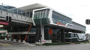
Herston busway station
Bus station in Brisbane, Australia
Distance: Approx. 673 meters
Latitude and longitude: -27.44972222,153.025
Herston busway station is located in Brisbane, Australia serving the suburb of Herston. It opened on 14 December 2005 as RCH Herston on an existing section of the Inner Northern Busway. It was the northernmost station until the busway was extended to RBWH on 3 August 2009.

Royal Brisbane and Women's Hospital
Hospital in Queensland, Australia
Distance: Approx. 525 meters
Latitude and longitude: -27.4469,153.0283
The Royal Brisbane and Women's Hospital (RBWH) is a tertiary public hospital located in Herston, a suburb of Brisbane, Queensland, Australia. It is operated by Metro North Health, part of the Queensland Health network. The hospital has 929 beds, and it is estimated that 65% of the patients served come from within 15 kilometres (9.3 mi) of the hospital.
Brisbane Roar FC (women)
Football club
Distance: Approx. 683 meters
Latitude and longitude: -27.44194444,153.01777778
Brisbane Roar Women Football Club, formerly known Queensland Roar Women, is an Australian professional women's soccer club based in Brisbane, Queensland (founded in 2008). The Roar competes in the country's premier women's soccer competition, the A-League Women.
2009 W-League grand final (January)
Football match
Distance: Approx. 683 meters
Latitude and longitude: -27.44194444,153.01777778
The 2008–09 W-League grand final was the grand final of the inaugural season of the W-League, the premier league of football (soccer) in Australia. Top of the table in the regular season Queensland Roar hosted home-and-away third-placed Canberra United FC at Ballymore Stadium in Herston, Brisbane in the Saturday 17 January 2009 season decider. In a closely contested match, the Roar defeated United 2–0.
2009 Brisbane Roar FC (women) season
Brisbane Roar (W-League) 2009 football season
Distance: Approx. 683 meters
Latitude and longitude: -27.44194444,153.01777778
The 2009 season was Brisbane Roar Football Club (W-League)'s second season, in the W-League. Brisbane Roar finished 3rd in their W-League season, and finished as runners-up in the Grand Final.

RBWH busway station
Bus station in Brisbane, Australia
Distance: Approx. 633 meters
Latitude and longitude: -27.4475,153.02916667
RBWH busway station is located in Brisbane, Australia serving the suburb of Herston and Royal Brisbane & Women's Hospital from which its name is an acronym of. It opened on 3 August 2009 when the Northern Busway was extended from Herston. The station has two platforms which can be accessed via an elevated concourse located below the platforms, while stairs and elevators also give passengers access to ground level just below the concourse.

University of Queensland Mayne Medical School
Historic site in Queensland, Australia
Distance: Approx. 559 meters
Latitude and longitude: -27.4487,153.0239
University of Queensland Mayne Medical School is a heritage-listed university building at 288 Herston Road, Herston, City of Brisbane, Queensland, Australia. It was designed by Raymond Clare Nowland and built from 1938 to 1939. It is also known as University of Queensland Medical School.

Royal Brisbane Hospital Nurses' Homes
Historic site in Queensland, Australia
Distance: Approx. 536 meters
Latitude and longitude: -27.4481,153.0266
The Royal Brisbane Hospital Nurses' Homes are heritage-listed accommodation for nurses at the Royal Brisbane Hospital, Herston Road, Herston, City of Brisbane, Queensland, Australia. It was built from 1896 to 1939. It includes the Lady Lamington Nurses' Home and Nurses' Homes Blocks 1 & 2.

Brisbane General Hospital Precinct
Historic site in Queensland, Australia
Distance: Approx. 616 meters
Latitude and longitude: -27.4486,153.0273
Brisbane General Hospital Precinct is a heritage-listed hospital precinct at 40 Bowen Bridge Road, Herston, City of Brisbane, Queensland, Australia. It was built from 1875 to 1941. It includes six historic buildings associated with the Royal Brisbane and Women's Hospital and the former Royal Children's Hospital, as well as aspects of their grounds and landscaping.

Marks-Hirschfeld Museum of Medical History
Distance: Approx. 504 meters
Latitude and longitude: -27.4482,153.0238
The Marks-Hirschfeld Museum of Medical History is a museum at the University of Queensland Mayne Medical School at 288 Herston Road, Herston, City of Brisbane, Queensland, Australia. Operated by volunteers and supported by the University of Queensland Alumni, it has a collection of over 7,000 items of medical memorabilia, medical and surgical instruments. The focus is on the study of medical history in Queensland, but the collection includes items with broader significance to Australia and internationally.
Royal Children's Hospital, Brisbane
Hospital in Queensland, Australia
Distance: Approx. 621 meters
Latitude and longitude: -27.449192,153.025475
The Royal Children's Hospital (RCH) was a hospital for children in Herston, Brisbane, Australia. RCH was located next to the Royal Brisbane and Women's Hospital before it was demolished and the land was used to build the Surgical, Treatment and Rehabilitation Service (STARS).
Weather in this IP's area
overcast clouds
28 Celsius
31 Celsius
27 Celsius
30 Celsius
1013 hPa
65 %
1013 hPa
1013 hPa
10000 meters
2.24 m/s
3.58 m/s
48 degree
99 %
04:47:26
18:18:58
