Country:
 India
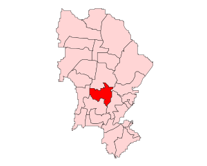
IndiaRegion:
City:
Latitude and Longitude:
Time Zone:
Postal Code:
IP information under different IP Channel
ip-api
Country
Region
City
ASN
Time Zone
ISP
Blacklist
Proxy
Latitude
Longitude
Postal
Route
IPinfo
Country
Region
City
ASN
Time Zone
ISP
Blacklist
Proxy
Latitude
Longitude
Postal
Route
MaxMind
Country
Region
City
ASN
Time Zone
ISP
Blacklist
Proxy
Latitude
Longitude
Postal
Route
Luminati
Country
INASN
Time Zone
Asia/Kolkata
ISP
NTT COMMUNICATIONS INDIA NETWORK SERVICES PRIVATE LIMITED
Latitude
Longitude
Postal
db-ip
Country
Region
City
ASN
Time Zone
ISP
Blacklist
Proxy
Latitude
Longitude
Postal
Route
ipdata
Country
Region
City
ASN
Time Zone
ISP
Blacklist
Proxy
Latitude
Longitude
Postal
Route
Popular places and events near this IP address

St. John the Baptist Church, Mumbai
Ruined church in Mumbai
Distance: Approx. 1018 meters
Latitude and longitude: 19.1216159,72.8743576
St. John the Baptist Church is an abandoned and ruined church presently located within the SEEPZ Industrial Area, in Andheri, Mumbai, India. It was built by the Portuguese Jesuits in 1579 and opened to public worship on the feast of John the Baptist that year.

Holy Family High School (Mumbai)
Private primary and secondary school in Maharashtra, India
Distance: Approx. 909 meters
Latitude and longitude: 19.116999,72.861843
The Holy Family High School is a private Catholic primary and secondary school for boys located in the suburb of East Andheri in Mumbai, in the state of Maharashtra, India. While the school is primarily English-medium, there is also a smaller Marathi-medium section that runs in parallel from the fifth to the tenth standard. The school now also has a junior college named Holy Family Junior College for 11th and 12th grade HSC students.
Marol
Neighbourhood in Mumbai Suburban, Maharashtra, India
Distance: Approx. 1508 meters
Latitude and longitude: 19.119219,72.882743
Marol is a locality in the suburb of the Andheri (East) in Mumbai, India.
Chakala
Neighbourhood in Mumbai Suburban, Maharashtra, India
Distance: Approx. 965 meters
Latitude and longitude: 19.11138889,72.86083333
Chakala is a locality in the suburb of Andheri in Mumbai. It had a station on the Salsette–Trombay Railway, which was dismantled after the rail line closed down in 1934. It is served by the Western Express Highway and Chakala stations on Line 1 of the Mumbai Metro.
SEEPZ
Neighbourhood in Mumbai Suburban, Maharashtra, India
Distance: Approx. 1239 meters
Latitude and longitude: 19.123,72.876
Santacruz Electronics Export Processing Zone (SEEPZ) is a Special Economic Zone in Mumbai, India. Situated in the Andheri East area, it is subjected to liberal economic laws as compared to the rest of India to promote rapid economic growth using tax and business incentives and attract foreign investment and technology. Seepz was created in 1973 and was seen as export processing zone.

Western Express Highway metro station
Mumbai Metro's Blue Line 1 metro station
Distance: Approx. 1417 meters
Latitude and longitude: 19.11555556,72.85638889
Western Express Highway is an elevated metro station on the Blue Line 1 of Mumbai Metro serving the Andheri suburb of Mumbai, India. It is the flagship station of the line and was opened to the public on 8 June 2014.

Chakala (J B Nagar) metro station
Mumbai Metro's Blue Line 1 metro station
Distance: Approx. 273 meters
Latitude and longitude: 19.112045,72.867696
Chakala (J.B. Nagar) (Officially known as IndusInd Bank Chakala (J.B. Nagar)) is an elevated metro station on the East-West Corridor of the Blue Line 1 of Mumbai Metro, serving the JB Nagar neighbourhood of Andheri in Mumbai. It was opened to the public on 8 June 2014. Chakala station is located 1.5–2 km away from the Chakala, neighbourhood of Andheri.
Andheri East Assembly constituency
Indian constituency
Distance: Approx. 713 meters
Latitude and longitude: 19.12,72.87
Andheri East constituency is one of the 26 Vidhan Sabha constituencies located in Mumbai Suburban district. It is a segment of the Mumbai North West Lok Sabha constituency along with five other Vidhan Sabha segments, namely Goregaon, Versova, Jogeshwari East, Dindoshi and Andheri West in Mumbai Suburban district.

Maker's Asylum
Makerspace / hackerspace which started in Mumbai
Distance: Approx. 923 meters
Latitude and longitude: 19.11988333,72.87542778
Maker's Asylum is a makerspace / hackerspace which started in Mumbai back in 2013 and is now headquartered in Goa, India, inspired by Artisan's Asylum, Chaos Computer Club and other maker organisations.
House of Love (Mumbai)
Distance: Approx. 1080 meters
Latitude and longitude: 19.11603889,72.85976389
House of Love (Mumbai) (Sneha Sadan) houses homeless children in the area of Mumbai, India, along with other services. It is a work of the Society of Jesus. The first House of Love was a hut at Kajuwadi in Chakala, Andheri with just five boys.

Gurdwara Guru Nanak Punjabi Sabha Chakala
Gurdwara established by Guru Nanak Punjabi Sabha in 1956
Distance: Approx. 1219 meters
Latitude and longitude: 19.11488889,72.85819444
Gurdwara Guru Nanak Punjabi Sabha Chakala is a Sikh Gurdwara in Chakala in Mumbai. The Guru Nanak Punjabi Sabha was founded by Shamsher Singh Jolly (1922–1992) to establish the Gurdwara, the Charitable Dispensary and the Guru Nanak Mission High School. The Gurdwara and Charitable Dispensary is located on Andheri Kurla Road, Amrit Nagar, Andheri East, Mumbai - 400093, Opposite Holy Family Church, Chakala.

Gundavali metro station
Mumbai Metro's Red Line 7 terminal metro station
Distance: Approx. 1536 meters
Latitude and longitude: 19.11502,72.85517
Gundavali is the elevated southern terminal metro station on the North-South corridor of the Red Line 7 of Mumbai Metro in Mumbai, India. This metro station was inaugurated on 20 January 2023 by Prime Minister Narendra Modi. Gundavali is connected to the Western Express Highway station on Line 1 through a 58 metre long foot overbridge.
Weather in this IP's area
mist
27 Celsius
30 Celsius
27 Celsius
29 Celsius
1009 hPa
83 %
1009 hPa
1007 hPa
3000 meters
75 %
06:26:54
18:37:47