Country:
 New Zealand
Region:
City:
Latitude and Longitude:
Time Zone:
Postal Code:
IP information under different IP Channel
ip-api
Country
Region
City
ASN
Time Zone
ISP
Blacklist
Proxy
Latitude
Longitude
Postal
Route
IPinfo
Country
Region
City
ASN
Time Zone
ISP
Blacklist
Proxy
Latitude
Longitude
Postal
Route
MaxMind
Country
Region
City
ASN
Time Zone
ISP
Blacklist
Proxy
Latitude
Longitude
Postal
Route
Luminati
Country
NZASN
Time Zone
Pacific/Auckland
ISP
Two Degrees Networks Limited
Latitude
Longitude
Postal
db-ip
Country
Region
City
ASN
Time Zone
ISP
Blacklist
Proxy
Latitude
Longitude
Postal
Route
ipdata
Country
Region
City
ASN
Time Zone
ISP
Blacklist
Proxy
Latitude
Longitude
Postal
Route
Popular places and events near this IP address

Radio New Zealand
Public-service radio broadcast network
Distance: Approx. 96 meters
Latitude and longitude: -41.285,174.77416667
Radio New Zealand (Māori: Te Reo Irirangi o Aotearoa), commonly known as RNZ or Radio NZ, is a New Zealand public-service radio broadcaster and Crown entity that was established under the Radio New Zealand Act 1995. It operates news and current-affairs network, RNZ National, and a classical-music and jazz network, RNZ Concert, with full government funding from NZ On Air. Since 2014, the organisation's focus has been to transform RNZ from a radio broadcaster to a multimedia outlet, increasing its production of digital content in audio, video, and written forms.
Wellington City Libraries
Library system in the city of Wellington, New Zealand
Distance: Approx. 112 meters
Latitude and longitude: -41.28376111,174.77601944
Wellington City Libraries is the public library service for Wellington, New Zealand.
Transport Accident Investigation Commission
New Zealand government investigative agency for civil transportation accidents
Distance: Approx. 229 meters
Latitude and longitude: -41.283,174.777
The Transport Accident Investigation Commission (TAIC, Māori: Te Kōmihana Tirotiro Aituā Waka) is a transport safety body of New Zealand. It has its headquarters on the 7th floor of 10 Brandon Street in Wellington. The agency investigates aviation, marine, and rail accidents and incidents occurring in New Zealand, with a view to avoid similar occurrences in the future, rather than ascribing blame to any person.
New Zealand Geographic Board
New Zealand geographical naming agencies
Distance: Approx. 81 meters
Latitude and longitude: -41.285,174.77444444
The New Zealand Geographic Board Ngā Pou Taunaha o Aotearoa (NZGB) is the authority over geographical and hydrographic names within New Zealand and its territorial waters. This includes the naming of small urban settlements, localities, mountains, lakes, rivers, waterfalls, harbours and natural features and may include researching local Māori names. It has named many geographical features in the Ross Sea region of Antarctica.

Wellington Harbour Board Wharf Office Building
Historic building in Wellington, New Zealand
Distance: Approx. 250 meters
Latitude and longitude: -41.284705,174.777954
Wellington Harbour Board Wharf Office Building (also known as Shed 7) is a historic building on Jervois Quay erected by the Wellington Harbour Board in Wellington, New Zealand. The building, is classified as a Category 1 Historic Place (places of "special or outstanding historical or cultural heritage significance or value") by Heritage New Zealand. The building currently houses the New Zealand Academy of Fine Arts and 25 luxurious inner-city apartments.

AMP Society Building
Distance: Approx. 176 meters
Latitude and longitude: -41.285401,174.776623
The AMP Society Building is a historic building on Customhouse Quay, Wellington, New Zealand. The Australian Mutual Provident society was founded in 1849 and established a branch on Featherston Street, Wellington in 1871. The AMP Society Building was built in 1928, and features a classical facade of grey New Zealand granite and sandstone from the Hawkesbury River in New South Wales.

Former Australian Temperance and General Mutual Life Assurance Society Limited Head Office
Historic building in Wellington, New Zealand
Distance: Approx. 68 meters
Latitude and longitude: -41.284293,174.775789
The Former Australian Temperance & General Mutual Life Assurance Society Limited Head Office (also known as the T&G Building or the Harcourts Building) is a historic building on Lambton Quay, Wellington, New Zealand. The building was constructed by Mitchell and King Ltd. in 1926 and its construction was supervised by Atkins and Mitchell.

Old Bank Arcade
Retail and office complex on a corner site In New Zealand
Distance: Approx. 216 meters
Latitude and longitude: -41.286075,174.776285
The Old Bank Arcade is a retail and office complex on a corner site at Lambton Quay, Wellington, New Zealand. The property consists of four buildings built between 1883 and 1904. The most prominent is the Bank of New Zealand building (no.
Inconstant (ship)
Distance: Approx. 184 meters
Latitude and longitude: -41.28574444,174.77626667
Inconstant was a wooden full-rigged sailing ship built in 1848 at Cape Breton, Nova Scotia which later became known as "Plimmer's Ark" and played an important role in the development of Wellington, New Zealand. The ship's hull remains in Wellington today as an important archaeological site. Built by George Old at Big Bras d'Or, Nova Scotia Inconstant was one of largest wooden ships ever built in Cape Breton Island, Nova Scotia and the largest ship built by Old, a shipbuilder who started with schooners before focusing mainly on brigs.

Stewart Dawson's Building
Historic building in Wellington, New Zealand
Distance: Approx. 241 meters
Latitude and longitude: -41.2864,174.7761
Stewart Dawson's building was a historic building on the corner of Lambton Quay and Willis Street in Wellington, New Zealand. The façade has been retained. Built in 1900 for the London jeweller David Stewart Dawson, it was located on a prominent corner where major thoroughfares Lambton Quay and Willis St meet.
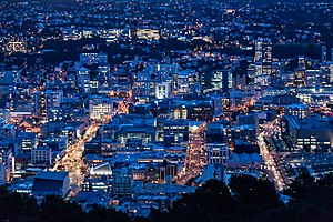
Wellington Central
Central business district of Wellington City, New Zealand
Distance: Approx. 256 meters
Latitude and longitude: -41.284,174.778
Wellington Central is an inner-city suburb of Wellington, and the financial heart of both the city and the Wellington Region. It comprises the northern part of the central business district, with the majority of Wellington's high-rise buildings.
South Pacific Regional Fisheries Management Organisation
Distance: Approx. 259 meters
Latitude and longitude: -41.2858901,174.7726154
The South Pacific Regional Fisheries Management Organisation (SPRFMO) is an intergovernmental organization created by international treaty, the Convention on the Conservation and Management of High Seas Fishery Resources in the South Pacific Ocean signed in Auckland on 14 November 2009.
Weather in this IP's area
light rain
12 Celsius
11 Celsius
12 Celsius
14 Celsius
1026 hPa
83 %
1026 hPa
1021 hPa
10000 meters
4.12 m/s
10 degree
85 %
06:27:14
19:44:36