103.227.66.110 - IP Lookup: Free IP Address Lookup, Postal Code Lookup, IP Location Lookup, IP ASN, Public IP
Country:
Region:
City:
Location:
Time Zone:
Postal Code:
IP information under different IP Channel
ip-api
Country
Region
City
ASN
Time Zone
ISP
Blacklist
Proxy
Latitude
Longitude
Postal
Route
Luminati
Country
ASN
Time Zone
Australia/Sydney
ISP
Anycast Global Backbone
Latitude
Longitude
Postal
IPinfo
Country
Region
City
ASN
Time Zone
ISP
Blacklist
Proxy
Latitude
Longitude
Postal
Route
IP2Location
103.227.66.110Country
Region
victoria
City
warragul
Time Zone
Australia/Melbourne
ISP
Language
User-Agent
Latitude
Longitude
Postal
db-ip
Country
Region
City
ASN
Time Zone
ISP
Blacklist
Proxy
Latitude
Longitude
Postal
Route
ipdata
Country
Region
City
ASN
Time Zone
ISP
Blacklist
Proxy
Latitude
Longitude
Postal
Route
Popular places and events near this IP address

Warragul
Town in Victoria, Australia
Distance: Approx. 1030 meters
Latitude and longitude: -38.15,145.93333333
Warragul is a town in Victoria, Australia, 102 kilometres (63 miles) south-east of Melbourne. Warragul lies between the Strzelecki Ranges to the south and the Mount Baw Baw Plateau of the Great Dividing Range to the north. As of the 2021 census, the town had a population of 19,856 people.
Nilma, Victoria
Town in Victoria, Australia
Distance: Approx. 4112 meters
Latitude and longitude: -38.18333333,145.96666667
Nilma is a locality in the West Gippsland region of Victoria, Australia located between Warragul and Darnum. The Post Office opened on 1 May 1886 as Bloomfield Railway Station, was renamed Nilma in 1909 and closed in 1979. The locality in conjunction with neighbouring township Darnum has an Australian Rules football team competing in the Ellinbank & District Football League.

Drouin railway station
Railway station in Victoria, Australia
Distance: Approx. 7129 meters
Latitude and longitude: -38.1359,145.8553
Drouin railway station is a regional railway station on the Gippsland line, part of the Victorian railway network. It serves the town of Drouin, in Victoria, Australia. Drouin station is a ground level unstaffed station, featuring an island platform with two faces.
Warragul railway station
Railway station in Victoria, Australia
Distance: Approx. 631 meters
Latitude and longitude: -38.1647,145.9323
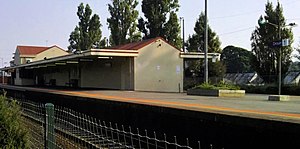
Warragul railway station is a regional railway station on the Gippsland line, part of the Victorian railway network. It serves the town of Warragul, in Victoria, Australia. Warragul station is a ground level premium station, featuring one side platform.
Warragul Show
Distance: Approx. 955 meters
Latitude and longitude: -38.16722222,145.93472222
The Warragul Show is an agricultural show that has been held annually on the first weekend of March since 1885 in Warragul, a town in the West Gippsland region of Victoria in Australia. The show takes place at the Warragul showgrounds, located at Logan Park where the greyhound and harness tracks are also situated. The show is run by the Warragul and West Gippsland Agricultural Society.

St Paul's Anglican Grammar School
School in Australia
Distance: Approx. 1000 meters
Latitude and longitude: -38.15027778,145.93333333
St Paul's Anglican Grammar School is a multi-campus private Anglican co-educational early learning, primary, and secondary day school, with campuses located in Warragul and Traralgon, Victoria, Australia.
Marist-Sion College
School in Warragul, Victoria, Australia
Distance: Approx. 1569 meters
Latitude and longitude: -38.16027778,145.91333333
Marist-Sion College is a co-educational Roman Catholic independent school founded in 1975 and located in Warragul, Victoria, Australia. Marist-Sion College enrols students from towns spanning from Trafalgar to Nar Nar Goon, Neerim District and Ellinbank District. Marist-Sion College serves four local parishes: Warragul, Drouin, Trafalgar and Iona/Maryknoll.
Chairo Christian School
Christian school in Drouin, Leongatha, Pakenham, Traralgon, Victoria, Australia
Distance: Approx. 4995 meters
Latitude and longitude: -38.14333333,145.87777778
Chairo Christian School is a multi-campus co-educational private, non-denominational Christian School with campuses in Drouin, Victoria, Drouin East, Pakenham, Victoria, Leongatha, Victoria, and Traralgon, Victoria. Founded in 1983, Chairo currently caters for over 1,700 students from Prep to Year 12 all across Gippsland, with the largest campus being at Pakenham. Chairo Christian School also has a Kindergarten program that caters for children aged 3–4.

3RPH Warragul
Radio station
Distance: Approx. 442 meters
Latitude and longitude: -38.163058,145.93086
3RPH Warragul (callsign 3RPH/T) is a radio station based in Warragul, Victoria. It is part of the Vision Australia Radio network, a reading and information service for those persons unable to read or easily access information in print. The station is run and operated by volunteers.
West Gippsland Hospital
Hospital in Warragul Victoria , Australia
Distance: Approx. 1608 meters
Latitude and longitude: -38.17333333,145.92805556
West Gippsland Hospital is a regional hospital in Warragul, Victoria, first established in 1888 on land donated by a local resident, Mary Sargeant. The current hospital is an 83-bed facility with an additional 60 beds available in the adjoining Cooinda Lodge Nursing Home.
Nilma railway station, Victoria
Former railway station in Victoria, Australia
Distance: Approx. 3480 meters
Latitude and longitude: -38.17083333,145.96805556
Nilma is a closed station on the Orbost railway line in the town of the same name in Victoria, Australia. It was originally named Bloomfield but was changed to Nilma in 1909, due to confusion with Broomfield railway station near Creswick, on the Ballarat to Daylesford railway line. Nilma station was closed in 1951.
Lillico, Victoria
Town in Victoria, Australia
Distance: Approx. 4578 meters
Latitude and longitude: -38.12583333,145.96194444
Lillico is a locality in West Gippsland, Victoria. At the 2021 census, it had a population of 94.
Weather in this IP's area
overcast clouds
21 Celsius
21 Celsius
21 Celsius
22 Celsius
1015 hPa
53 %
1015 hPa
999 hPa
10000 meters
3.19 m/s
4.81 m/s
234 degree
90 %

