103.227.52.232 - IP Lookup: Free IP Address Lookup, Postal Code Lookup, IP Location Lookup, IP ASN, Public IP
Country:
Region:
City:
Location:
Time Zone:
Postal Code:
ISP:
ASN:
language:
User-Agent:
Proxy IP:
Blacklist:
IP information under different IP Channel
ip-api
Country
Region
City
ASN
Time Zone
ISP
Blacklist
Proxy
Latitude
Longitude
Postal
Route
db-ip
Country
Region
City
ASN
Time Zone
ISP
Blacklist
Proxy
Latitude
Longitude
Postal
Route
IPinfo
Country
Region
City
ASN
Time Zone
ISP
Blacklist
Proxy
Latitude
Longitude
Postal
Route
IP2Location
103.227.52.232Country
Region
kerala
City
pambadi
Time Zone
Asia/Kolkata
ISP
Language
User-Agent
Latitude
Longitude
Postal
ipdata
Country
Region
City
ASN
Time Zone
ISP
Blacklist
Proxy
Latitude
Longitude
Postal
Route
Popular places and events near this IP address

Pampady
Town in Kerala, Southern India
Distance: Approx. 5 meters
Latitude and longitude: 9.566667,76.66667
Pampady is a major town in Kottayam district of Kerala, India. It lies midway between the backwaters of Western Kerala and the mountains of the Western Ghats.
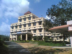
KG College Pampady
Distance: Approx. 3165 meters
Latitude and longitude: 9.55666667,76.63972222
The Kuriakose Gregorios College, Pampady (commonly known as KG College) is situated in Pampady, 16 km (10 mi) from Kottayam. It was started in 1981 and is affiliated to Mahatma Gandhi University, Kottayam, Kerala, India.
Kodungoor
Town in Kerala, India
Distance: Approx. 4101 meters
Latitude and longitude: 9.55,76.7
Kodungoor is a town in Kottayam District, Kerala, India. It is the site of the Kodungoor Devi Temple.
Kooroppada
Village in Kerala, India
Distance: Approx. 3707 meters
Latitude and longitude: 9.6,76.66666667
Kooroppada is a village in Kottayam district, Kerala, India, situated 16 kilometres east to Kottayam town. Kooroppada village was formed in 1953 by merging Kooroppada with a certain portion of Pampady and Anikkad villages.
Vazhoor
Town in Kerala, India
Distance: Approx. 4328 meters
Latitude and longitude: 9.56402,76.70603
Vazhoor is a town in Kottayam district in the state of Kerala, India.It is a village, panchayat and block with headquarters at Kodungoor on NH183.
Anicad (Kottayam)
Village in Kerala, India
Distance: Approx. 4220 meters
Latitude and longitude: 9.6002541,76.6845937
Anickadu (a.k.a. Anicad or Anickad) is a village in Kottayam district in the state of Kerala, India.
BMM English Medium School
School in Pampady, Kottayam district, Kerala, India
Distance: Approx. 4060 meters
Latitude and longitude: 9.5549,76.6317
Baselios Marthoma Mathews English Medium School (B.M.M E.M.S) is a school situated in Pampady, Kottayam district, Kerala, India.

Aruvikkuzhi Waterfalls
Waterfall in Kerala, India
Distance: Approx. 4078 meters
Latitude and longitude: 9.60333333,76.66722222
Aruvikuzhy Waterfalls (not to be confused with Aruvikkuzhy Falls in pathanamthitta, Kerala) is a waterfall in Kottayam district in the Kerala state of India. It is situated 2 km (1.2 mi) from Pallickathode and 7.5 km (4.7 mi) from Pampady. The waterfall measures about 30 ft in height and active only during monsoon.
Kothala
Village in Kerala, India
Distance: Approx. 323 meters
Latitude and longitude: 9.5646116,76.6646576
Kothala is a village 21 km east of Kottayam in Kerala, Southern India. National highway 220 passes through Kothala village. It is located 3 km from Pampady.
Kodungoor Devi Temple
Hindu temple in Kottayam district, Kerala
Distance: Approx. 4388 meters
Latitude and longitude: 9.56441667,76.70661111
Kodungoor Devi Temple is a famous temple located at Kodungoor, Kerala, India. The primary deity of this temple is Kodungooramma. Its antiquity was estimated above 200 years.
Anicad Sree Bhagavathi Temple
Hindu temple in Kerala, India
Distance: Approx. 4422 meters
Latitude and longitude: 9.60261111,76.68391667
Anicad Sree Bhagavathi Temple is a well-known Hindu temple of the goddess Bhadrakali located at Anicad, Kottayam, Kerala, India. The temple is located on top of a hill.
Moozhayil Sankaranarayana Temple Anicad
Hindu temple in Kottayam district, Kerala
Distance: Approx. 3744 meters
Latitude and longitude: 9.59375,76.68697222
Moozhayil Sankaranarayana Temple is a Hindu temple located at Anicad, in Kottayam, Kerala, India. This is one of the 7 Sankaranarayana temples in Kerala. The other six temples are: Navaikkulam Sankaranarayana temple in Thiruvananthapuram district Panamanna Sankaranarayana temple in Palakkad district Puthukode Sankaranarayana temple in Palakkad district Ramanthali Sankaranarayana temple in Kannur district Sankaranarayana temple in Thrissur district Thiruvegappura Sankaranarayana temple in Palakkad district.
Weather in this IP's area
clear sky
35 Celsius
34 Celsius
35 Celsius
35 Celsius
1009 hPa
25 %
1009 hPa
1005 hPa
10000 meters
0.61 m/s
3.41 m/s
262 degree
9 %
