Country:
 Australia
Region:
City:
Latitude and Longitude:
Time Zone:
Postal Code:
IP information under different IP Channel
ip-api
Country
Region
City
ASN
Time Zone
ISP
Blacklist
Proxy
Latitude
Longitude
Postal
Route
IPinfo
Country
Region
City
ASN
Time Zone
ISP
Blacklist
Proxy
Latitude
Longitude
Postal
Route
MaxMind
Country
Region
City
ASN
Time Zone
ISP
Blacklist
Proxy
Latitude
Longitude
Postal
Route
Luminati
Country
AURegion
qld
City
cairns
ASN
Time Zone
Australia/Brisbane
ISP
Virtutel Pty Ltd
Latitude
Longitude
Postal
db-ip
Country
Region
City
ASN
Time Zone
ISP
Blacklist
Proxy
Latitude
Longitude
Postal
Route
ipdata
Country
Region
City
ASN
Time Zone
ISP
Blacklist
Proxy
Latitude
Longitude
Postal
Route
Popular places and events near this IP address

Albury
City in New South Wales, Australia
Distance: Approx. 975 meters
Latitude and longitude: -36.08055556,146.91583333
Albury (; Wiradjuri: Bungambrawatha) is a major regional city that is located in the Murray region of New South Wales, Australia. It is part of the twin city of Albury-Wodonga and is located on the Hume Highway and the northern side of the Murray River. Albury is the seat of local government for the council area which also bears the city's name – the City of Albury.
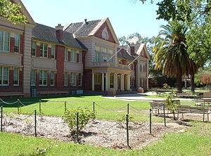
Scots School Albury
School in Albury, New South Wales, Australia
Distance: Approx. 429 meters
Latitude and longitude: -36.072421,146.927749
The Scots School Albury is an independent, K–12, co-educational day and boarding School, located in Albury, New South Wales, Australia. It draws students from the local area and other parts of Australia. It is associated with the Uniting Church in Australia but is not managed or governed by the Church.
Albury High School
School in Australia
Distance: Approx. 762 meters
Latitude and longitude: -36.072863,146.915874
Albury High School is a government-funded co-educational comprehensive secondary day school located in Albury, a city in the Riverina region of New South Wales, Australia. Established in 1920, the school enrolled approximately 1,000 students in 2018, from Year 7 to Year 12, of whom four percent identified as Indigenous Australians and ten percent were from a language background other than English. The school is operated by the NSW Department of Education; the principal is Darryl Ward.

East Albury, New South Wales
Suburb of Albury, New South Wales, Australia
Distance: Approx. 540 meters
Latitude and longitude: -36.075,146.93
East Albury is a suburb of the city of Albury, New South Wales, located 3 kilometres (2 mi) east of the Albury Central Business District. At the 2006 census, East Albury had a population of 5686. East Albury lies on the eastern side of the railway/freeway line that runs through Albury.

Albury Library Museum
Distance: Approx. 843 meters
Latitude and longitude: -36.07888889,146.91611111
Albury Library Museum is a combined library and museum in Albury, New South Wales, Australia. Designed by Ashton Raggatt McDougall it was opened in 2007. In the first year of its operation the building had 226,000 visitors, of which 80,000 entered the exhibition space.

Albury Post Office
Historic site in New South Wales, Australia
Distance: Approx. 952 meters
Latitude and longitude: -36.0804,146.916
Albury Post Office is a heritage-listed post office at 570 Dean Street, Albury, in the Riverina region of New South Wales, Australia. It was designed by NSW Colonial Architects Office under James Barnet and built in 1880. The property is owned by Australia Post.

Commercial Hotel, Albury
Historic site in New South Wales, Australia
Distance: Approx. 948 meters
Latitude and longitude: -36.0832,146.9223
Commercial Hotel is a heritage-listed former hotel at 430–436 Smollett Street, Albury, New South Wales, Australia. It was formerly known as Waterstreet Hotel. The property is owned by Cohalan & Mitchell Roofing Pty Ltd, Lavington Plaster Linings Pty Ltd, Layisa Pty Ltd and Waterstreet Property Pty Ltd.

Albury Technical College
Australian college
Distance: Approx. 850 meters
Latitude and longitude: -36.0807,146.918
Albury Technical College is a heritage-listed tertiary college at 502 Dean Street, Albury, in the Riverina region of New South Wales, Australia. It is also known as Albury TAFE Annex. The property is owned by Charles Sturt University.

Bonegilla House
Historic site in New South Wales, Australia
Distance: Approx. 711 meters
Latitude and longitude: -36.0758,146.9162
Bonegilla House is a heritage-listed house at 587 Kiewa Street, Albury, in the Riverina region of New South Wales, Australia. It is also known as Grace-evelyn Lodge. It was added to the New South Wales State Heritage Register on 2 April 1999.

Model Store
Historic site in New South Wales, Australia
Distance: Approx. 286 meters
Latitude and longitude: -36.0768,146.922
Model Store is a heritage-listed commercial building at 582 David Street, Albury, City of Albury, New South Wales, Australia. It was added to the New South Wales State Heritage Register on 2 April 1999.

Reid's Butcher Shop
Historic site in New South Wales, Australia
Distance: Approx. 236 meters
Latitude and longitude: -36.0745,146.9214
Reid's Butcher Shop is a heritage-listed former shop at 462 Guinea Street, Albury, City of Albury, New South Wales, Australia. The property is owned by John and Margaret-Anne Baker. It was added to the New South Wales State Heritage Register on 2 April 1999.

Uiver Collection
Historic site in New South Wales, Australia
Distance: Approx. 842 meters
Latitude and longitude: -36.0791,146.9163
Uiver Collection is a heritage-listed museum collection at 553 Kiewa Street, Albury, City of Albury, New South Wales, Australia. It was built from 1984 to 2016. It is also known as The Uiver Collection, Uiver DC-2 Collection and The Uiver Memorial Collection - Albury Library and Museum.
Weather in this IP's area
overcast clouds
14 Celsius
14 Celsius
13 Celsius
14 Celsius
1018 hPa
100 %
1018 hPa
998 hPa
10000 meters
3.58 m/s
5.36 m/s
324 degree
100 %
06:22:42
17:57:43