103.224.84.41 - IP Lookup: Free IP Address Lookup, Postal Code Lookup, IP Location Lookup, IP ASN, Public IP
Country:
Region:
City:
Location:
Time Zone:
Postal Code:
IP information under different IP Channel
ip-api
Country
Region
City
ASN
Time Zone
ISP
Blacklist
Proxy
Latitude
Longitude
Postal
Route
Luminati
Country
ASN
Time Zone
Australia/Sydney
ISP
Real World - The Core
Latitude
Longitude
Postal
IPinfo
Country
Region
City
ASN
Time Zone
ISP
Blacklist
Proxy
Latitude
Longitude
Postal
Route
IP2Location
103.224.84.41Country
Region
victoria
City
malvern
Time Zone
Australia/Melbourne
ISP
Language
User-Agent
Latitude
Longitude
Postal
db-ip
Country
Region
City
ASN
Time Zone
ISP
Blacklist
Proxy
Latitude
Longitude
Postal
Route
ipdata
Country
Region
City
ASN
Time Zone
ISP
Blacklist
Proxy
Latitude
Longitude
Postal
Route
Popular places and events near this IP address

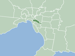
City of Stonnington
Local government area in Melbourne, Victoria, Australia
Distance: Approx. 719 meters
Latitude and longitude: -37.856245,145.029563
The City of Stonnington is a local government area located within the metropolitan area of Melbourne, Australia. It comprises the inner south-eastern suburbs, between 3 and 13 km (2 and 8 mi), from the Melbourne CBD. The city covers an area of 25.7 km2 (9.9 sq mi). Within twenty years of the settlement of Melbourne in 1835, the Prahran Municipality (later City of Prahran) was formed in 1855, followed by the Gardiner Road Board (later City of Malvern) in 1856.

Armadale, Victoria
Suburb of Melbourne, Victoria, Australia
Distance: Approx. 882 meters
Latitude and longitude: -37.857,145.021
Armadale is an inner suburb in Melbourne, Victoria, Australia, 7 km south-east of Melbourne's Central Business District, located within the City of Stonnington local government area. Armadale recorded a population of 9,368 at the 2021 census. The suburb has its own railway station, as well as Toorak railway station, which is also in Armadale.

Malvern, Victoria
Suburb of Melbourne, Victoria, Australia
Distance: Approx. 933 meters
Latitude and longitude: -37.857,145.036
Malvern ( ) is a suburb of Melbourne, Victoria, Australia, 8 km south-east of Melbourne's Central Business District, located within the City of Stonnington local government area. Malvern recorded a population of 9,929 at the 2021 census.

Armadale railway station, Melbourne
Railway station in Melbourne, Australia
Distance: Approx. 1044 meters
Latitude and longitude: -37.8563,145.0193
Armadale railway station is a commuter railway station in Armadale, a suburb of Melbourne, Victoria, Australia. The station is listed on the Victorian Heritage Register and was opened on 7 May 1879. The station consists of an island platform and two side platforms, all accessed by a pedestrian bridge.

Malvern railway station, Melbourne
Railway station in Melbourne, Australia
Distance: Approx. 430 meters
Latitude and longitude: -37.8664,145.029
Malvern railway station is a commuter railway station that is part of the Melbourne railway network in Victoria, Australia. The station is located on the southern border of Malvern, a suburb of Melbourne, and was opened on 7 May 1879. The station complex consists of an island platform and two side platforms all accessed by a pedestrian bridge.
De La Salle College, Malvern
Independent, single-sex school in Malvern, Victoria, Australia
Distance: Approx. 826 meters
Latitude and longitude: -37.85583333,145.03194444
De La Salle College is a Catholic private school for boys in the Melbourne suburb of Malvern. The college was founded in 1912 by the De La Salle Brothers, a religious order based on the teachings of Jean-Baptiste de la Salle, and is a member of the Associated Catholic Colleges. The college consists of three campuses (Tiverton, Holy Eucharist and Kinnoull) located in Malvern and Malvern East.

Malvern Town Hall
Local government seat in Victoria, Australia
Distance: Approx. 719 meters
Latitude and longitude: -37.856245,145.029563
Malvern Town Hall is the former town hall of the municipality of Malvern in the state of Victoria, Australia. It is the seat of the local government area of the City of Stonnington. The Second Empire and Italianate style Victorian era building is located on the northeast corner of Glenferrie Road and High Street, in Malvern.

Malvern tram depot
Distance: Approx. 434 meters
Latitude and longitude: -37.8587,145.0281
Malvern tram depot is located on Coldblo Road, Armadale, Victoria, a suburb in Melbourne, Victoria, Australia. Operated by Yarra Trams, it is one of eight tram depots on the Melbourne tram network.

City of Prahran
Local government area in Victoria, Australia
Distance: Approx. 933 meters
Latitude and longitude: -37.857,145.036
The City of Prahran was a local government area about 5 kilometres (3 mi) southeast of Melbourne, the state capital of Victoria, Australia. The city covered an area of 9.55 square kilometres (3.69 sq mi), and existed from 1855 until 1994, when it was merged with the City of Malvern to create the City of Stonnington.

House at Caulfield
Distance: Approx. 823 meters
Latitude and longitude: -37.86294444,145.01875
House at Caulfield, is a family home situated at 450 Dandenong Road in Caulfield North, Melbourne, Victoria, Australia, designed by Anatol Kagan in 1956 for Polish-Jewish emigre Leo Lind and his wife Dorothy. Born in Russian on October 4, 1913 Anatol Kagan's career as an architect spanned over seven decades until his death on July 2, 2009. He was actively involved in the field of design, as well as a writer, translator, lecturer and political activist.

Malvern Presbyterian Church
Church in Victoria, Australia
Distance: Approx. 273 meters
Latitude and longitude: -37.8626,145.031205
Malvern Presbyterian Church is located in Victoria, Australia. Opened in 1886, it was the first Presbyterian Church to be founded in the City of Malvern and is now within Stonnington, a metropolitan area of Melbourne. The church is a congregation of the Presbyterian Church of Australia.
Malvern Central Shopping Centre
Shopping mall in Victoria, Australia
Distance: Approx. 87 meters
Latitude and longitude: -37.863,145.02725
Malvern Central Shopping Centre is a luxury regional shopping centre located in the Eastern Melbourne suburb of Malvern, in Victoria, Australia. The centre, which opened in 1987 includes a food court, two anchor tenants and numerous specialty stores.
Weather in this IP's area
scattered clouds
23 Celsius
22 Celsius
21 Celsius
25 Celsius
1015 hPa
56 %
1015 hPa
1008 hPa
10000 meters
1.34 m/s
4.02 m/s
212 degree
25 %