Country:
 Indonesia
Region:
City:
Latitude and Longitude:
Time Zone:
Postal Code:
IP information under different IP Channel
ip-api
Country
Region
City
ASN
Time Zone
ISP
Blacklist
Proxy
Latitude
Longitude
Postal
Route
IPinfo
Country
Region
City
ASN
Time Zone
ISP
Blacklist
Proxy
Latitude
Longitude
Postal
Route
MaxMind
Country
Region
City
ASN
Time Zone
ISP
Blacklist
Proxy
Latitude
Longitude
Postal
Route
Luminati
Country
IDRegion
kt
City
pangkalanbuun
ASN
Time Zone
Asia/Pontianak
ISP
PT Mitra Lintas Multimedia
Latitude
Longitude
Postal
db-ip
Country
Region
City
ASN
Time Zone
ISP
Blacklist
Proxy
Latitude
Longitude
Postal
Route
ipdata
Country
Region
City
ASN
Time Zone
ISP
Blacklist
Proxy
Latitude
Longitude
Postal
Route
Popular places and events near this IP address

Iskandar Airport
Airport serving Pangkalan Bun, Central Kalimantan, Indonesia
Distance: Approx. 6576 meters
Latitude and longitude: -2.705,111.67305556
Iskandar Airport (IATA: PKN, ICAO: WAGI (previous: WAOI)) is a military type-C airport in Pangkalan Bun, Central Kalimantan, Indonesia and is the only airport in Central Kalimantan which has an Avtur fuel station. It is the largest military airport in Indonesia, with around a 3,570 hectare area; however, only 200 hectares is currently used for runway and buildings. Iskandar Airport is named after an Indonesian paratrooper from central Kalimantan, Iskandar (1928–1947).
Arut River
River in Indonesia
Distance: Approx. 6165 meters
Latitude and longitude: -2.7191,111.5781
Arut River is a river in the province of Kalimantan Tengah, island of Borneo, Indonesia, about 700 km northeast of the capital Jakarta. It is a tributary of the Lamandau River. The river flows through the north side of Pangkalan Bun town.
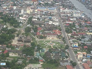
Pangkalan Bun
Town in Central Kalimantan
Distance: Approx. 313 meters
Latitude and longitude: -2.68333333,111.61666667
Pangkalan Bun is the capital of West Kotawaringin Regency in Borneo, Indonesia. It has a population of around 200,000 It is also the administrative headquarters of South Arut (Arut Selatan) district (kecamatan). Pangkalan Bun is served by Iskandar Airport.
Weather in this IP's area
overcast clouds
23 Celsius
24 Celsius
23 Celsius
23 Celsius
1013 hPa
96 %
1013 hPa
1011 hPa
10000 meters
0.96 m/s
3.97 m/s
307 degree
100 %
05:12:34
17:23:24