Country:
 The Philippines
Region:
City:
Latitude and Longitude:
Time Zone:
Postal Code:
IP information under different IP Channel
ip-api
Country
Region
City
ASN
Time Zone
ISP
Blacklist
Proxy
Latitude
Longitude
Postal
Route
IPinfo
Country
Region
City
ASN
Time Zone
ISP
Blacklist
Proxy
Latitude
Longitude
Postal
Route
MaxMind
Country
Region
City
ASN
Time Zone
ISP
Blacklist
Proxy
Latitude
Longitude
Postal
Route
Luminati
Country
PHASN
Time Zone
Asia/Manila
ISP
Converge ICT Solutions Inc.
Latitude
Longitude
Postal
db-ip
Country
Region
City
ASN
Time Zone
ISP
Blacklist
Proxy
Latitude
Longitude
Postal
Route
ipdata
Country
Region
City
ASN
Time Zone
ISP
Blacklist
Proxy
Latitude
Longitude
Postal
Route
Popular places and events near this IP address

Clark Air Base
Philippine Air Force base in Luzon
Distance: Approx. 3058 meters
Latitude and longitude: 15.18583333,120.55972222
Clark Air Base is a Philippine Air Force base in Luzon, located 3 miles (4.8 km) west of Angeles City, and about 40 miles (64 km) northwest of Metro Manila. Clark Air Base was previously a United States military facility, operated by the U.S. Air Force under the aegis of Pacific Air Forces (PACAF) and their predecessor organizations from 1903 to 1991. The base covered 14.3 square miles (37 km2) with a military reservation extending north that covered another 230 square miles (600 km2).
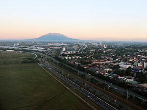
Angeles City
Highly urbanized city in Pampanga, Philippines
Distance: Approx. 3439 meters
Latitude and longitude: 15.147181,120.584733
Angeles (locally [ˈaŋhɛlɛs]), officially the City of Angeles (Kapampangan: Lakanbalen ning Angeles; Filipino: Lungsod ng Angeles), is a 1st class highly urbanized city in the Central Luzon region of the Philippines. According to the 2020 census, it has a population of 462,928 people. While Angeles City is politically independent from the province of Pampanga, it is usually grouped with it for statistical purposes by the Philippine Statistics Authority and also it is the largest city of that province.

Clark International Airport
Commercial airport near Mabalacat, Pampanga, Philippines
Distance: Approx. 3058 meters
Latitude and longitude: 15.18583333,120.55972222
Clark International Airport (IATA: CRK, ICAO: RPLC) — known as Diosdado Macapagal International Airport from 2003 to 2014 — is an international airport covering portions of the cities of Angeles and Mabalacat within the Clark Freeport and Special Economic Zone in the province of Pampanga, Philippines. It is located 80 kilometers (50 mi) northwest of Manila. It is accessible by way of the Subic–Clark–Tarlac Expressway (SCTEX).

Balibago
Barangay in Angeles City, Philippines
Distance: Approx. 1070 meters
Latitude and longitude: 15.1687,120.5895
Balibago is a barangay of Angeles City, Philippines. It is located around 50 miles north of the nation's capital, Manila. Within its border to the former U.S. Clark Air Base.
Systems Plus College Foundation
Private college in Angeles, Philippines
Distance: Approx. 2321 meters
Latitude and longitude: 15.15821,120.59379
Systems Plus College Foundation (SPCF) is a private, non-Sectarian basic and higher education institution in Angeles, Pampanga, Philippines.

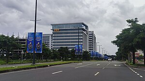
SM City Clark
Shopping mall in Angeles, Philippines
Distance: Approx. 1291 meters
Latitude and longitude: 15.16845,120.58018
SM City Clark is a large shopping mall owned and operated by SM Prime Holdings, Inc. It is located along M.A. Roxas Highway in Clark Freeport, Angeles City, Philippines. It is the second SM supermall in the province of Pampanga after SM City Pampanga in City of San Fernando and Mexico, Pampanga.

Marquee Mall
Shopping mall in Pulung Maragul, Angeles City
Distance: Approx. 2954 meters
Latitude and longitude: 15.1638,120.61023
Marquee Mall is a shopping mall owned and operated by the North Beacon Commercial Corporation, a 100% wholly owned subsidiary of Ayala Land. It is located in Barangay Pulung Maragul, Angeles City, Philippines. The mall has a land area of 9.3 hectares (23 acres) and a gross floor area of 140,000 square meters (1,500,000 sq ft).

Clark Veterans Cemetery
ABMC cemetery in Luzon, Philippines
Distance: Approx. 1783 meters
Latitude and longitude: 15.167444,120.574519
Clark Veterans Cemetery is located in Clark Freeport Zone, Angeles City, Philippines. The cemetery is the burial place for thousands of mainly American veterans and Filipino Scouts who served in the United States Army, and who died in conflicts other than World War II or on military bases in the Philippines.
Clark Global City
Planned development in the Philippines
Distance: Approx. 1156 meters
Latitude and longitude: 15.17838889,120.57625
Clark Global City (formerly the Global Gateway Logistics City) is a planned mixed-use central business district development at the Clark Freeport Zone in Mabalacat and Angeles City, Philippines. Udenna Corporation is responsible for the development of Clark Global City since 2017. The development was initially meant as a product of Kuwaiti investment and was known as the Global Gateway Logistics City.

Bayanihan Park
Distance: Approx. 1063 meters
Latitude and longitude: 15.168459,120.586597
Bayanihan Park is a park in Clark Freeport Zone, Angeles City, Philippines.

The Medical City Clark
Private hospital in Pampanga, Philippines
Distance: Approx. 1639 meters
Latitude and longitude: 15.17825,120.57175
The Medical City Clark is a tertiary care hospital at the Clark Global City in Mabalacat, Pampanga, Philippines. It is a hospital under The Medical City (TMC) which maintains a network of hospitals and clinics which are mostly based in the Philippines.

Clark station
A future station of the North South Commuter Railway.
Distance: Approx. 630 meters
Latitude and longitude: 15.1758,120.5816
Clark station is an under-construction elevated North–South Commuter Railway (NSCR) station located in Mabalacat, Pampanga, Philippines. The station is situated within the Clark Freeport and Special Economic Zone. Adjacent to the station is SM City Clark, where an intermodal terminal is currently under construction.
Weather in this IP's area
scattered clouds
31 Celsius
37 Celsius
31 Celsius
31 Celsius
1011 hPa
66 %
1011 hPa
999 hPa
10000 meters
3.09 m/s
180 degree
40 %
05:48:02
17:42:04