Country:
 Hong Kong (China)
Region:
City:
Latitude and Longitude:
Time Zone:
Postal Code:
IP information under different IP Channel
ip-api
Country
Region
City
ASN
Time Zone
ISP
Blacklist
Proxy
Latitude
Longitude
Postal
Route
IPinfo
Country
Region
City
ASN
Time Zone
ISP
Blacklist
Proxy
Latitude
Longitude
Postal
Route
MaxMind
Country
Region
City
ASN
Time Zone
ISP
Blacklist
Proxy
Latitude
Longitude
Postal
Route
Luminati
Country
HKASN
Time Zone
Asia/Hong_Kong
ISP
HUAWEI CLOUDS
Latitude
Longitude
Postal
db-ip
Country
Region
City
ASN
Time Zone
ISP
Blacklist
Proxy
Latitude
Longitude
Postal
Route
ipdata
Country
Region
City
ASN
Time Zone
ISP
Blacklist
Proxy
Latitude
Longitude
Postal
Route
Popular places and events near this IP address

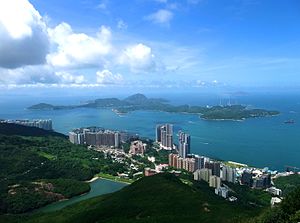
Cyberport
Business park in Hong Kong
Distance: Approx. 105 meters
Latitude and longitude: 22.26180556,114.13021389
Cyberport is a business park in Southern District, Hong Kong, consisting of four office buildings, a hotel, and a retail entertainment complex. It describes itself as a digital technology community with over 1,800 (800 on-site and 1,000 off-site) digital and technology companies. The Cyberport project has courted controversy since its inception because of the government bypassing the open-tender process in awarding the project to real estate developer Richard Li Tzar-Kai, and also because of its reliance on "ancillary residential" revenue.

Le Méridien Cyberport Hotel
Hospitality in Hong Kong Island, Hong Kong
Distance: Approx. 166 meters
Latitude and longitude: 22.26148611,114.12972778
Le Méridien Hong Kong, Cyberport (Chinese: 香港數碼港艾美酒店) is a 170-room hotel forming part of the Cyberport digital community development in Hong Kong's Telegraph Bay, in Southern District. It opened in 20 April 2004 and is operated by Le Méridien, a design-focused brand of Marriott International. Le Méridien was awarded a 10-year management contract for this hotel to be built at the Cyberport complex.
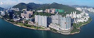
Pok Fu Lam
Residential area on Hong Kong Island
Distance: Approx. 740 meters
Latitude and longitude: 22.260017,114.137703
Pok Fu Lam (薄扶林) or Pokfulam is a residential area on Hong Kong Island, at the western end of the Southern District. It is a valley between Victoria Peak and Mount Kellett, around Telegraph Bay. Pok Fu Lam can claim several firsts in the history of Hong Kong: It was the place where Hong Kong's floral emblem, Bauhinia blakeana, was first discovered; the site for Hong Kong's first reservoir, Pok Fu Lam Reservoir (1883, now part of a country park), and the site for Hong Kong's first dairy farm by five investors, including Sir Patrick Manson in 1885.

Baguio Villa
Housing estate in Pokfulam, Hong Kong
Distance: Approx. 213 meters
Latitude and longitude: 22.2619,114.133
Baguio Villa (Chinese: 碧瑤灣) is a large scale luxury private housing estate located in Pok Fu Lam, Southern District, Hong Kong. It is divided by Victoria Road into Upper Baguio Villa (555 Victoria Road) and Lower Baguio Villa (550 Victoria Road).

Pok Fu Lam Reservoir
Reservoir in Hong Kong
Distance: Approx. 707 meters
Latitude and longitude: 22.26498,114.13727
Pok Fu Lam Reservoir, formerly known as the Pokefulum Reservoir, is the first reservoir in Hong Kong. It is located in a valley in Pok Fu Lam. It is actually two reservoirs with capacity of 260,000 m3.
Telegraph Bay
Bay on the west shore of Hong Kong Island
Distance: Approx. 491 meters
Latitude and longitude: 22.25833333,114.12916667
Telegraph Bay or Kong Sin Wan (Chinese: 鋼綫灣), formerly known as Tai Hau Wan (大口環), is a bay in the west shore near Pok Fu Lam, between Sandy Bay and Waterfall Bay on the Hong Kong Island, Hong Kong. It is where the Cyberport is located.

Chinese Culinary Institute
Cooking school in Hong Kong focusing on Chinese cuisine
Distance: Approx. 544 meters
Latitude and longitude: 22.260026,114.13562
Chinese Culinary Institute (CCI) formerly known in English as Chinese Cuisine Training Institute (CCTI), is a cooking school at Pok Fu Lam, Hong Kong. It is established and run by the Vocational Training Council of Hong Kong. It provides both full-time and part-time courses to beginners and practicing chefs in the industry who wish to obtain or upgrade their qualifications in Chinese cuisine.

Béthanie (Hong Kong)
Old sanatorium in Hong Kong
Distance: Approx. 448 meters
Latitude and longitude: 22.262156,114.135342
Béthanie is a historic building complex located in Pok Fu Lam, in Southern District, Hong Kong built in 1875 as a sanatorium by the Paris Foreign Missions Society (French: Missions Étrangères de Paris). Béthanie and the nearby Dairy Farm cowsheds were allocated in 2003 to the Hong Kong Academy for Performing Arts. After a series of renovations, the complex reopened in 2006 and is now used by the Academy's School of Film and Television.

University Hall, University of Hong Kong
University of Hong Kong residential hall
Distance: Approx. 447 meters
Latitude and longitude: 22.2634,114.1352
University Hall (Chinese: 大學堂), or UHall, is a historical residential hall for males at the University of Hong Kong. University Hall is one of the oldest residential halls under the university's hall system and houses about 110 students. Its hall colours are green, black and silver.

Li Ka Shing Faculty of Medicine
Public medical school in Hong Kong
Distance: Approx. 628 meters
Latitude and longitude: 22.26748,114.12834
The HKU Li Ka Shing Faculty of Medicine, branded as HKUMed and formerly named as the Faculty of Medicine of the University of Hong Kong, is the medical school of the University of Hong Kong, a public research university. The school consists of several schools and departments that provide tertiary programmes in medicine, nursing, pharmacy and Chinese medicine. English is the medium of instruction for all classes, while Chinese is retained for the teaching of Chinese medicine.

Jessville
Distance: Approx. 610 meters
Latitude and longitude: 22.267444,114.133307
Jessville is a mansion located at 128 Pok Fu Lam Road in Pok Fu Lam, Hong Kong. The building is built in the Italian Renaissance style.

Ebenezer School & Home for the Visually Impaired
School for visually impaired children in Hong Kong
Distance: Approx. 481 meters
Latitude and longitude: 22.26656944,114.13222778
Ebenezer School & Home for the Visually Impaired (Chinese: 心光盲人院暨學校), also known as Ebenezer School (Chinese: 心光學校) is a school for blind and visually impaired children in Pok Fu Lam, Hong Kong. A German missionary, Martha Postler, created the school in 1897. The school's first location was in Western District.
Weather in this IP's area
moderate rain
29 Celsius
35 Celsius
27 Celsius
29 Celsius
1007 hPa
86 %
1007 hPa
1005 hPa
10000 meters
2.24 m/s
100 degree
100 %
06:08:27
18:34:15