103.215.162.187 - IP Lookup: Free IP Address Lookup, Postal Code Lookup, IP Location Lookup, IP ASN, Public IP
Country:
Region:
City:
Location:
Time Zone:
Postal Code:
IP information under different IP Channel
ip-api
Country
Region
City
ASN
Time Zone
ISP
Blacklist
Proxy
Latitude
Longitude
Postal
Route
Luminati
Country
Region
vic
City
melbourne
ASN
Time Zone
Australia/Melbourne
ISP
VMvault Pty Ltd
Latitude
Longitude
Postal
IPinfo
Country
Region
City
ASN
Time Zone
ISP
Blacklist
Proxy
Latitude
Longitude
Postal
Route
IP2Location
103.215.162.187Country
Region
queensland
City
brendale
Time Zone
Australia/Brisbane
ISP
Language
User-Agent
Latitude
Longitude
Postal
db-ip
Country
Region
City
ASN
Time Zone
ISP
Blacklist
Proxy
Latitude
Longitude
Postal
Route
ipdata
Country
Region
City
ASN
Time Zone
ISP
Blacklist
Proxy
Latitude
Longitude
Postal
Route
Popular places and events near this IP address
Bald Hills railway station
Railway station in Brisbane, Queensland, Australia
Distance: Approx. 2680 meters
Latitude and longitude: -27.3208,153.011
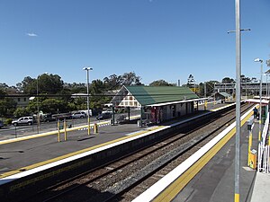
Bald Hills railway station is located on the North Coast line in Queensland, Australia. It serves the Brisbane suburb of Bald Hills. On 28 August 2000, a third platform opened as part of the addition of a third track from Northgate.
Strathpine railway station
Railway station in Queensland, Australia
Distance: Approx. 1258 meters
Latitude and longitude: -27.311,152.9896
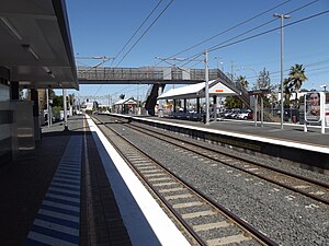
Strathpine railway station is located on the North Coast line in Queensland, Australia. It serves the suburb of Strathpine in the City of Moreton Bay. In 2001, a third platform opened as part of the addition of a third track from Bald Hills to Lawnton.
Bray Park railway station
Railway station in Queensland, Australia
Distance: Approx. 2405 meters
Latitude and longitude: -27.2996,152.9863
Bray Park railway station is located on the North Coast line in Queensland, Australia. Despite the name, Bray Park railway station is located in the north of the suburb of Strathpine in the City of Moreton Bay (immediately to the south of the suburb of Bray Park). Strathpine railway station is in the south of Strathpine.

Electoral district of Aspley
State electoral district of Queensland, Australia
Distance: Approx. 2095 meters
Latitude and longitude: -27.33333333,153
Aspley is an electoral district of the Legislative Assembly in the Australian state of Queensland. The district is located in the north-eastern residential suburbs of Brisbane, encompassing Aspley, Bridgeman Downs and Carseldine, as well as parts of McDowall, Chermside West, Lawnton and Zillmere. It is now wholly within the local government area of Brisbane City Council, following the redistribution prior to the 2009 election.

St Paul's Anglican School, Bald Hills
School in Australia
Distance: Approx. 2221 meters
Latitude and longitude: -27.31583333,153.00555556
St Paul's Anglican School, Bald Hills, commonly known as St Paul's School is an independent Anglican co-educational early learning, primary and secondary day school located in the northern Brisbane suburb of Bald Hills, Queensland, Australia, bordering the Pine River and the City of Moreton Bay. The school opened on 31 January 1960 and takes its name from St Paul's School in London. St.
Strathpine Centre
Shopping mall in Strathpine, Brisbane Australia
Distance: Approx. 1753 meters
Latitude and longitude: -27.30694444,152.99166667
Strathpine Centre is an urban shopping centre located in Strathpine, a suburb in the City of Moreton Bay, north of Brisbane, in Queensland, Australia. The centre was built and opened in 1983 by The Westfield Group. It is anchored by Big W and Target discount department stores and Woolworths, Coles and ALDI supermarkets.

Strathpine, Queensland
Suburb of City of Moreton Bay, Queensland, Australia
Distance: Approx. 2192 meters
Latitude and longitude: -27.3019,152.9888
Strathpine is a suburb in the City of Moreton Bay, Queensland, Australia. It is home to the Pine Rivers District offices of the City of Moreton Bay, as well as many businesses, administrative, and local, state and federal government offices. The area is home to Strathpine Centre, a medium-sized urban shopping centre, built by Westfield.
Brendale, Queensland
Suburb of City of Moreton Bay, Queensland, Australia
Distance: Approx. 396 meters
Latitude and longitude: -27.3238,152.9813
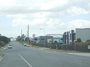
Brendale is a suburb in the City of Moreton Bay, Queensland, Australia. In the 2021 census, Brendale had a population of 3,100 people.
Pine Rivers State High School
State secondary school in Strathpine, Queensland, Australia
Distance: Approx. 2816 meters
Latitude and longitude: -27.29611111,152.98833333
Pine Rivers State High School is a government state secondary school in the suburb of Strathpine, City of Moreton Bay, Queensland, Australia. First opened in 1964, Pine Rivers High School is a large school.
Moreton City Excelsior FC
Football club
Distance: Approx. 2638 meters
Latitude and longitude: -27.3445,152.9797
Moreton City Excelsior FC (formerly Moreton Bay United FC) is an Australian soccer club located in the northern Brisbane suburb of Albany Creek and representing the City of Moreton Bay of Queensland. The club was formed in 2012 and currently competes in the National Premier Leagues Queensland.

Hoop Pines, Bald Hills
Historic site in Queensland, Australia
Distance: Approx. 2107 meters
Latitude and longitude: -27.3151,153.0041
The Hoop Pines are a heritage-listed pair of Araucaria cunninghamii trees at 34 Strathpine Road, Bald Hills, City of Brisbane, Queensland, Australia. They were added to the Queensland Heritage Register on 22 February 2002.

Pine Rivers Shire Hall
Historic site in Queensland, Australia
Distance: Approx. 1419 meters
Latitude and longitude: -27.3096,152.9901
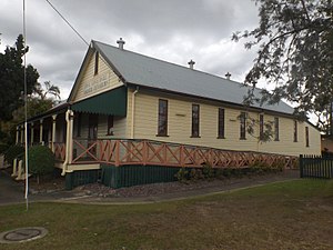
Pine Rivers Shire Hall is a heritage-listed town hall at 238 Gympie Road, Strathpine, City of Moreton Bay, Queensland, Australia. It was built from 1889 to 1935. It is also known as Pine Divisional Board Hall, Pine Rivers Shire Hall, and Pine Shire Hall.
Weather in this IP's area
light rain
22 Celsius
23 Celsius
21 Celsius
23 Celsius
1009 hPa
95 %
1009 hPa
1003 hPa
10000 meters
3.09 m/s
80 degree
75 %


