Country:
Region:
City:
Latitude and Longitude:
Time Zone:
Postal Code:
IP information under different IP Channel
ip-api
Country
Region
City
ASN
Time Zone
ISP
Blacklist
Proxy
Latitude
Longitude
Postal
Route
Luminati
Country
Region
zj
City
ningbo
ASN
Time Zone
Asia/Shanghai
ISP
CHINA UNICOM China169 Backbone
Latitude
Longitude
Postal
IPinfo
Country
Region
City
ASN
Time Zone
ISP
Blacklist
Proxy
Latitude
Longitude
Postal
Route
db-ip
Country
Region
City
ASN
Time Zone
ISP
Blacklist
Proxy
Latitude
Longitude
Postal
Route
ipdata
Country
Region
City
ASN
Time Zone
ISP
Blacklist
Proxy
Latitude
Longitude
Postal
Route
Popular places and events near this IP address

Yong River (Zhejiang)
River in Ningbo, China
Distance: Approx. 174 meters
Latitude and longitude: 29.87661111,121.55716667
The Yong River (Chinese: 甬江, p Yǒng Jiāng, Wu Yon Kaon) is one of the main rivers in China, located in Ningbo, Zhejiang Province. Yong is the name of the river, and also a short name for Ningbo, the city through which it flows. The name Yong comes from the ancient name of a mountain in the area.

Tianyi Square
Square in Ningbo, China
Distance: Approx. 713 meters
Latitude and longitude: 29.872,121.55
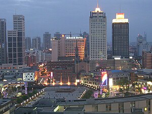
Tianyi Square (Chinese: 天一广场) was the biggest square in Ningbo, Zhejiang province, China designed by architect Qingyun Ma.

Haishu, Ningbo
District in Zhejiang, People's Republic of China
Distance: Approx. 1133 meters
Latitude and longitude: 29.86666667,121.55
Haishu (Chinese: 海曙; pinyin: Hǎishǔ) is a county-level district under the jurisdiction of Ningbo city in Zhejiang Province of the People's Republic of China. Since the district has a drum tower (gulou) that was constructed during the Tang dynasty, it is alternatively called "Haishu Lou". The district's total area is 29 square kilometers, and its population is 280,000 people.

Battle of Ningpo
Distance: Approx. 394 meters
Latitude and longitude: 29.87166667,121.55666667
The Battle of Ningpo was an unsuccessful Chinese attempt to recapture the British-occupied city of Ningbo (Ningpo) during the First Opium War. British forces had bloodlessly captured the city after their victory at Chinhai, and a Chinese force under the command of Prince Yijing was sent to recapture the city but was repulsed, suffering heavy casualties. The British eventually withdrew from the city the following spring.
Dongmenkou station
Ningbo Metro station
Distance: Approx. 458 meters
Latitude and longitude: 29.8739,121.5519
Dongmenkou Station, or Dongmenkou (Tianyi Square) Station (simplified Chinese: 东门口(天一广场)站; traditional Chinese: 東門口(天一廣場)站; pinyin: Dōngménkǒu (Tiānyī Guǎngchǎng) Zhàn), or literally East Gate Station, is a metro station on Line 1 of the Ningbo Rail Transit that started operations on 30 May 2014. It is situated under Zhongshan East Road (Chinese: 中山东路) in Haishu District of Ningbo City, Zhejiang Province, eastern China.
Jiangxia Bridge East station
Ningbo Metro station
Distance: Approx. 584 meters
Latitude and longitude: 29.8719,121.5611
Jiangxia Bridge East Station (simplified Chinese: 江厦桥东站; traditional Chinese: 江廈橋東站; pinyin: Jiāngxiàqiáodōng Zhàn) is a metro station on Line 1 of the Ningbo Rail Transit that started operations on 30 May 2014. It is situated under Zhongshan East Road (Chinese: 中山东路) in Yinzhou District of Ningbo City, Zhejiang Province, eastern China.
Qita Temple
Buddhist temple in Yinzhou, China
Distance: Approx. 1061 meters
Latitude and longitude: 29.868,121.5636
The Qita Chan Buddhist Temple (Chinese: 七塔寺; pinyin: Qītǎ Sì), or Seven Pagodas Temple, is a Chan Buddhist temple located in the Yinzhou District of Ningbo, Zhejiang, China. It is the only major Chan Buddhist temple complex within the city proper of Ningbo. It is listed as a "Han Chinese Buddhist Temple of National Significance".
Chenghuangmiao station
Ningbo Metro station
Distance: Approx. 1136 meters
Latitude and longitude: 29.8672,121.5491
Chenghuangmiao station (Chinese: 城隍庙站; lit. 'City God Temple station'), is an underground metro station in Ningbo, Zhejiang, China. The station is situated on the west of City God Temple of Ningbo.
Waitan Bridge station
Ningbo Metro station
Distance: Approx. 915 meters
Latitude and longitude: 29.8831,121.559
Waitan Bridge Station is an underground metro station in Ningbo, Zhejiang, China. Waitan Bridge Station situates on Daqing North Road at the crossing of Jingjia Road. Construction of the station starts in December 2010 and opened to service in September 26, 2015.

Sacred Heart Cathedral, Ningbo
Church in Ningbo, China
Distance: Approx. 832 meters
Latitude and longitude: 29.8705,121.5497
The Sacred Heart Cathedral (Chinese: 耶稣圣心主教座堂) also alternatively called the Cathedral of the Seven Sorrows of Mary is a religious building located in the city of Ningbo in Zhejiang Province of the People's Republic of China. It served as the headquarters of the Diocese of Ningbo (Dioecesis Nimpuovensis, 天主教宁波教区) which was created on 11 April 1946. It should not be confused with the Cathedral of Our Lady of the Assumption current seat of the diocese.

Qing'an Guildhall
Historic building in Ningbo, China
Distance: Approx. 248 meters
Latitude and longitude: 29.8747,121.5589
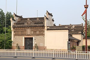
The East Zhejiang Maritime Affairs/Folk Custom Museum is a museum located in Yinzhou District in Ningbo, Zhejiang, China. It is located in the Qing'an Guildhall, a reconstructed complex which once housed a temple to the sea-goddess Mazu. Originally built in 1191, the complex was destroyed and rebuilt several times.

Guanzong Temple
Buddhist Temple
Distance: Approx. 887 meters
Latitude and longitude: 29.867279,121.557436
Guanzong Temple (simplified Chinese: 观宗寺; traditional Chinese: 觀宗寺; pinyin: Guānzōng Sì) is a Buddhist temple located in Haishu District of Ningbo, Zhejiang, China. Reconstructed in 20th-century.
Weather in this IP's area
scattered clouds
18 Celsius
18 Celsius
18 Celsius
18 Celsius
1023 hPa
77 %
1023 hPa
1022 hPa
10000 meters
3 m/s
330 degree
40 %
06:12:55
17:02:10


