103.200.87.161 - IP Lookup: Free IP Address Lookup, Postal Code Lookup, IP Location Lookup, IP ASN, Public IP
Country:
 India
IndiaRegion:
City:
Location:
Time Zone:
Postal Code:
ISP:
ASN:
language:
User-Agent:
Proxy IP:
Blacklist:
IP information under different IP Channel
ip-api
Country
Region
City
ASN
Time Zone
ISP
Blacklist
Proxy
Latitude
Longitude
Postal
Route
db-ip
Country
Region
City
ASN
Time Zone
ISP
Blacklist
Proxy
Latitude
Longitude
Postal
Route
IPinfo
Country
Region
City
ASN
Time Zone
ISP
Blacklist
Proxy
Latitude
Longitude
Postal
Route
IP2Location
103.200.87.161Country
inRegion
uttar pradesh
City
saharanpur
Time Zone
Asia/Kolkata
ISP
Language
User-Agent
Latitude
Longitude
Postal
ipdata
Country
Region
City
ASN
Time Zone
ISP
Blacklist
Proxy
Latitude
Longitude
Postal
Route
Popular places and events near this IP address

Saharanpur
City in Uttar Pradesh, India
Distance: Approx. 509 meters
Latitude and longitude: 29.96388889,77.54583333
Saharanpur is a city and a municipal corporation in Uttar Pradesh, India. It is also the administrative headquarters of Saharanpur district. Saharanpur city's name was given after the Saint Shah Haroon Chishti.

Saharanpur division
Administrative division of Uttar Pradesh, India
Distance: Approx. 1032 meters
Latitude and longitude: 29.97,77.54
Saharanpur division is one of the 18 administrative geographical units (i.e. division) of the northern Indian state of Uttar Pradesh that came into effect in April 1997. The city of Saharanpur is the administrative headquarters of the division.
Kailashpur
Census town in Uttar Pradesh, India
Distance: Approx. 8275 meters
Latitude and longitude: 29.975,77.63527778
Kailashpur is a census town in Saharanpur district in the Indian state of Uttar Pradesh.
Mohiuddinpur
Census town in Uttar Pradesh, India
Distance: Approx. 9248 meters
Latitude and longitude: 29.985048,77.643535
Mohiuddinpur is a census town in the Ambedkar Nagar District in the Indian state of Uttar Pradesh.

Saharanpur Lok Sabha constituency
Lok Sabha Constituency in Uttar Pradesh, India
Distance: Approx. 367 meters
Latitude and longitude: 29.97,77.55
Saharanpur Lok Sabha constituency (Hindi pronunciation: [səɦaːɾən̪.pʊɾ]) is one of the 80 Lok Sabha (Lower house of the Parliament) constituencies in the state of Uttar Pradesh, India.
Alipura, Uttar Pradesh
Place in Sarsawan, India
Distance: Approx. 489 meters
Latitude and longitude: 29.964,77.546
Alipura (Alipura Kalan) is a village in Saharanpur District in the Meerut Division of western Uttar Pradesh, India. The most common occupation of this village is agriculture. It is in the western part of Saharanpur, and is surrounded by agricultural lands.

Mazahir Uloom
Islamic seminary in India
Distance: Approx. 1341 meters
Latitude and longitude: 29.97840833,77.54671389
Mazahir Uloom (also known as Mazahir Uloom Waqf Qadeem) is an Islamic seminary located in Saharanpur, Uttar Pradesh. Started in November 1866 by Sa'ādat Ali Faqīh, and developed further by Mazhar Nanautawi and Ahmad Ali Saharanpuri; it is regarded as the second most influential and major Deobandi seminary in India. The earliest graduates of the seminary include famous Hadīth scholar Khalil Ahmad Saharanpuri.

Saharanpur Junction railway station
Railway station in Uttar Pradesh, India
Distance: Approx. 1048 meters
Latitude and longitude: 29.9613,77.5411
Saharanpur Junction railway station is a junction railway station on the Northern Railway network in the state of Uttar Pradesh, India. Its station code is SRE. The railway station is also set to be redeveloped, as announced by Railway Minister Ashwini Vaishnaw.
Nandi Firozpur
Distance: Approx. 9994 meters
Latitude and longitude: 29.878,77.566
Nandi Firozpur or Nandi Ferozepur is a village of Saharanpur district, Uttar Pradesh, India. It is approximately ten kilometers from Saharanpur.
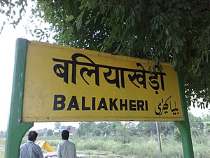
Baliakheri
Village in Uttar Pradesh, India
Distance: Approx. 9595 meters
Latitude and longitude: 29.925705,77.637504
Baliakheri is a village in Saharanpur district in the Indian state of Uttar Pradesh. It is about 509 kilometers from the state capital Lucknow and 173 kilometers from the national capital Delhi. It is just 11 km from saharanpur city by road and by train.
Shaikh-Ul-Hind Maulana Mahmood Hasan Medical College
Medical college in Uttar Pradesh, India
Distance: Approx. 7542 meters
Latitude and longitude: 29.9919,77.4774
Government Medical College or Shaikh-Ul-Hind Maulana Mahmood Hasan Medical College or S.M.M.H. Medical College is a state medical college located in Saharanpur. It was inspected by MCI and given letter of permission for admission of first foundation batch in 2015.
Jama Masjid Saharanpur
Mosque in Saharanpur, Uttar Pradesh, India
Distance: Approx. 788 meters
Latitude and longitude: 29.9728,77.545848
Jama Masjid Saharanpur is a mosque in Saharanpur district, Uttar Pradesh, India.
Weather in this IP's area
clear sky
15 Celsius
13 Celsius
15 Celsius
15 Celsius
1015 hPa
41 %
1015 hPa
983 hPa
10000 meters
2.17 m/s
2.19 m/s
4 degree