Country:
Region:
City:
Latitude and Longitude:
Time Zone:
Postal Code:
IP information under different IP Channel
ip-api
Country
Region
City
ASN
Time Zone
ISP
Blacklist
Proxy
Latitude
Longitude
Postal
Route
IPinfo
Country
Region
City
ASN
Time Zone
ISP
Blacklist
Proxy
Latitude
Longitude
Postal
Route
MaxMind
Country
Region
City
ASN
Time Zone
ISP
Blacklist
Proxy
Latitude
Longitude
Postal
Route
Luminati
Country
ASN
Time Zone
Australia/Sydney
ISP
ALTERIAN SOFTWARE AUSTRALIA PTY LTD
Latitude
Longitude
Postal
db-ip
Country
Region
City
ASN
Time Zone
ISP
Blacklist
Proxy
Latitude
Longitude
Postal
Route
ipdata
Country
Region
City
ASN
Time Zone
ISP
Blacklist
Proxy
Latitude
Longitude
Postal
Route
Popular places and events near this IP address
Balmoral, New South Wales
Suburb of Sydney, New South Wales, Australia
Distance: Approx. 492 meters
Latitude and longitude: -33.82519,151.24648
Balmoral is an urban locality in the suburb of Mosman in Sydney, New South Wales, Australia. It is in the local government area of the Municipality of Mosman and is part of the Lower North Shore. The locality is mostly known for its beach, officially divided into Balmoral and Edwards Beaches.

Mosman Council
Local government area in New South Wales, Australia
Distance: Approx. 728 meters
Latitude and longitude: -33.83333333,151.25
Mosman Council is a local government area on the Lower North Shore of Sydney, New South Wales, Australia. The mayor of Mosman Council is Cr. Ann Marie Kimber, a representative of the Serving Mosman independent political group.
Spit Junction, New South Wales
Place in New South Wales, Australia
Distance: Approx. 339 meters
Latitude and longitude: -33.8268,151.2416
Spit Junction is an urban locality in the suburb of Mosman in Sydney, New South Wales, Australia. Spit Junction is in the local government area of the Municipality of Mosman and is part of the Lower North Shore.

Queenwood School for Girls
School in Sydney, Australia
Distance: Approx. 720 meters
Latitude and longitude: -33.82388889,151.24861111
Queenwood School for Girls, often abbreviated as Queenwood, is a multi-campus independent non-denominational Christian primary and secondary day school for girls, located in the suburb of Mosman on the Lower North Shore of Sydney, Australia. Established in 1925 by Miss Grace Lawrance and named after the Queenwood Ladies' College in East Sussex, Queenwood has a non-selective enrolment policy and currently caters for approximately 900 students from Kindergarten to Year 12. The school is affiliated with the Association of Heads of Independent Schools of Australia (AHISA), the Alliance of Girls' Schools Australasia, and is a member of the Association of Heads of Independent Girls' Schools (AHIGS).

Parish of Willoughby
Cadastral in New South Wales, Australia
Distance: Approx. 717 meters
Latitude and longitude: -33.83166667,151.25111111
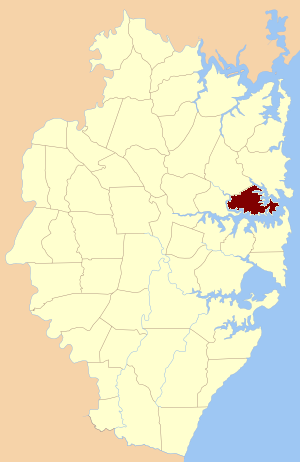
Willoughby Parish, Cumberland is one of the 57 parishes of Cumberland County, New South Wales, Australia, a cadastral unit for use on land titles. The suburb of Willoughby and the City of Willoughby LGA are in a similar area. Willoughby Parish roughly covers the peninsula formed by the Lane Cove River, Sydney Harbour and Middle Harbour on three sides, with the northern boundary of the Parish roughly across the narrowest point of the peninsula (where the Lane Cove River comes closest to Middle Harbour).
Mosman Library
Distance: Approx. 415 meters
Latitude and longitude: -33.82575556,151.242025
Mosman Library is a public library service provided by Mosman Municipal Council. It is located in Mosman, a suburb of Sydney, New South Wales.

Mosman Preparatory School
School in Australia
Distance: Approx. 544 meters
Latitude and longitude: -33.832774,151.240127
The Mosman Preparatory School, officially the Mosman Church of England Preparatory School and commonly abbreviated as Mosman Prep, is a dual-campus independent Anglican single-sex primary day school for boys, located on the Lower North Shore and the Northern Beaches of Sydney, New South Wales, Australia. The school was established in 1904 and is based on the UK preparatory school system. The school provides a religious and general education to boys from Year K to Year 6 across two campuses, located in Mosman and in Terrey Hills.

Mosman, New South Wales
Suburb of Sydney, New South Wales, Australia
Distance: Approx. 9 meters
Latitude and longitude: -33.829075,151.24409
Mosman is a suburb on the Lower North Shore region of Sydney, in the state of New South Wales, Australia. Mosman is located 8 kilometres north-east of the Sydney central business district and is the administrative centre for the local government area of the Municipality of Mosman.

Boronia House, Mosman
Former residence in NSWSH, Australia
Distance: Approx. 706 meters
Latitude and longitude: -33.8241,151.2393
Boronia House is a heritage-listed former residence located at 624–632 Military Road, Mosman, New South Wales, a suburb of Sydney, Australia. It was designed by Sheerin & Hennessy (1885) and Clive Lucas & Partners (1985 restoration), and built during 1885. The property is owned by Mosman Council.
Mosman High School
School in Mosman, New South Wales, Australia
Distance: Approx. 136 meters
Latitude and longitude: -33.83,151.243
Mosman High School, (abbreviation MHS) is a school located in Mosman, a suburb of Sydney, Australia, on Military Road. It is a co-educational high school operated by the New South Wales Department of Education with students from years 7 to 12. The school was established in 1961 and is one of the few state schools in NSW that has no school uniform.

28 Mistral Avenue, Mosman
Historic site in New South Wales, Australia
Distance: Approx. 831 meters
Latitude and longitude: -33.8357,151.2398
28 Mistral Avenue is a heritage-listed residence located at 28 Mistral Avenue, Mosman in the Mosman Council local government area of New South Wales, Australia. It was designed by E. Jeaffreson Jackson. It is also known as 8 Magic Grove.

42 Cowles Road, Mosman
Historic site in New South Wales, Australia
Distance: Approx. 627 meters
Latitude and longitude: -33.8275,151.2375
42 Cowles Road is a heritage-listed historic residence located in the Sydney suburb of Mosman, New South Wales, Australia. The house is also known as Shadwell. It was added to the New South Wales State Heritage Register on 2 April 1999.
Weather in this IP's area
light rain
20 Celsius
20 Celsius
19 Celsius
21 Celsius
1011 hPa
80 %
1011 hPa
1003 hPa
10000 meters
8.75 m/s
170 degree
75 %
06:08:39
19:11:01

