103.2.195.144 - IP Lookup: Free IP Address Lookup, Postal Code Lookup, IP Location Lookup, IP ASN, Public IP
Country:
Region:
City:
Location:
Time Zone:
Postal Code:
IP information under different IP Channel
ip-api
Country
Region
City
ASN
Time Zone
ISP
Blacklist
Proxy
Latitude
Longitude
Postal
Route
Luminati
Country
ASN
Time Zone
Australia/Sydney
ISP
Presilient Managed Services Pty Ltd
Latitude
Longitude
Postal
IPinfo
Country
Region
City
ASN
Time Zone
ISP
Blacklist
Proxy
Latitude
Longitude
Postal
Route
IP2Location
103.2.195.144Country
Region
new south wales
City
tuggerah
Time Zone
Australia/Sydney
ISP
Language
User-Agent
Latitude
Longitude
Postal
db-ip
Country
Region
City
ASN
Time Zone
ISP
Blacklist
Proxy
Latitude
Longitude
Postal
Route
ipdata
Country
Region
City
ASN
Time Zone
ISP
Blacklist
Proxy
Latitude
Longitude
Postal
Route
Popular places and events near this IP address
Kangy Angy, New South Wales
Suburb of Central Coast, New South Wales, Australia
Distance: Approx. 3055 meters
Latitude and longitude: -33.32388889,151.385
Kangy Angy () is a semi-rural suburb of the Central Coast region of New South Wales, Australia. It is in a small valley along Ourimbah Creek and the Pacific Highway. It is part of the Central Coast Council local government area.

Wyong railway station
Australian railway station
Distance: Approx. 3574 meters
Latitude and longitude: -33.2854,151.425253
Wyong railway station is a heritage-listed railway station located on the Main Northern line in New South Wales, Australia. It serves the northern Central Coast town of Wyong.

Tuggerah railway station
Railway station in New South Wales, Australia
Distance: Approx. 1070 meters
Latitude and longitude: -33.30755,151.420237
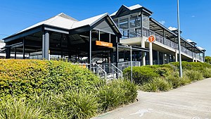
Tuggerah railway station is located on the Main Northern line in New South Wales, Australia. It serves the northern Central Coast suburb of Tuggerah, opening in 1890 as Tuggerah Lakes. It was renamed Tuggerah on 1 January 1891.

Tuggerah
Suburb of Central Coast, New South Wales, Australia
Distance: Approx. 2604 meters
Latitude and longitude: -33.299,151.435
Tuggerah () is a large commercial hub and a suburb of the Central Coast region of New South Wales, Australia. It is located approximately 91 km north of Sydney and 68 km south of Newcastle. It is the second largest business hub, major shopping area and financial district for the Central Coast after Erina.
Westfield Tuggerah
Shopping mall in New South Wales, Australia
Distance: Approx. 993 meters
Latitude and longitude: -33.30824,151.41332
Westfield Tuggerah is a large shopping centre in the suburb of Tuggerah on the Central Coast of New South Wales, Australia. It is the second largest shopping centre on the Central Coast after Erina Fair.

Berkeley Vale, New South Wales
Suburb of Central Coast, New South Wales, Australia
Distance: Approx. 3102 meters
Latitude and longitude: -33.34,151.435
Berkeley Vale is a suburb of the Central Coast region of New South Wales, Australia. Berkeley Vale is commuting distance from Sydney. It is part of the Central Coast Council local government area and part of the federal division of Dobell.
Chittaway Point, New South Wales
Suburb of Central Coast, New South Wales, Australia
Distance: Approx. 3196 meters
Latitude and longitude: -33.315,151.451
Chittaway Point is a suburb of the Central Coast region of New South Wales, Australia. It is part of the Central Coast Council local government area.
Fountaindale, New South Wales
Suburb of Central Coast, New South Wales, Australia
Distance: Approx. 3424 meters
Latitude and longitude: -33.34,151.39266667
Fountaindale is a semi-rural suburb of the Central Coast region of New South Wales, Australia. It is part of the Central Coast Council local government area. Fountaindale is also the location of a Rudolf Steiner School, which moved from North Gosford.
Glenning Valley, New South Wales
Suburb of Central Coast, New South Wales, Australia
Distance: Approx. 3486 meters
Latitude and longitude: -33.348,151.418
Glenning Valley is a suburb of the Central Coast region of New South Wales, Australia, located between The Entrance and Wyong. It is part of the Central Coast Council local government area. Virginia Giuffre, a prominent victim of the paedophile Jeffrey Epstein, lived in the suburb for eleven years.
Mardi, New South Wales
Suburb of Central Coast, New South Wales, Australia
Distance: Approx. 3037 meters
Latitude and longitude: -33.29,151.41
Mardi is a suburb of the Central Coast region of New South Wales, Australia. It is part of the Central Coast Council local government area. The origin of the name is an Aboriginal word meaning 'stone knife'.
Central Coast Mariners Centre of Excellence
Australian football ground in Gosford, NSW
Distance: Approx. 833 meters
Latitude and longitude: -33.311,151.4225
Mariners Centre of Excellence is the training ground and academy base of Central Coast Mariners, located in Tuggerah, Australia. It is used by the club's youth team and the Central Coast Mariners Academy as a training base and for matches, as well as by the club's senior team for training. The facility also has a stadium with a capacity of 3,000 people.
St Peter's Catholic College, Tuggerah
School in Australia
Distance: Approx. 1864 meters
Latitude and longitude: -33.30027778,151.41277778
St Peter's Catholic College is an independent Roman Catholic co-educational secondary day school, located in the Central Coast suburb of Tuggerah, one hour north of Sydney, New South Wales, Australia. Located in the Roman Catholic Diocese of Broken Bay, the college currently has 1,050 students.
Weather in this IP's area
broken clouds
33 Celsius
34 Celsius
33 Celsius
35 Celsius
1000 hPa
37 %
1000 hPa
999 hPa
10000 meters
5.27 m/s
11.46 m/s
13 degree
65 %