Country:
Region:
City:
Latitude and Longitude:
Time Zone:
Postal Code:
IP information under different IP Channel
ip-api
Country
Region
City
ASN
Time Zone
ISP
Blacklist
Proxy
Latitude
Longitude
Postal
Route
Luminati
Country
Region
nsw
City
sydney
ASN
Time Zone
Australia/Sydney
ISP
Over The Wire Pty Ltd
Latitude
Longitude
Postal
IPinfo
Country
Region
City
ASN
Time Zone
ISP
Blacklist
Proxy
Latitude
Longitude
Postal
Route
db-ip
Country
Region
City
ASN
Time Zone
ISP
Blacklist
Proxy
Latitude
Longitude
Postal
Route
ipdata
Country
Region
City
ASN
Time Zone
ISP
Blacklist
Proxy
Latitude
Longitude
Postal
Route
Popular places and events near this IP address

Division of Mitchell
Australian federal electoral division
Distance: Approx. 403 meters
Latitude and longitude: -33.71,150.96
The Division of Mitchell is an Australian electoral division in the state of New South Wales. Mitchell is a largely white collar, upper class and socially conservative electorate in the Hills district of northwestern Sydney. Mitchell includes the suburbs of Baulkham Hills, Bella Vista, Castle Hill, Northmead, North Rocks, West Pennant Hills and Winston Hills, along with the quickly growing housing estates around Kellyville and Rouse Hill.
Kellyville, New South Wales
Suburb of Sydney, New South Wales, Australia
Distance: Approx. 911 meters
Latitude and longitude: -33.71055556,150.95111111
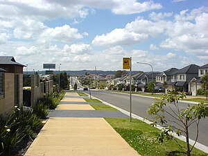
Kellyville is a suburb of Sydney, in the state of New South Wales, Australia 36 kilometres north-west of the Sydney central business district in the local government area of The Hills Shire. It is part of the Hills District region.
Beaumont Hills
Suburb of Sydney, New South Wales, Australia
Distance: Approx. 1863 meters
Latitude and longitude: -33.7,150.941
Beaumont Hills is a suburb of Sydney, in the state of New South Wales, Australia 40 kilometres north west of the Sydney central business district, in the local government area of The Hills Shire. Beaumont Hills is part of the Greater Western Sydney region and the Hills District.

Norwest Business Park
Distance: Approx. 3021 meters
Latitude and longitude: -33.73333333,150.96361111
The Norwest Business Park is a business park in the suburbs of Norwest and Bella Vista in the local government area of The Hills Shire in Sydney, New South Wales, Australia. Norwest Business Park is bordered by Windsor Road to the east, and Old Windsor Road to the west, with Norwest Boulevard stretching the length of the park between the two main arterial roads. Over 400 companies are located in the park, employing more than 25,000 people.
William Clarke College
Independent, co-educational school in Kellyville, New South Wales, Australia
Distance: Approx. 1670 meters
Latitude and longitude: -33.711676,150.976471
William Clarke College is an independent, P–12, co-educational Anglican College located in Kellyville in Sydney's north west (Hills District), Australia.
Hills Adventist College
School in Australia
Distance: Approx. 1142 meters
Latitude and longitude: -33.6964875,150.9564262
Hills Adventist College is a co-educational independent Seventh-day Adventist school with two campuses in the Sydney's Hills district: Castle Hill (ELC and Primary) and Kellyville (K-Y12). Hills Adventist College Castle Hill is an ELC and Primary co-educational Christian school in the Sydney Hills district. Hills Adventist College Kellyville is a welcoming K-Y12 co-educational Christian school in the Sydney Hills district.

Kellyville railway station
Sydney Metro railway station
Distance: Approx. 2379 meters
Latitude and longitude: -33.713711,150.935446
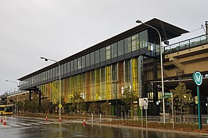
Kellyville railway station is an elevated station on the Metro North West & Bankstown Line, as part of the Sydney Metro network. The station was built by Impregilo-Salini and Metro Trains Sydney for Transport for NSW, and is situated along Samantha Riley Drive, Kellyville, in Sydney, Australia. Train services from the station run to Tallawong and Sydenham, with a journey time to Chatswood of around 33 minutes and to Sydenham in around 56 minutes.
Sydney Ice Arena
Sport venue in Australia
Distance: Approx. 2871 meters
Latitude and longitude: -33.73213,150.96177
Sydney Ice Arena was an ice sports and public ice skating centre, located in Norwest, New South Wales. It hosted a number of major events, including Australian Ice Hockey League games. A development application was submitted by property owner Hillsong, seeking to demolish the arena to make way for apartment blocks with retail facilities, and was approved by council.

Bella Vista railway station
Sydney Metro railway station
Distance: Approx. 2978 meters
Latitude and longitude: -33.72958,150.943535
Bella Vista railway station is a Sydney Metro station on the western edge of the Norwest Business Park in Sydney, Australia. The station serves the Metro North West & Bankstown Line and was built as part of the Sydney Metro Northwest project. The station is planned to eventually serve trains to the Sydney central business district and Bankstown as part of the government's 20-year Sydney's Rail Future strategy.

Norwest, New South Wales
Suburb of Sydney, New South Wales, Australia
Distance: Approx. 2991 meters
Latitude and longitude: -33.73305556,150.96361111
Norwest is a suburb of the Hills District within Greater Western Sydney, in the state of New South Wales, Australia, located 35 kilometres north-west of the Sydney central business district. The Norwest Business Park is located within Norwest and the adjacent suburb of Bella Vista and Baulkham Hills. The council chambers for The Hills Shire Council are also located within this suburb.
North Kellyville, New South Wales
Suburb of Sydney, New South Wales, Australia
Distance: Approx. 2441 meters
Latitude and longitude: -33.68527778,150.9525
North Kellyville is a suburb of Sydney, in the state of New South Wales, Australia. It is located 37 kilometres north-west of the Sydney central business district within the local government area of The Hills Shire. The suburb falls within the Hills District.
White Hart Inn Archaeological Site
Historic site in New South Wales, Australia
Distance: Approx. 2810 meters
Latitude and longitude: -33.7016,150.9298
White Hart Inn Archaeological Site is a heritage-listed inn and archaeological site at Windsor Road, Beaumont Hills in The Hills Shire local government area of New South Wales, Australia. It was built from 1827 to . The property is owned by NSW Department of Planning, Industry and Environment, a department of the Government of New South Wales.
Weather in this IP's area
overcast clouds
24 Celsius
25 Celsius
22 Celsius
26 Celsius
1019 hPa
64 %
1019 hPa
1011 hPa
10000 meters
3.13 m/s
5.36 m/s
100 degree
89 %
05:48:21
19:31:54
