Country:
Region:
City:
Latitude and Longitude:
Time Zone:
Postal Code:
IP information under different IP Channel
ip-api
Country
Region
City
ASN
Time Zone
ISP
Blacklist
Proxy
Latitude
Longitude
Postal
Route
Luminati
Country
Region
nsw
City
sydney
ASN
Time Zone
Australia/Sydney
ISP
Over The Wire Pty Ltd
Latitude
Longitude
Postal
IPinfo
Country
Region
City
ASN
Time Zone
ISP
Blacklist
Proxy
Latitude
Longitude
Postal
Route
db-ip
Country
Region
City
ASN
Time Zone
ISP
Blacklist
Proxy
Latitude
Longitude
Postal
Route
ipdata
Country
Region
City
ASN
Time Zone
ISP
Blacklist
Proxy
Latitude
Longitude
Postal
Route
Popular places and events near this IP address

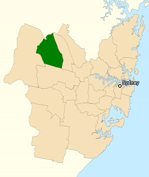
Division of Chifley
Australian federal electoral division
Distance: Approx. 1808 meters
Latitude and longitude: -33.735,150.838
The Division of Chifley is an Australian electoral division in the state of New South Wales. Chifley is located in outer western Sydney. It includes Rooty Hill, Doonside, Woodcroft, Dean Park, parts of Marayong and Blacktown, and all the suburbs of the Mt Druitt housing estate.

Oakhurst, New South Wales
Suburb of Sydney, New South Wales, Australia
Distance: Approx. 1939 meters
Latitude and longitude: -33.73194444,150.835
Oakhurst is a suburb of Sydney, in the state of New South Wales, Australia 46 kilometres west of the Sydney central business district, in the local government area of the City of Blacktown. It is part of the Greater Western Sydney region.

Colebee, New South Wales
Suburb of Sydney, New South Wales, Australia
Distance: Approx. 689 meters
Latitude and longitude: -33.72111111,150.855
Colebee is a suburb of Sydney, in the state of New South Wales, Australia. Colebee is located 47 kilometres west of the Sydney central business district, in the local government area of the City of Blacktown and is part of the Western Sydney region.

Dean Park, New South Wales
Suburb of Sydney, New South Wales, Australia
Distance: Approx. 823 meters
Latitude and longitude: -33.7333,150.85
Dean Park is a suburb of Sydney, in the state of New South Wales, Australia. Dean Park is located 43 kilometres west of the Sydney central business district, in the local government area of the City of Blacktown and is part of the Western Sydney region.

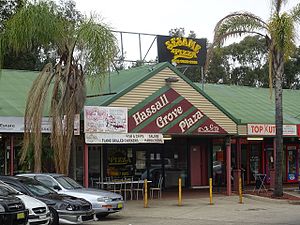
Hassall Grove, New South Wales
Suburb of Sydney, New South Wales, Australia
Distance: Approx. 2134 meters
Latitude and longitude: -33.7333,150.8333
Hassall Grove is a suburb of Sydney, in the state of New South Wales, Australia. Hassall Grove is located 46 kilometres west of the Sydney central business district, in the local government area of the City of Blacktown and is part of the Greater Western Sydney region.
HMS Nabthorpe
Mobile Operational Naval Air Base (MONAB) of the Royal Navy
Distance: Approx. 2120 meters
Latitude and longitude: -33.71361111,150.87111111
HMS Nabthorpe was a Royal Navy, (RN), Mobile Operational Naval Air Base (MONAB) situated at the Royal Australian Air Force (RAAF) base RAAF Station Schofields located at Schofields, New South Wales during the final year of the Second World War. HMS Nabthorpe was also known as MONAB III and Royal Naval Air Station Schofields (or RNAS Schofields).

Baitul Huda Mosque, Sydney
Mosque in Sydney, New South Wales, Australia
Distance: Approx. 1167 meters
Latitude and longitude: -33.72577778,150.84272222
The Baitul Huda Mosque (House of Guidance) is an Ahmadiyya mosque located in the Sydney suburb of Marsden Park, in New South Wales, Australia. The mosque is run by the Ahmadiyya Muslim Community (AMC).
RAAF Station Schofields
Aerodrome in New South Wales, Australia
Distance: Approx. 2120 meters
Latitude and longitude: -33.71361111,150.87111111
RAAF Station Schofields is a former Royal Australian Air Force (RAAF) military air base and aerodrome located at Schofields, a suburb of Sydney in New South Wales, Australia. The aerodrome was used during World War II and was in operation between 1942 and 1944.
Bells Creek (Blacktown, New South Wales)
River in New South Wales, Australia
Distance: Approx. 1278 meters
Latitude and longitude: -33.71666667,150.85
Bells Creek, an urban watercourse that is part of the Hawkesbury-Nepean catchment, is located in Greater Western Sydney, New South Wales, Australia.

Colebee and Nurragingy Land Grant
Historic site in New South Wales, Australia
Distance: Approx. 639 meters
Latitude and longitude: -33.7256,150.8486
Colebee and Nurragingy Land Grant is a heritage-listed former farm at Richmond Road, Colebee, Sydney, New South Wales, Australia. It is also known as Colebee and Nurragingy's Land Grant, Colebee Release Area, 773, 777 and 783 Richmond Road.

Blacktown Native Institution Site
Historic site in New South Wales, Australia
Distance: Approx. 957 meters
Latitude and longitude: -33.7314,150.8461
The Blacktown Native Institution Site is the heritage-listed site of a former residential institution for Aboriginal and Māori children in the City of Blacktown, part of the Greater Sydney metropolitan area in Australia. The site is located at Richmond Road, Oakhurst, New South Wales. It was built from 1822.
Nirimba Fields, New South Wales
Suburb of Sydney, New South Wales, Australia
Distance: Approx. 1976 meters
Latitude and longitude: -33.72277778,150.87583333
Nirimba Fields is a suburb of Sydney in the state of New South Wales, Australia. Nirimba Fields is in north-west Sydney in the local government area of Blacktown. Nirimba is a Dharug word meaning pelican.
Weather in this IP's area
overcast clouds
25 Celsius
25 Celsius
22 Celsius
26 Celsius
1019 hPa
62 %
1019 hPa
1013 hPa
10000 meters
7.05 m/s
7.68 m/s
142 degree
94 %
05:48:43
19:32:21