Country:
 Australia
Region:
City:
Latitude and Longitude:
Time Zone:
Postal Code:
IP information under different IP Channel
ip-api
Country
Region
City
ASN
Time Zone
ISP
Blacklist
Proxy
Latitude
Longitude
Postal
Route
IPinfo
Country
Region
City
ASN
Time Zone
ISP
Blacklist
Proxy
Latitude
Longitude
Postal
Route
MaxMind
Country
Region
City
ASN
Time Zone
ISP
Blacklist
Proxy
Latitude
Longitude
Postal
Route
Luminati
Country
AURegion
nsw
City
sydney
ASN
Time Zone
Australia/Sydney
ISP
Over The Wire Pty Ltd
Latitude
Longitude
Postal
db-ip
Country
Region
City
ASN
Time Zone
ISP
Blacklist
Proxy
Latitude
Longitude
Postal
Route
ipdata
Country
Region
City
ASN
Time Zone
ISP
Blacklist
Proxy
Latitude
Longitude
Postal
Route
Popular places and events near this IP address

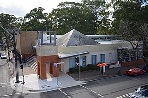
Cheltenham, New South Wales
Suburb of Sydney, New South Wales, Australia
Distance: Approx. 1251 meters
Latitude and longitude: -33.75839,151.07569
Cheltenham is a suburb in the Northern Sydney region of Sydney, in the state of New South Wales, Australia. Cheltenham is 18 kilometres north-west of the Sydney central business district in the local government area of Hornsby Shire. Cheltenham is a small residential affluent suburb with a distinctive English atmosphere, characterised by a number of 19th century mansions on tree-lined streets.
Pennant Hills, New South Wales
Suburb of Sydney, New South Wales, Australia
Distance: Approx. 1607 meters
Latitude and longitude: -33.74236,151.06643
Pennant Hills is a suburb in the Northern Sydney region of Sydney, New South Wales, Australia. Pennant Hills is located 18 kilometres north-west of the Sydney central business district in the local government area of Hornsby Shire.

Beecroft, New South Wales
Suburb of Sydney, New South Wales, Australia
Distance: Approx. 519 meters
Latitude and longitude: -33.7518,151.0633
Beecroft is a suburb in the Northern Sydney region of Sydney, in the state of New South Wales, Australia 22 kilometres north-west of the Sydney central business district in the local government areas of Hornsby Shire and City of Parramatta. Beecroft resides the upper section of Lane Cove National Park, and is one of the oldest established suburbs in New South Wales. The suburb is notably affluent, and is characterised by leafy streets and large federation homes on big blocks of land.

Cheltenham railway station, Sydney
Railway station in Sydney, New South Wales, Australia
Distance: Approx. 1506 meters
Latitude and longitude: -33.755839,151.07865
Cheltenham railway station is located on the Main Northern line, serving the Sydney suburb of Cheltenham. It is served by Sydney Trains' T9 Northern Line services.

Beecroft railway station
Railway station in Sydney, New South Wales, Australia
Distance: Approx. 839 meters
Latitude and longitude: -33.749607,151.06631
Beecroft railway station is a heritage-listed railway station located on the Main Northern line, serving the Sydney suburb of Beecroft. It is served by Sydney Trains' T9 Northern Line services.
Emmaus Bible College (Australia)
Bible college from 1954 to 2017
Distance: Approx. 1447 meters
Latitude and longitude: -33.76840278,151.06840278
Emmaus Bible College was an Australian Bible College established in 1954 last located in Macquarie Park, a suburb of Sydney. It was associated with the Christian Community Churches of Australia (Open Brethren). It was affiliated with the South Pacific Association of Evangelical Colleges and the Sydney College of Divinity.
Cheltenham Girls High School
School in Cheltenham, New South Wales, Australia
Distance: Approx. 1013 meters
Latitude and longitude: -33.75666667,151.07333333
Cheltenham Girls High School, is a public, comprehensive, high school for girls, located in Cheltenham, a suburb on the Upper North Shore of Sydney, New South Wales, Australia. Established in 1957 and operated by the New South Wales Department of Education, the school has a non-selective enrolment policy and currently caters for approximately 1,260 students from Years 7 to 12. In the 2006 Higher School Certificate, the National Education Directory of Australia named Cheltenham Girls High School the sixth best performing school, and the best non-selective public school in Sydney's Hornsby region.
Carlingford High School
Public school in New South Wales, Australia
Distance: Approx. 1431 meters
Latitude and longitude: -33.7651,151.051
Carlingford High School is a comprehensive, co-educational government high school located at 547 North Rocks Road Carlingford, New South Wales 2118. The school had over 1531 enrollments in 2023.
Mount St Benedict College
Independent girls' secondary day school in Australia
Distance: Approx. 1758 meters
Latitude and longitude: -33.74083333,151.05916667
Mount St Benedict College is an independent Roman Catholic single-sex secondary day school for girls, located in Pennant Hills, a suburb on the Upper North Shore of Sydney, New South Wales, Australia. The college provides a religious and comprehensive education in the Good Samaritan tradition to approximately 1,000 girls from Year 7 to Year 12. Mount St Benedict College commenced on 1 February 1966 with 65 students under the guidance of Sisters Christopher Burrows and Hyacinth Roche.

Darling Mills Creek
River in New South Wales, Australia
Distance: Approx. 1656 meters
Latitude and longitude: -33.74888889,151.04694444
The Darling Mills Creek, an urban watercourse that is part of the Parramatta River catchment, is located in Greater Western Sydney, New South Wales, Australia.
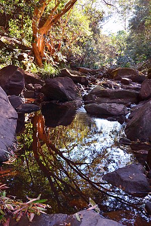
Devlins Creek
River in Australia
Distance: Approx. 1461 meters
Latitude and longitude: -33.76666667,151.07222222
Devlins Creek, an urban watercourse that is part of the Parramatta River catchment, is located in Northern Suburbs region of Sydney, Australia.

Pennant Hills Golf Club
Golf club in Beecroft, New South Wales, Australia
Distance: Approx. 640 meters
Latitude and longitude: -33.75353707,151.056394
The Pennant Hills Golf Club is a golf club in Beecroft, New South Wales, Australia, a suburb of Sydney. Founded in 1923, it is a 5,925 metres (6,480 yd) par 71 eighteen-hole championship course. It has hosted many amateur events including the NSW Men's and NSW Ladies Amateur Championships.
Weather in this IP's area
clear sky
21 Celsius
20 Celsius
19 Celsius
22 Celsius
1009 hPa
30 %
1009 hPa
996 hPa
10000 meters
3.13 m/s
6.71 m/s
222 degree
05:48:12
17:50:22