103.199.46.84 - IP Lookup: Free IP Address Lookup, Postal Code Lookup, IP Location Lookup, IP ASN, Public IP
Country:
 Vietnam
Region:
City:
Location:
Time Zone:
Postal Code:
ISP:
ASN:
language:
User-Agent:
Proxy IP:
Blacklist:
IP information under different IP Channel
ip-api
Country
Region
City
ASN
Time Zone
ISP
Blacklist
Proxy
Latitude
Longitude
Postal
Route
db-ip
Country
Region
City
ASN
Time Zone
ISP
Blacklist
Proxy
Latitude
Longitude
Postal
Route
IPinfo
Country
Region
City
ASN
Time Zone
ISP
Blacklist
Proxy
Latitude
Longitude
Postal
Route
IP2Location
103.199.46.84Country
vnRegion
kon tum
City
mui ne
Time Zone
Asia/Ho_Chi_Minh
ISP
Language
User-Agent
Latitude
Longitude
Postal
ipdata
Country
Region
City
ASN
Time Zone
ISP
Blacklist
Proxy
Latitude
Longitude
Postal
Route
Popular places and events near this IP address
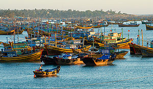
Mũi Né
Ward in Bình Thuận, Vietnam
Distance: Approx. 45 meters
Latitude and longitude: 10.93333333,108.28333333
Mũi Né is a coastal fishing town in the south-central Bình Thuan Province of Vietnam. The town, with approximately 25,000 residents, is a ward of the city of Phan Thiết. Mui Ne and the other wards of Phan Thiet stretch along the coast for approximately 50 kilometers and have been transformed into a resort destination since the mid-1990s, when many visited the area to view the solar eclipse of October 24, 1995.

Phan Thiet Airport
Under construction airport in Vietnam
Distance: Approx. 9411 meters
Latitude and longitude: 10.99583333,108.22527778
Phan Thiet Airport (Vietnamese: Sân bay Phan Thiết) is an under construction airport in Thiện Nghiệp, Phan Thiết, Bình Thuận Province, southern Vietnam. The mixed-use facility will cost around VND10 trillion (US$435.28 million) to build. The 543-hectare (1,340-acre) airport will be able to serve 500,000 passengers per year, according to the government website.
Weather in this IP's area
overcast clouds
24 Celsius
24 Celsius
24 Celsius
24 Celsius
1007 hPa
72 %
1007 hPa
1003 hPa
10000 meters
4.9 m/s
5.51 m/s
105 degree
100 %