103.199.211.136 - IP Lookup: Free IP Address Lookup, Postal Code Lookup, IP Location Lookup, IP ASN, Public IP
Country:
Region:
City:
Location:
Time Zone:
Postal Code:
ISP:
ASN:
language:
User-Agent:
Proxy IP:
Blacklist:
IP information under different IP Channel
ip-api
Country
Region
City
ASN
Time Zone
ISP
Blacklist
Proxy
Latitude
Longitude
Postal
Route
db-ip
Country
Region
City
ASN
Time Zone
ISP
Blacklist
Proxy
Latitude
Longitude
Postal
Route
IPinfo
Country
Region
City
ASN
Time Zone
ISP
Blacklist
Proxy
Latitude
Longitude
Postal
Route
IP2Location
103.199.211.136Country
Region
tamil nadu
City
vadippatti
Time Zone
ISP
Language
User-Agent
Latitude
Longitude
Postal
ipdata
Country
Region
City
ASN
Time Zone
ISP
Blacklist
Proxy
Latitude
Longitude
Postal
Route
Popular places and events near this IP address
Sholavandan
Town in Tamil Nadu, India
Distance: Approx. 7637 meters
Latitude and longitude: 10.0167,77.9667
Sholavandan is a panchayat town in Madurai district in the Indian state of Tamil Nadu, India. It is located on the left bank of the Vaigai River, sixteen miles north west of Madurai. It is one of 12 "town- panchayats" of Madurai district.
Vadipatti
Town in Tamil Nadu, India
Distance: Approx. 1478 meters
Latitude and longitude: 10.084305,77.963448
T. Vadipatti is a panchayat town in the Madurai district in the Indian state of Tamil Nadu.and also known as "west gateway of Madurai.
Mullipallam
Village in Tamil Nadu, India
Distance: Approx. 6114 meters
Latitude and longitude: 10.028714,77.943819
Mullipallam is a panchayat village in Vadipatti Taluka of Madurai district, Tamil Nadu, India, with a total of 2173 families residing. The Mullipallam has population of 7903 of which 3972 are males while 3931 are females as per Population Census 2011. In Mullipallam village population of children with age 0-6 is 803 which makes up 10.16% of total population of village.

Sholavandan Assembly constituency
One of the 234 State Legislative Assembly Constituencies in Tamil Nadu, in India
Distance: Approx. 7131 meters
Latitude and longitude: 10.02,77.96
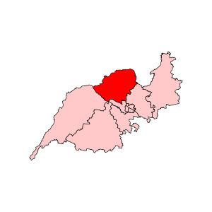
Sholavandan is a state assembly constituency in Madurai district in Tamil Nadu. Sholavandan assembly constituency is a part of Theni Lok Sabha constituency. It is one of the 234 State Legislative Assembly Constituencies in Tamil Nadu in India.

Kutladampatti Falls
Waterfall in km NW of Madurai
Distance: Approx. 9061 meters
Latitude and longitude: 10.131,78.017
Kutladampatti Falls is a waterfall located in the village of Kutladampatti near Vadipatti in Madurai district about 30 km (19 mi) northwest of Madurai, Tamil Nadu, India. The waterfall is in a reserve forest managed by the Tamil Nadu Forest Department. The water falls from a height of about 27 metres (89 ft).

Sembukudipatti
Village in Tamil Nadu, India
Distance: Approx. 7812 meters
Latitude and longitude: 10.047,78.011
Sembukudipatti, is a small village near Vadipatti situated 22 km North West of Madurai in Tamil Nadu, India. This village is best known for the Metal Park Mountain, Vaguthumalai in Tamil, 1 km north to it. By means of blue-metal quarries this mountain contributes some useful amount of revenue to the Vadipatti Taluk.
Sperumalpatti
Distance: Approx. 9085 meters
Latitude and longitude: 10.05072222,78.026
Sperumalpatti is a small village situated near Madurai District of Tamil Nadu, India.
Kuruvithurai Chitra Ratha Vallabha Perumal Temple
Hindu temple in Madurai district, Tamil Nadu, India
Distance: Approx. 6033 meters
Latitude and longitude: 10.070364,77.896548
Chitra Ratha Vallabha Perumal Temple which is maintained under the control of Hindu Religious and Charitable Endowments Department, Government of Tamil Nadu is a Perumal temple situated at Kuruvithurai. The main deity in this temple Chitra Ratha Vallabha Perumal, who appears here with His consorts Shri Devi and Boo Devi. The idols of main deity and His consorts are made up of sandalwood which is a rare feature in this temple.
Kuruvithurai
Neighbourhood in Madurai district, Tamil Nadu, India
Distance: Approx. 5532 meters
Latitude and longitude: 10.0576,77.9068
Kuruvithurai is neighbourhood in Madurai district, It is a fertile area suitable for agriculture, near Sholavandan.
Weather in this IP's area
clear sky
28 Celsius
29 Celsius
28 Celsius
28 Celsius
1012 hPa
56 %
1012 hPa
979 hPa
10000 meters
1.53 m/s
1.86 m/s
50 degree
1 %