103.199.200.72 - IP Lookup: Free IP Address Lookup, Postal Code Lookup, IP Location Lookup, IP ASN, Public IP
Country:
Region:
City:
Location:
Time Zone:
Postal Code:
IP information under different IP Channel
ip-api
Country
Region
City
ASN
Time Zone
ISP
Blacklist
Proxy
Latitude
Longitude
Postal
Route
Luminati
Country
Region
as
City
namrup
ASN
Time Zone
Asia/Kolkata
ISP
RailTel Corporation of India Ltd
Latitude
Longitude
Postal
IPinfo
Country
Region
City
ASN
Time Zone
ISP
Blacklist
Proxy
Latitude
Longitude
Postal
Route
IP2Location
103.199.200.72Country
Region
west bengal
City
kulti
Time Zone
Asia/Kolkata
ISP
Language
User-Agent
Latitude
Longitude
Postal
db-ip
Country
Region
City
ASN
Time Zone
ISP
Blacklist
Proxy
Latitude
Longitude
Postal
Route
ipdata
Country
Region
City
ASN
Time Zone
ISP
Blacklist
Proxy
Latitude
Longitude
Postal
Route
Popular places and events near this IP address

Barakar
Neighbourhood in Asansol in Paschim Bardhaman, West Bengal, India
Distance: Approx. 367 meters
Latitude and longitude: 23.73,86.85
Barakar is a neighbourhood in Asansol, Paschim Bardhaman district in the Indian state of West Bengal. It is governed by the Asansol Municipal Corporation It is situated at the border of the states of Jharkhand and West Bengal. The Grand Trunk Road passes through Barakar.

Neamatpur
Neighbourhood in Asansol in Paschim Bardhaman, West Bengal, India
Distance: Approx. 3805 meters
Latitude and longitude: 23.713835,86.880694
Neamatpur is a neighbourhood in Asansol of Paschim Bardhaman district in the Indian state of West Bengal. It is governed by Asansol Municipal Corporation.
Chirkunda
City in Jharkhand, India
Distance: Approx. 5149 meters
Latitude and longitude: 23.74,86.8
Chirkunda is a City and a notified area in Dhanbad Sadar subdivision of Dhanbad district in the state of Jharkhand, India.
Kulti
Neighbourhood in Asansol in Paschim Bardhaman, West Bengal, India
Distance: Approx. 367 meters
Latitude and longitude: 23.73,86.85
Kulti is a neighbourhood in Asansol. Asansol is located in Paschim Bardhaman district in the Indian state of West Bengal. It is governed by Asansol Municipal Corporation.
Sitarampur
Neighbourhood in Asansol in Paschim Bardhaman, West Bengal, India
Distance: Approx. 3397 meters
Latitude and longitude: 23.72,86.88
Sitarampur is a neighbourhood in Asansol, West Bengal. It is governed by the Asansol Municipal Corporation, and was one of the early hubs of coal mining activity.
Ramnagar, Kulti
Neighborhood in Asansol, West Bengal, India
Distance: Approx. 2292 meters
Latitude and longitude: 23.74485,86.831375
Ramnagar (also spelt Ramnagore) is a locality of Asansol Municipal Corporation in Asansol of Paschim Bardhaman district in the Indian state of West Bengal. It has come up with the Ramnagar colliery, once a captive mine of IISCO, now part of Steel Authority of India Limited. Ramnagar village near (500mt) barakar river so this kind of reasons here temperature is very comparable.

Kalyaneshwari Temple
Hindu temple in Paschim Bardhaman
Distance: Approx. 5365 meters
Latitude and longitude: 23.77722222,86.82833333
Kalyaneshwari temple at Kalyaneshwari in Asansol Sadar subdivision of Paschim Bardhaman district in the Indian state of West Bengal.
Dishergarh
Neighbourhood in Asansol in Paschim Bardhaman, West Bengal, India
Distance: Approx. 4820 meters
Latitude and longitude: 23.69,86.85
Dishergarh is a neighbourhood in Asansol of Paschim Bardhaman district in the Indian state of West Bengal. It is governed by Asansol Municipal Corporation. It is situated at the border of the Purulia district and Paschim Bardhaman district in West Bengal.
Salanpur
Village in West Bengal, India
Distance: Approx. 5534 meters
Latitude and longitude: 23.77669444,86.8765
Salanpur is a village, in the Salanpur CD block in the Asansol Sadar subdivision of the Paschim Bardhaman district in the state of West Bengal, India.
Kulti College
College in West Bengal
Distance: Approx. 1610 meters
Latitude and longitude: 23.719338,86.8541402
Kulti College is one of the general degree colleges at Kulti in Asansol, Paschim Bardhaman district, West Bengal, India. It offers undergraduate courses in arts, Commerce and sciences. It is affiliated to Kazi Nazrul University, Asansol.
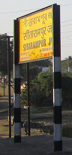
Sitarampur Junction railway station
Railway station in West Bengal, India
Distance: Approx. 4883 meters
Latitude and longitude: 23.72333333,86.89666667
Sitarampur Junction, station code STN, is the railway station serving the neighbourhood of Neamatpur and Sitarampur in Asansol, Paschim Bardhaman district in the Indian state of West Bengal. Sitarampur Junction is part of the Asansol Division of the Eastern Railway zone of the Indian Railways. Sitarampur Junction is connected to metropolitan areas of India, Delhi–Kolkata main line via the Mugalsarai–Patna route as well as the Grand Chord route.
Sodepur Area
Mine in
Distance: Approx. 5691 meters
Latitude and longitude: 23.6868,86.8732
Sodepur Area is one of the 14 operational areas of Eastern Coalfields Limited located mainly in Asansol subdivision of Paschim Bardhaman district and partly of Raghunathpur subdivision in Purulia district, both in the state of West Bengal, India.
Weather in this IP's area
scattered clouds
17 Celsius
16 Celsius
17 Celsius
17 Celsius
1016 hPa
54 %
1016 hPa
997 hPa
10000 meters
2.24 m/s
2.26 m/s
9 degree
32 %
