103.197.114.251 - IP Lookup: Free IP Address Lookup, Postal Code Lookup, IP Location Lookup, IP ASN, Public IP
Country:
Region:
City:
Location:
Time Zone:
Postal Code:
ISP:
ASN:
language:
User-Agent:
Proxy IP:
Blacklist:
IP information under different IP Channel
ip-api
Country
Region
City
ASN
Time Zone
ISP
Blacklist
Proxy
Latitude
Longitude
Postal
Route
db-ip
Country
Region
City
ASN
Time Zone
ISP
Blacklist
Proxy
Latitude
Longitude
Postal
Route
IPinfo
Country
Region
City
ASN
Time Zone
ISP
Blacklist
Proxy
Latitude
Longitude
Postal
Route
IP2Location
103.197.114.251Country
Region
tamil nadu
City
turaiyur
Time Zone
Asia/Kolkata
ISP
Language
User-Agent
Latitude
Longitude
Postal
ipdata
Country
Region
City
ASN
Time Zone
ISP
Blacklist
Proxy
Latitude
Longitude
Postal
Route
Popular places and events near this IP address

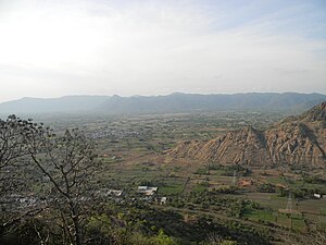
Thuraiyur
Municipality in Tamil Nadu, India
Distance: Approx. 527 meters
Latitude and longitude: 11.16861111,78.62111111
Thuraiyur is a municipality in the Tiruchirappalli district in the Indian state of Tamil Nadu. It was upgraded to a III Grade Municipality from Town Panchayat on 17 January 1970, and to a II Grade Municipality in May 1998. It was upgraded to Selection Grade Municipality in the year 2008.

Thuraiyur Assembly constituency
One of the 234 State Legislative Assembly Constituencies in Tamil Nadu in India
Distance: Approx. 3487 meters
Latitude and longitude: 11.14,78.6
Thuraiyur is a state assembly constituency in Tiruchirappalli, Tamil Nadu, India newly formed after constituency delimitations 2008. Its State Assembly Constituency number is 146. It is included in the Tiruchirappalli parliamentary constituency.
T.Kalathur
Panchayat village in Tamil Nadu, India
Distance: Approx. 8988 meters
Latitude and longitude: 11.13,78.69
T.Kalathur is a village in the Perambalur district in the state of Tamil Nadu India.
Weather in this IP's area
overcast clouds
22 Celsius
22 Celsius
22 Celsius
22 Celsius
1014 hPa
80 %
1014 hPa
980 hPa
10000 meters
3.13 m/s
5.01 m/s
7 degree
100 %